Category:Hunebed D14 in Eexter halte
Jump to navigation
Jump to search
| Object location | | View all coordinates using: OpenStreetMap |
|---|
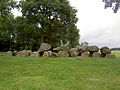
dolmen in the Netherlands  | |||||
| Upload media | |||||
| Instance of | |||||
|---|---|---|---|---|---|
| Part of | |||||
| Location | Eext, Aa en Hunze, Drenthe, Netherlands | ||||
| Street address |
| ||||
| Located on street |
| ||||
| Heritage designation |
| ||||
 | |||||
|
This is a category about rijksmonument number 45029
|
| Address |
|
Media in category "Hunebed D14 in Eexter halte"
The following 12 files are in this category, out of 12 total.
-
 D14 1.JPG 2,272 × 1,704; 1,006 KB
-
 D14 2.JPG 2,272 × 1,704; 1.02 MB
-
 D14 3.JPG 2,272 × 1,704; 1.06 MB
-
 D14 gaten.JPG 2,272 × 1,704; 1.01 MB
-
 Hunebed Alma Tadema.jpg 3,440 × 1,249; 900 KB
-
 Hunebed D14 at Eext.jpg 3,327 × 1,691; 774 KB
-
 Hunebed D14 bij Eexterhalte.jpg 1,257 × 770; 223 KB
-
 Hunebed D14 view from Northwest Camper.png 984 × 683; 377 KB
-
 Hunebed D14 view from South Camper (cropped).png 942 × 518; 199 KB
-
 Hunebed D14 view from South Camper.png 1,004 × 753; 456 KB
-
 Jongen, liggend bij rotsen te Gieten, RP-F-00-11332.jpg 2,138 × 1,408; 284 KB
-
 Megawal55.jpg 726 × 435; 264 KB


.png)


