Category:Hull Bridge
Jump to navigation
Jump to search
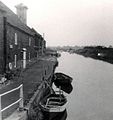
English: Hull Bridge is a village in the East Riding of Yorkshire, England. It is situated approximately 1.5 miles (2.4 km) north east of Beverley town centre. It lies south of the A1035 road and straddles the River Hull from which it takes its name.
village in the East Riding of Yorkshire, England, United Kingdom | |||||
| Upload media | |||||
| Instance of | |||||
|---|---|---|---|---|---|
| Location | Tickton, East Riding of Yorkshire, Yorkshire and the Humber, England | ||||
 | |||||
Media in category "Hull Bridge"
The following 46 files are in this category, out of 46 total.
-
Beverley and Barmston Drain - geograph.org.uk - 1552056.jpg 640 × 480; 64 KB
-
Beverley and Barmston Drain - geograph.org.uk - 470052.jpg 481 × 640; 108 KB
-
Beverley and Barmston Drain - geograph.org.uk - 470054.jpg 640 × 408; 109 KB
-
Beverley and Barmston Drain at Swine Moor.jpg 640 × 458; 124 KB
-
Beverley and Barmston Drain Hull Bridge.jpg 640 × 480; 89 KB
-
Boats at Hull Bridge.jpg 640 × 479; 58 KB
-
Bridge over Drain - geograph.org.uk - 143406.jpg 640 × 480; 112 KB
-
Crown and Anchor, Tickton - panoramio.jpg 1,200 × 721; 397 KB
-
Development on Hull Bridge Road.jpg 640 × 410; 183 KB
-
Footbridge over the River Hull.jpg 640 × 412; 151 KB
-
Hull Bridge - geograph.org.uk - 37749.jpg 480 × 640; 117 KB
-
Hull Bridge 1969.jpg 601 × 640; 105 KB
-
Hull Bridge 2007 1.jpg 640 × 480; 135 KB
-
Hull Bridge 2007 2.jpg 640 × 397; 103 KB
-
Hull Bridge 2007.jpg 640 × 460; 81 KB
-
Hull Bridge from the footbridge..jpg 640 × 468; 85 KB
-
Hull Bridge pre 1913 (archive ref PO-1-14-184) (30349149406).jpg 840 × 507; 50 KB
-
Hull Bridge Road - geograph.org.uk - 1552021.jpg 640 × 480; 45 KB
-
Hull Bridge Road.jpg 640 × 480; 67 KB
-
Hull Bridge.JPG 2,272 × 1,704; 1.11 MB
-
Little Storkhill Farm.jpg 640 × 480; 59 KB
-
Looking towards Hull Bridge.jpg 640 × 420; 158 KB
-
North of Hull Bridge - geograph.org.uk - 143404.jpg 640 × 480; 81 KB
-
River Hull moorings.jpg 537 × 640; 176 KB
-
River Hull, north of Hull Bridge. - geograph.org.uk - 527637.jpg 640 × 384; 70 KB
-
Riverside Trees north of Tickton Bridge.jpg 640 × 480; 124 KB
-
The Beverley to Tickton road. - geograph.org.uk - 64058.jpg 640 × 442; 58 KB
-
The Crown and Anchor Hull Bridge 1.jpg 640 × 427; 178 KB
-
The Crown and Anchor Hull Bridge 2.jpg 640 × 480; 92 KB
-
The Crown and Anchor Hull Bridge.jpg 640 × 480; 74 KB
-
The River Hull at Hull Bridge.jpg 640 × 392; 99 KB
-
The River Hull Hull Bridge.jpg 640 × 359; 140 KB
-
The river Hull north of Tickton - geograph.org.uk - 525417.jpg 640 × 480; 74 KB
-
The River Hull south of Hull Bridge.jpg 640 × 364; 104 KB
-
The river Hull to Tickton - geograph.org.uk - 766832.jpg 640 × 350; 166 KB
-
Tickton - panoramio (1).jpg 1,200 × 800; 597 KB
-
Tickton - panoramio (2).jpg 1,200 × 800; 426 KB
-
Tickton - panoramio.jpg 1,200 × 669; 327 KB
-
Tickton Bridge Structure.jpg 640 × 511; 92 KB
-
Tickton Bridge.jpg 640 × 480; 78 KB
-
Track to Storkhill Nurseries Hull Bridge.jpg 640 × 480; 110 KB
-
Turf Gutter.jpg 480 × 640; 227 KB
-
Viaduct at Hull Bridge.jpg 640 × 405; 112 KB


