Category:Houses in Sowerby Bridge
Jump to navigation
Jump to search
Subcategories
This category has the following 3 subcategories, out of 3 total.
Media in category "Houses in Sowerby Bridge"
The following 51 files are in this category, out of 51 total.
-
 Brockwell Gate, Sowerby Flickr 3 March 2024.jpg 2,257 × 2,441; 4.47 MB
-
 Brockwell Gate, Sowerby.jpg 640 × 480; 95 KB
-

-
 Fore Lane towards Sowerby (geograph 6827261).jpg 1,024 × 768; 232 KB
-
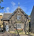
 Glebe House - Butterworth Lane - geograph.org.uk - 4302482.jpg 640 × 480; 76 KB
-
 Grand View, off Boggart Lane, Sowerby Bridge - geograph.org.uk - 4887406.jpg 1,484 × 1,988; 944 KB
-
 Holmes Cottage at south end of Gas Works Bridge - geograph.org.uk - 6033525.jpg 1,024 × 683; 212 KB
-
 Houses at Lower Brock Well - geograph.org.uk - 4638848.jpg 2,048 × 1,536; 930 KB
-
 Houses at Rose Hill, Thorney Lane, Midgley - geograph.org.uk - 4381475.jpg 2,000 × 1,468; 775 KB
-

-
 Houses on Red Brink Lane, Sowerby - geograph.org.uk - 4586944.jpg 2,004 × 1,482; 885 KB
-
 Houses, Jerry Lane - geograph.org.uk - 3502356.jpg 2,000 × 1,473; 850 KB
-
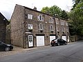
 Houses, Rochdale Road - geograph.org.uk - 3847793.jpg 2,000 × 1,247; 1.03 MB
-
 Houses, Scarr Head Road, Norland - geograph.org.uk - 2999117.jpg 2,000 × 1,479; 1 MB
-
 Houses, Thorney Lane, Midgley - geograph.org.uk - 4381453.jpg 2,000 × 1,500; 689 KB
-
 Hoyle House - Water Hill Lane - geograph.org.uk - 4324405.jpg 640 × 480; 99 KB
-
 Hoyle House at Friendly - geograph.org.uk - 4326655.jpg 1,600 × 1,200; 476 KB
-
 Lime Tree Court off Hollins Lane - geograph.org.uk - 1844402.jpg 640 × 480; 168 KB
-
 Little England, Sowerby Bridge - geograph.org.uk - 6065648.jpg 768 × 1,024; 212 KB
-
 Lower Breck Farmhouse, Sowerby - geograph.org.uk - 4638290.jpg 2,048 × 1,536; 1.07 MB
-
 Lower Oak - Oak Hill - geograph.org.uk - 4515148.jpg 640 × 480; 86 KB
-
 Lower Old Hall - geograph.org.uk - 271330.jpg 640 × 480; 118 KB
-
 Millstone Cottage - Wakefield Road - geograph.org.uk - 4377821.jpg 4,608 × 2,451; 4.35 MB
-
 Modern houses, West Street - geograph.org.uk - 3847805.jpg 2,000 × 1,259; 731 KB
-
 Modern houses, West Street - geograph.org.uk - 3847809.jpg 2,000 × 1,281; 874 KB
-

-
 Mount Pleasant, Norland - geograph.org.uk - 4526385.jpg 2,007 × 1,452; 730 KB
-

-
 No52 Sowerby Street, Sowerby Bridge - geograph.org.uk - 1814467.jpg 481 × 640; 95 KB
-
 Orrel House, Church Bank - geograph.org.uk - 5822552.jpg 1,024 × 683; 259 KB
-
 Pipe marker post at Boulder Clough - geograph.org.uk - 3501500.jpg 2,000 × 1,484; 1 MB
-
-

-

-
 Scar Hall, Dye House Lane (12), Norland - geograph.org.uk - 4511060.jpg 1,989 × 1,470; 799 KB
-
 Sowerby Bridge - Gasworks Bridge - geograph.org.uk - 3870379.jpg 1,600 × 1,180; 937 KB
-

-
 Sowerby Bridge - houses on Rochdale Road - geograph.org.uk - 3694587.jpg 1,600 × 1,201; 654 KB
-
 Sowerby Bridge FP69 on Daisy Lee Lane, Sowerby - geograph.org.uk - 5627234.jpg 2,000 × 1,500; 729 KB
-
 Sowerby Bridge FP98 alongside the Woodlands housing estate - geograph.org.uk - 4638708.jpg 2,048 × 1,536; 1.03 MB
-
 Sowerby bridge FP98 at Brock Well Mill - geograph.org.uk - 4638776.jpg 2,016 × 1,494; 848 KB
-
 Staveley - a house built in 1928 - geograph.org.uk - 610621.jpg 640 × 480; 99 KB
-
 The Old Manse, Well Head Lane, Sowerby - geograph.org.uk - 3118879.jpg 2,000 × 1,471; 1.03 MB
-
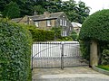
 The Royd - Town Gate - geograph.org.uk - 4547455.jpg 640 × 480; 77 KB
-
 Top of Hollins Mill Lane - Sowerby Bridge - geograph.org.uk - 989681.jpg 640 × 438; 226 KB
-
 Travellers Cottages - geograph.org.uk - 4845431.jpg 1,600 × 1,200; 391 KB
-
 Trough and houses, Jim Allen Lane, Midgley - geograph.org.uk - 4381444.jpg 2,000 × 1,369; 774 KB
-
 Upper Gauk Roger, Sowerby - geograph.org.uk - 5627237.jpg 2,000 × 1,486; 862 KB
-
 Walker Bridge - geograph.org.uk - 3128841.jpg 2,000 × 1,500; 878 KB
-
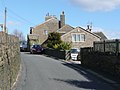
 Well Head Lane, Sowerby - geograph.org.uk - 3118870.jpg 2,000 × 1,484; 745 KB
-
 ^46 Wakefield Road - geograph.org.uk - 5852259.jpg 1,024 × 683; 196 KB


.jpg)


,_Norland_-_geograph.org.uk_-_4511060.jpg)


