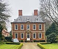
Category:Houses in Nottinghamshire
Jump to navigation
Jump to search
Ceremonial counties of England: Bedfordshire · Berkshire · Buckinghamshire · Cambridgeshire · Cheshire · Cornwall · Cumbria · Derbyshire · Devon · Dorset · Durham · East Riding of Yorkshire · East Sussex · Essex · Gloucestershire · Greater London · Greater Manchester · Hampshire · Herefordshire · Hertfordshire · Isle of Wight · Kent · Lancashire · Leicestershire · Lincolnshire · Merseyside · Norfolk · North Yorkshire · Northamptonshire · Northumberland · Nottinghamshire · Oxfordshire · Rutland · Shropshire · Somerset · South Yorkshire · Staffordshire · Suffolk · Surrey · Tyne and Wear · Warwickshire · West Midlands · West Sussex · West Yorkshire · Wiltshire · Worcestershire
City-counties: Bristol · City of London
Former historic counties: Huntingdonshire · Westmorland ·
Other former counties:
City-counties: Bristol · City of London
Former historic counties: Huntingdonshire · Westmorland ·
Other former counties:
Wikimedia category | |||||
| Upload media | |||||
| Instance of | |||||
|---|---|---|---|---|---|
| |||||
Subcategories
This category has the following 12 subcategories, out of 12 total.
Media in category "Houses in Nottinghamshire"
The following 200 files are in this category, out of 204 total.
(previous page) (next page)-
182 Beardall St, Hucknall - geograph.org.uk - 892824 (cropped).jpg 523 × 396; 52 KB
-
182 Beardall St, Hucknall - geograph.org.uk - 892824.jpg 640 × 485; 74 KB
-
19 and 21 Church Street - geograph.org.uk - 1014463.jpg 640 × 377; 107 KB
-
1930s suburbia, Wollaton - geograph.org.uk - 1040735.jpg 640 × 469; 123 KB
-
A Maple on Sycamore Road - geograph.org.uk - 2832.jpg 545 × 640; 65 KB
-
A616 Kneesall - geograph.org.uk - 118071.jpg 640 × 438; 64 KB
-
Beeston MMB 51.jpg 4,113 × 2,579; 2.91 MB
-
Beeston MMB 75.jpg 4,035 × 2,634; 5.01 MB
-
Beeston MMB 76.jpg 3,690 × 2,601; 3.08 MB
-
Beeston MMB 79.jpg 4,195 × 2,559; 4 MB
-
Beeston MMB 80.jpg 4,049 × 2,421; 3.81 MB
-
Beeston MMB A8 Hetley Road.jpg 3,798 × 2,697; 4.16 MB
-
Beeston MMB A9 Boundary Road.jpg 4,065 × 2,280; 3.73 MB
-
Bestwood Village, Coronation Road - geograph.org.uk - 661614.jpg 640 × 480; 112 KB
-
Bestwood Village, The Spinney - geograph.org.uk - 661606.jpg 640 × 429; 76 KB
-
Bestwood Village, The Spinney - geograph.org.uk - 661609.jpg 640 × 480; 129 KB
-
Bestwood Village, The Spinney - geograph.org.uk - 661611.jpg 640 × 437; 93 KB
-
Far Street, Bradmore - geograph.org.uk - 667866.jpg 640 × 427; 87 KB
-
Steeple Cottage - geograph.org.uk - 1771500.jpg 939 × 1,280; 257 KB
-
Bradmore Church - geograph.org.uk - 1771503.jpg 1,280 × 1,023; 266 KB
-
Black Horse, Caythorpe - geograph.org.uk - 1551415.jpg 640 × 479; 169 KB
-
Main Street, Caythorpe - geograph.org.uk - 956081.jpg 640 × 480; 82 KB
-
Christmas Day in West Bridgford - geograph.org.uk - 95302.jpg 640 × 480; 72 KB
-
Collington Street, Beeston - geograph.org.uk - 1771800.jpg 640 × 480; 105 KB
-
Cotmanhay - geograph.org.uk - 1409652.jpg 640 × 479; 146 KB
-
Curates House - geograph.org.uk - 748119.jpg 640 × 480; 178 KB
-
Dale Lane, Beeston - geograph.org.uk - 1768188.jpg 640 × 480; 58 KB
-
Derelict Almshouses, Northgate, Newark on Trent - geograph.org.uk - 6014252.jpg 1,024 × 768; 128 KB
-
Elkesley High Street and church - geograph.org.uk - 14305.jpg 600 × 333; 28 KB
-
Empty streets (71 of 81).jpg 1,600 × 900; 1.1 MB
-
Epperstone Manor - geograph.org.uk - 1628988.jpg 640 × 479; 113 KB
-
Epperstone Manor - geograph.org.uk - 1629002.jpg 640 × 479; 100 KB
-
Former Mapperley Brickworks - geograph.org.uk - 307645.jpg 640 × 426; 91 KB
-
From Bilborough churchyard - geograph.org.uk - 606866.jpg 640 × 480; 99 KB
-
Garages between Nos. 24 and 26 Harewood Avenue - geograph.org.uk - 5243271.jpg 1,024 × 683; 203 KB
-
Garages next to ^116 Lime Grove - geograph.org.uk - 5165039.jpg 1,024 × 683; 221 KB
-
All Saint's church - geograph.org.uk - 1659541.jpg 640 × 426; 67 KB
-
Harlow Wood, private housing estate - geograph.org.uk - 57474.jpg 640 × 480; 94 KB
-
Harrow Road - geograph.org.uk - 569474.jpg 640 × 480; 86 KB
-
Heckdyke Grange - geograph.org.uk - 170960.jpg 640 × 480; 93 KB
-
Holme, buttress and pantiled house - geograph.org.uk - 1718528.jpg 640 × 480; 104 KB
-
House by Edwinstowe Churchyard - geograph.org.uk - 1590519.jpg 640 × 480; 96 KB
-
House on Wood Lane , Gotham - geograph.org.uk - 1298905.jpg 640 × 480; 193 KB
-
Houses and shop due for demolition (geograph 2790082).jpg 640 × 427; 97 KB
-
Houses on Buckingham Drive - geograph.org.uk - 1614871.jpg 640 × 479; 119 KB
-
Houses on Main Street, Gamston - geograph.org.uk - 939651.jpg 619 × 640; 80 KB
-
Houses on Netherfield Lane - geograph.org.uk - 521449.jpg 640 × 480; 77 KB
-
Houses on Saxondale Drive - geograph.org.uk - 1615706.jpg 640 × 479; 104 KB
-
Houses on Winthorpe Road - geograph.org.uk - 241153.jpg 640 × 486; 79 KB
-
Housing at Upper Saxondale - geograph.org.uk - 1614848.jpg 640 × 479; 124 KB
-
Housing at Upper Saxondale - geograph.org.uk - 1614851.jpg 640 × 479; 106 KB
-
Housing on Lily Lane - geograph.org.uk - 6259268.jpg 1,024 × 768; 207 KB
-
Housing, Waters Edge, Newark - geograph.org.uk - 6246020.jpg 1,024 × 768; 195 KB
-
Keepers Cottage - geograph.org.uk - 1761630.jpg 640 × 480; 99 KB
-
Killarney Park - geograph.org.uk - 35010.jpg 640 × 480; 112 KB
-
Kimbolton.jpg 264 × 515; 18 KB
-
Knowle Lane, Swingate - geograph.org.uk - 617039.jpg 640 × 466; 58 KB
-
Lenton Terrace, Millgate - geograph.org.uk - 6075020.jpg 1,024 × 768; 213 KB
-
Limelane House - geograph.org.uk - 35043.jpg 640 × 480; 106 KB
-
Millwell House - geograph.org.uk - 376994.jpg 640 × 427; 83 KB
-
Millwell House - geograph.org.uk - 67688.jpg 640 × 480; 78 KB
-
Modernised 'prefab' home, Bulwell - geograph.org.uk - 46138.jpg 640 × 443; 83 KB
-
Newark, Notts (Mill Gate Area) - geograph.org.uk - 3049833.jpg 3,942 × 2,582; 2.08 MB
-
Newlands - geograph.org.uk - 179388.jpg 640 × 480; 80 KB
-
Northern Terrace - geograph.org.uk - 6393225.jpg 4,032 × 3,024; 4.19 MB
-
Nottingham MMB I4 Meriden Avenue.jpg 3,876 × 2,664; 3.96 MB
-
Nottingham MMB I5 Wensor Avenue.jpg 3,596 × 2,376; 2.89 MB
-
Nottingham MMB K7 Nottingham Canal.jpg 3,827 × 2,589; 3.72 MB
-
Off Millgate, Newark on Trent, Notts. - geograph.org.uk - 5582793.jpg 2,751 × 2,884; 1.81 MB
-
Oxton I Prebendal House.jpg 1,528 × 1,317; 1,002 KB
-
Philip Road houses - geograph.org.uk - 5245164.jpg 1,024 × 683; 187 KB
-
Porter's Yard - geograph.org.uk - 3242237.jpg 427 × 640; 82 KB
-
Potterdyke House, Newark.jpg 1,024 × 768; 127 KB
-
Prefab style home, Bulwell - geograph.org.uk - 46136.jpg 640 × 480; 80 KB
-
Quaker House .jpg 1,758 × 1,950; 391 KB
-
Quaker House Skegby .jpg 1,758 × 1,950; 1.01 MB
-
Quaker House, Mansfield Road, Skegby.jpg 1,758 × 1,950; 1 MB
-
Quaker House, Skegby .jpg 1,758 × 1,950; 938 KB
-
Rampton Hospital - geograph.org.uk - 211315.jpg 640 × 427; 61 KB
-
Riverside Walk, Newark.jpg 1,024 × 768; 256 KB
-
Roadworks on Northgate, Newark - geograph.org.uk - 5818550.jpg 683 × 1,024; 103 KB
-
Rose Cottage, Lovers Lane - geograph.org.uk - 6015265.jpg 1,024 × 882; 171 KB
-
Row of houses on Devon Road - geograph.org.uk - 5245082.jpg 1,024 × 688; 207 KB
-
Shalem Lodge - geograph.org.uk - 6380762.jpg 1,024 × 768; 215 KB
-
Side view of Kirkwood House (geograph 6551938).jpg 1,024 × 768; 324 KB
-
Standish House and outbuilding by bus stop - geograph.org.uk - 5245816.jpg 1,024 × 683; 126 KB
-
Steps up to Beacon Hill Road passing ^78 - geograph.org.uk - 5240146.jpg 683 × 1,024; 194 KB
-
Sutton-on-Trent - Vine House.JPG 2,272 × 1,704; 1.17 MB
-
Swingate near Sycamore Crescent - geograph.org.uk - 617036.jpg 640 × 466; 70 KB
-
Terraced houses ready for demolition - geograph.org.uk - 121120.jpg 640 × 423; 82 KB
-
Terraced houses, Appletongate, Newark on Trent - geograph.org.uk - 6015306.jpg 1,024 × 768; 156 KB
-
The Barns nr Babworth - geograph.org.uk - 773869.jpg 640 × 420; 69 KB
-
The entrance to Babbington Hall - geograph.org.uk - 616598.jpg 640 × 466; 59 KB
-
The Hut - geograph.org.uk - 588844.jpg 640 × 427; 56 KB
-
The top of Swingate - geograph.org.uk - 617024.jpg 630 × 452; 33 KB
-
Thoroton Dovecote - geograph.org.uk - 946582.jpg 640 × 427; 89 KB
-
Thoroton Dovecote - geograph.org.uk - 946587.jpg 640 × 427; 89 KB
-
University Park MMB «66.jpg 3,996 × 1,782; 2.34 MB
-
Winkburn Old School 2.jpg 4,032 × 3,024; 5.94 MB
-
Winthorpe Level Crossing - geograph.org.uk - 339690.jpg 640 × 431; 95 KB
-
A fine array of pots - geograph.org.uk - 1195756.jpg 640 × 479; 128 KB
-
A House called Kevin - geograph.org.uk - 1078051.jpg 640 × 423; 121 KB
-
Agnes Villas - geograph.org.uk - 1197657.jpg 640 × 467; 91 KB
-
Airedale Court, Chilwell - geograph.org.uk - 632141.jpg 640 × 365; 60 KB
-
Ancaster Gardens, Wollaton - geograph.org.uk - 1040849.jpg 640 × 474; 83 KB
-
Apartments and Car Park - geograph.org.uk - 745859.jpg 640 × 427; 152 KB
-
Apartments on Church Street, Beeston - geograph.org.uk - 1246899.jpg 640 × 478; 156 KB
-
Archers Field - geograph.org.uk - 838516.jpg 640 × 426; 120 KB
-
Babbington Hall - geograph.org.uk - 616356.jpg 640 × 466; 68 KB
-
Bayford Drive - geograph.org.uk - 213615.jpg 640 × 396; 48 KB
-
Belconnen Road - geograph.org.uk - 18538.jpg 640 × 480; 284 KB
-
Bramblewood Estate - geograph.org.uk - 674427.jpg 640 × 480; 110 KB
-
Bryn House - geograph.org.uk - 44014.jpg 640 × 480; 100 KB
-
Bunny Hill Top - geograph.org.uk - 7991.jpg 640 × 450; 156 KB
-
Cartwright Way, Beeston - geograph.org.uk - 1145633.jpg 640 × 426; 92 KB
-
Charnwood Street - geograph.org.uk - 487279.jpg 640 × 360; 83 KB
-
Charnwood Street - geograph.org.uk - 487287.jpg 640 × 359; 83 KB
-
Clifford Avenue, Beeston - geograph.org.uk - 673082.jpg 640 × 427; 179 KB
-
Cranston Road, Bramcote Hills - geograph.org.uk - 482762.jpg 640 × 428; 117 KB
-
Croxley Gardens, Assarts Farm Estate - geograph.org.uk - 612588.jpg 640 × 480; 79 KB
-
Curious house by the river - geograph.org.uk - 679457.jpg 640 × 458; 97 KB
-
Earthquake damage - geograph.org.uk - 708670.jpg 640 × 427; 79 KB
-
Ellicar House - geograph.org.uk - 605571.jpg 640 × 427; 63 KB
-
Former Inn - geograph.org.uk - 759993.jpg 640 × 427; 59 KB
-
Foxwood House - geograph.org.uk - 34982.jpg 640 × 480; 138 KB
-
Georgian town houses - geograph.org.uk - 332700.jpg 640 × 427; 85 KB
-
Grey House - geograph.org.uk - 92439.jpg 640 × 427; 86 KB
-
Gunthorpe riverside - geograph.org.uk - 652821.jpg 640 × 480; 117 KB
-
Hainton House - geograph.org.uk - 94696.jpg 640 × 480; 119 KB
-
Hayden Villa, Linby - geograph.org.uk - 431530.jpg 640 × 480; 115 KB
-
Hermitage House - geograph.org.uk - 663711.jpg 640 × 427; 88 KB
-
Hidden behind a bank - geograph.org.uk - 778115.jpg 640 × 427; 149 KB
-
Highfield House - geograph.org.uk - 507862.jpg 480 × 640; 108 KB
-
House in Normanton on Soar - geograph.org.uk - 552282.jpg 640 × 449; 135 KB
-
House near Babbington Hall - geograph.org.uk - 616492.jpg 640 × 466; 105 KB
-
House with tower - geograph.org.uk - 715809.jpg 543 × 640; 55 KB
-
Houses at New Kingston - geograph.org.uk - 14895.jpg 640 × 404; 128 KB
-
Houses in Budby - geograph.org.uk - 454143.jpg 640 × 480; 130 KB
-
Houses in South Leverton - geograph.org.uk - 458989.jpg 640 × 480; 122 KB
-
Housing north of Mill Lane - geograph.org.uk - 243759.jpg 640 × 480; 112 KB
-
I remember when all of this was school - geograph.org.uk - 463148.jpg 640 × 480; 118 KB
-
Innes Close, Carlton - geograph.org.uk - 312719.jpg 640 × 427; 85 KB
-
Isolated house - geograph.org.uk - 403635.jpg 640 × 480; 122 KB
-
Isolated House - geograph.org.uk - 4238.jpg 640 × 527; 87 KB
-
Isolated Street - geograph.org.uk - 148834.jpg 640 × 480; 84 KB
-
Keepers Close - geograph.org.uk - 661605.jpg 640 × 480; 77 KB
-
Kent Road, Porchester Gardens - geograph.org.uk - 87818.jpg 640 × 480; 90 KB
-
Kirkwood - geograph.org.uk - 360404.jpg 427 × 640; 89 KB
-
Lawrence Avenue, Colwick. - geograph.org.uk - 312620.jpg 640 × 421; 101 KB
-
Lea Pools, Arnold - geograph.org.uk - 32051.jpg 640 × 480; 133 KB
-
Little Hayes - geograph.org.uk - 182037.jpg 640 × 480; 107 KB
-
Lombard Street houses - geograph.org.uk - 338160.jpg 640 × 427; 71 KB
-
Lonely Semi - geograph.org.uk - 213401.jpg 640 × 480; 74 KB
-
Modern Mansion - geograph.org.uk - 221256.jpg 640 × 480; 76 KB
-
Moor Farm , Bramcote Hills - geograph.org.uk - 622485.jpg 626 × 459; 96 KB
-
Moor Lane, Normanton on Soar - geograph.org.uk - 551993.jpg 640 × 501; 96 KB
-
Morton Grange - geograph.org.uk - 50239.jpg 640 × 480; 163 KB
-
National Coal Board Housing, Cotgrave - geograph.org.uk - 161560.jpg 640 × 427; 123 KB
-
Near Wilford Hill - geograph.org.uk - 36213.jpg 640 × 426; 130 KB
-
New housing at Bilborough - geograph.org.uk - 667733.jpg 640 × 427; 71 KB
-
Norwood Lodge - geograph.org.uk - 287008.jpg 640 × 480; 162 KB
-
Old House, Sutton Bonington - geograph.org.uk - 10402.jpg 640 × 480; 179 KB
-
Old House, Sutton Bonington - geograph.org.uk - 10404.jpg 640 × 480; 138 KB
-
Orston Hall - geograph.org.uk - 132185.jpg 640 × 480; 176 KB
-
Pink House - geograph.org.uk - 194745.jpg 640 × 480; 79 KB
-
Pre-war houses - geograph.org.uk - 67858.jpg 640 × 480; 166 KB
-
Rampton Prebend - geograph.org.uk - 334670.jpg 640 × 427; 72 KB
-
Red Brick Gothic - geograph.org.uk - 452904.jpg 480 × 640; 102 KB
-
Rockley Nr Retford - geograph.org.uk - 83231.jpg 640 × 482; 78 KB
-
Rondesbosch - geograph.org.uk - 94697.jpg 640 × 480; 119 KB
-
Sacrista Prebend - geograph.org.uk - 334673.jpg 640 × 427; 71 KB
-
Southwold Drive - geograph.org.uk - 622767.jpg 640 × 427; 107 KB
-
Spring Hill, Swingate - geograph.org.uk - 616563.jpg 640 × 466; 46 KB
-
Station Road - geograph.org.uk - 588813.jpg 640 × 427; 62 KB
-
The demise of Abbey House - geograph.org.uk - 33643.jpg 640 × 480; 97 KB
-
The Duke's study - geograph.org.uk - 415712.jpg 640 × 427; 64 KB
-
The Fairways - geograph.org.uk - 663991.jpg 640 × 427; 64 KB
-
The Fairways - geograph.org.uk - 663993.jpg 640 × 427; 55 KB
-
The Hermitage - geograph.org.uk - 237862.jpg 640 × 427; 84 KB
-
The Old Nurseries, Norwell - geograph.org.uk - 450322.jpg 640 × 480; 78 KB
-
The Old Rectory - geograph.org.uk - 661591.jpg 480 × 640; 167 KB
-
The Sycamores - geograph.org.uk - 97442.jpg 640 × 427; 80 KB
-
The Vicarage - geograph.org.uk - 97431.jpg 640 × 427; 87 KB
-
The White House - geograph.org.uk - 44060.jpg 640 × 480; 146 KB
-
Tindale Bank Gatehouse - geograph.org.uk - 170873.jpg 640 × 480; 94 KB
-
Watermeadows - geograph.org.uk - 113847.jpg 640 × 427; 71 KB
-
Westholme Nr South Leverton Notts - geograph.org.uk - 90144.jpg 640 × 482; 96 KB


