Category:Houses in Headingley
Jump to navigation
Jump to search
Subcategories
This category has the following 2 subcategories, out of 2 total.
Media in category "Houses in Headingley"
The following 50 files are in this category, out of 50 total.
-
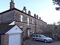
 189 Kirkstall Lane, Headingley, Leeds - geograph.org.uk - 4902978.jpg 1,280 × 720; 522 KB
-
 4-7, Ellis Terrace.jpg 3,733 × 2,799; 2.1 MB
-
 A house on Ash Crescent, Leeds - geograph.org.uk - 2771904.jpg 800 × 600; 115 KB
-
 Albert Grove, Headingley, Leeds - geograph.org.uk - 4898627.jpg 1,280 × 853; 566 KB
-
 Ancaster View, Leeds - geograph.org.uk - 5453421.jpg 1,280 × 720; 636 KB
-
 Apartments, Kirkstall Lane, Headingley - geograph.org.uk - 152021.jpg 640 × 480; 252 KB
-
 Balmoral Terrace from Shaw Lane.jpg 4,608 × 3,456; 3.22 MB
-
 Batcliffe Drive from Beckett Park (30th January 2010) 002.JPG 3,872 × 2,592; 3.98 MB
-
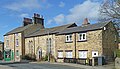
 Bennett Road, Headingley (7303302410).jpg 2,379 × 2,410; 3.3 MB
-
 Buckingham House.jpg 3,874 × 2,905; 1.99 MB
-
 Canterbury Drive, Headingley - geograph.org.uk - 169058.jpg 640 × 480; 310 KB
-

-
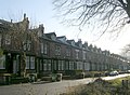
 Cardigan Road, Headingley, Leeds (5574475928).jpg 2,487 × 2,937; 5.57 MB
-
 Electricity substation, Newport View, Headingley - geograph.org.uk - 6502638.jpg 1,024 × 768; 182 KB
-
 Estcourt Avenue - Canterbury Drive - geograph.org.uk - 1102424.jpg 640 × 482; 218 KB
-
 Estcourt Avenue - Kirkstall Lane - geograph.org.uk - 1102607.jpg 640 × 452; 204 KB
-
 Estcourt Avenue, Headingley - geograph.org.uk - 169063.jpg 640 × 480; 241 KB
-
 Estcourt Terrace - Canterbury Drive - geograph.org.uk - 1102419.jpg 640 × 442; 196 KB
-
 Estcourt Terrace - Kirkstall Lane - geograph.org.uk - 1102609.jpg 640 × 431; 214 KB
-
 Estcourt Terrace, Headingley - geograph.org.uk - 169061.jpg 640 × 480; 273 KB
-
 Fulton Place, Leeds (34934120734).jpg 5,312 × 2,988; 8.31 MB
-

-
 Glebe House, Headingley.jpg 3,456 × 4,608; 4.85 MB
-
 Grove Gardens - geograph.org.uk - 604501.jpg 640 × 423; 35 KB
-
 House on Shire Oak Road, Headingley - geograph.org.uk - 4498686.jpg 1,632 × 918; 647 KB
-
 Houses on Cardigan Road - geograph.org.uk - 2763859.jpg 640 × 480; 80 KB
-
 Langdale Avenue - Canterbury Drive - geograph.org.uk - 1102414.jpg 640 × 450; 298 KB
-
 Langdale Avenue - Headingley - geograph.org.uk - 620998.jpg 640 × 461; 27 KB
-
 Langdale Avenue, Headingley - geograph.org.uk - 168841.jpg 640 × 480; 255 KB
-
 Langdale Gardens - Canterbury Drive - geograph.org.uk - 1102410.jpg 640 × 465; 218 KB
-
 Langdale Gardens, Headingley - geograph.org.uk - 169057.jpg 640 × 480; 252 KB
-
 Langdale Gardens, Headingley - geograph.org.uk - 169081.jpg 640 × 302; 54 KB
-
 Langdale Terrace - Canterbury Drive - geograph.org.uk - 1102403.jpg 640 × 467; 249 KB
-
 Moor Road, Far Headingley (5524361310).jpg 2,636 × 3,407; 5.01 MB
-
 Moor Road, Far Headingley (5578908721).jpg 3,923 × 2,245; 5.12 MB
-
 Moorfield House - Alma Road, Headingley - geograph.org.uk - 379992.jpg 639 × 483; 105 KB
-
 North Hill Road, Headingley, Leeds - geograph.org.uk - 4903069.jpg 1,280 × 853; 826 KB
-
 Sayers Close, Headingley (21st August 2020).jpg 5,152 × 3,864; 5 MB
-
 Smart suburban semis on Batcliffe Drive, Headingley, Leeds (31st December 2014).jpg 4,608 × 3,456; 6.38 MB
-
 South Lodge On St Chads Drive.jpg 3,264 × 2,448; 2.02 MB
-
 St Michael's Road - Headingley - geograph.org.uk - 621005.jpg 640 × 512; 41 KB
-
 St. Anne's Road, Headingley (30th January 2010) 001.JPG 3,872 × 2,592; 2.81 MB
-
 St. Anne's Road, Headingley (30th January 2010) 002.JPG 3,872 × 2,592; 3.48 MB
-
 St. Anne's Road, Headingley, Leeds (17th December 2012) 002.JPG 3,872 × 2,176; 2.26 MB
-
 St. Anne's Road, Headingley, Leeds (17th December 2012) 003.JPG 3,872 × 2,176; 2.26 MB
-
 St. Anne's Road, Headingley, Leeds (17th December 2012) 004.JPG 2,176 × 3,872; 2.09 MB
-
 St. Anne's Road, Headingley, Leeds (17th December 2012) 005.JPG 2,176 × 3,872; 2.25 MB
-
 Student houses, Headingley Mount, Headingley, Leeds (30th December 2014).JPG 4,608 × 3,456; 6.47 MB
-
 Terrace (5526211578).jpg 3,318 × 2,912; 6.82 MB
-
 Wood Lane, Headingley - geograph.org.uk - 141445.jpg 640 × 480; 73 KB


_002.JPG)
.jpg)


.jpg)


.jpg)


.jpg)
.jpg)


.jpg)
.jpg)


_001.JPG)
_002.JPG)
_002.JPG)
_003.JPG)
_004.JPG)
_005.JPG)
.JPG)
.jpg)
