Category:Houghton-le-Spring
Jump to navigation
Jump to search
town in the City of Sunderland in the county of Tyne and Wear, England | |||||
| Upload media | |||||
| Instance of | |||||
|---|---|---|---|---|---|
| Location | Sunderland, Tyne and Wear, North East England, England | ||||
 | |||||
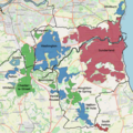
English: Houghton-le-Spring is part of Sunderland in the county of Tyne and Wear, North East England that has its recorded origins in Norman times. It is situated almost equidistant between the cathedral city of Durham 7 miles (11.3 km) to the south-west and the centre of the City of Sunderland about 6 miles (9.7 km) to the north-east. The town of Seaham and the North Sea lie about 5 miles (8 km) directly to the east. The towns of Newbottle, Fencehouses and Hetton-le-Hole lie nearby. It has a population of 36,746.
Nederlands: Houghton-le-Spring is een voormalige mijnplaats in het bestuurlijke gebied Tyne and Wear.
Română: Houghton-le-Spring este un oraş în comitatul Tyne and Wear, regiunea North East, Anglia. Oraşul se află în districtul metropolitan Sunderland.
Subcategories
This category has the following 10 subcategories, out of 10 total.
Media in category "Houghton-le-Spring"
The following 43 files are in this category, out of 43 total.
-
131203 Houghton Mines Rescue 002 The Building.jpg 4,608 × 3,440; 3.81 MB
-
Bridleway near Houghton-le-Spring - geograph.org.uk - 2584343.jpg 640 × 480; 75 KB
-
Church Street, Houghton-le-Spring - geograph.org.uk - 2584004.jpg 640 × 480; 68 KB
-
Edwin Street, Houghton-le-Spring - geograph.org.uk - 2579454.jpg 640 × 480; 62 KB
-
Edwin Street, Houghton-le-Spring - geograph.org.uk - 2579463.jpg 640 × 480; 67 KB
-
Entrance to the churchyard - geograph.org.uk - 3572101.jpg 3,648 × 2,736; 3.1 MB
-
Footpath leading to Hetton Bogs - geograph.org.uk - 1289009.jpg 640 × 480; 107 KB
-
Gillas Lane, Houghton-le-Spring - geograph.org.uk - 314159.jpg 640 × 480; 62 KB
-
Houghton Cut Viewed From South.jpg 4,128 × 2,322; 1.77 MB
-
Houghton le Spring - The Old Brewery.jpg 640 × 480; 73 KB
-
Houghton-le-Spring - geograph.org.uk - 1721513.jpg 640 × 480; 83 KB
-
Lawnswood, Houghton-le-Spring - geograph.org.uk - 2579493.jpg 640 × 480; 66 KB
-
Lawnswood, Houghton-le-Spring - geograph.org.uk - 2582644.jpg 640 × 480; 65 KB
-
Leeholme, Houghton-le-Spring - geograph.org.uk - 3394332.jpg 640 × 480; 84 KB
-
Leeholme, Houghton-le-Spring - geograph.org.uk - 3394340.jpg 640 × 480; 64 KB
-
Lilburne almshouse plaque.jpg 383 × 545; 67 KB
-
Local shop, Houghton-le-Spring - geograph.org.uk - 2582640.jpg 640 × 480; 78 KB
-
Market Place, Houghton-le-Spring - geograph.org.uk - 2579442.jpg 640 × 480; 54 KB
-
Mute swan,Joe's Pond - geograph.org.uk - 769025.jpg 640 × 480; 89 KB
-
Phragmites bed,Rainton Meadows - geograph.org.uk - 792529.jpg 640 × 480; 78 KB
-
Public footpath - geograph.org.uk - 1148278.jpg 640 × 480; 118 KB
-
Public footpath from Rainton Meadows - geograph.org.uk - 871336.jpg 640 × 480; 123 KB
-
Seaham Road, Houghton-le-Spring - geograph.org.uk - 314161.jpg 640 × 480; 66 KB
-
Second Lieutenant Frank Calder Tilbrook (8049887745).jpg 634 × 800; 47 KB
-
South East Entrance to the Lambton Estate - geograph.org.uk - 815430.jpg 640 × 480; 109 KB
-
Sunset,Rainton Meadows - geograph.org.uk - 786091.jpg 640 × 480; 44 KB
-
The Broadway, Houghton-le-Spring - geograph.org.uk - 314047.jpg 640 × 480; 66 KB
-
The Chilton, near Houghton-le-Spring - geograph.org.uk - 2584335.jpg 640 × 480; 66 KB
-
War Memorial - geograph.org.uk - 4553236.jpg 640 × 480; 96 KB
-
War memorial at Houghton-Le-Spring - geograph.org.uk - 5680655.jpg 1,200 × 1,600; 1.12 MB
-
WearsideBUA.png 850 × 850; 1 MB
-
Winter from Copt Hill - geograph.org.uk - 1750525.jpg 640 × 480; 71 KB
-
Field House Sand Hole - geograph.org.uk - 494871.jpg 640 × 480; 80 KB
-
Kentmere House Residential Care Home - geograph.org.uk - 466989.jpg 640 × 480; 162 KB
-
Rainton Bridge fire station - geograph.org.uk - 288199.jpg 640 × 427; 170 KB


