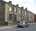
Category:Holmfield, West Yorkshire
Jump to navigation
Jump to search
suburb in Halifax, West Yorkshire, England, UK | |||||
| Upload media | |||||
| Instance of | |||||
|---|---|---|---|---|---|
| Part of | |||||
| Location | Calderdale, West Yorkshire, Yorkshire and the Humber, England | ||||
 | |||||
Subcategories
This category has the following 4 subcategories, out of 4 total.
H
- Holmfield Mills (6 F)
S
Media in category "Holmfield, West Yorkshire"
The following 66 files are in this category, out of 66 total.
-
94-102 Watkinson Road - geograph.org.uk - 1893026.jpg 640 × 549; 118 KB
-
Baker Street North - Beechwood Road - geograph.org.uk - 1457413.jpg 640 × 480; 244 KB
-
Beechwood Drive - Beechwood Road - geograph.org.uk - 3701815.jpg 640 × 480; 96 KB
-
Beechwood Road - Shay Lane - geograph.org.uk - 1457420.jpg 640 × 480; 242 KB
-
Blackmires - geograph.org.uk - 1893018.jpg 640 × 471; 96 KB
-
Blackmires - Shay Lane - geograph.org.uk - 1457425.jpg 640 × 480; 245 KB
-
Blackmires Barn - geograph.org.uk - 1893024.jpg 640 × 443; 85 KB
-
Brickfield Grove - Brickfield Lane - geograph.org.uk - 3701856.jpg 640 × 480; 76 KB
-
Brickfield Terrace - Brickfield Lane - geograph.org.uk - 3701850.jpg 640 × 480; 87 KB
-
Brow Lane - geograph.org.uk - 1479679.jpg 640 × 480; 87 KB
-
Churn Milk Lane, Halifax - geograph.org.uk - 5379406.jpg 2,000 × 1,500; 875 KB
-
Crocked Lane - geograph.org.uk - 1479688.jpg 640 × 480; 111 KB
-
Crocked Lane - geograph.org.uk - 1479696.jpg 640 × 480; 104 KB
-
Empire Mills, Blackmires - geograph.org.uk - 1893014.jpg 640 × 480; 65 KB
-
Footpath - Beechwood Road - geograph.org.uk - 3701844.jpg 480 × 640; 113 KB
-
Footpath - top of Brickfield Lane - geograph.org.uk - 3701858.jpg 480 × 640; 104 KB
-
Grange Avenue - Beechwood Drive - geograph.org.uk - 3701835.jpg 640 × 480; 85 KB
-
Halifax FP309 - geograph.org.uk - 5383936.jpg 2,048 × 1,536; 1.28 MB
-
Halifax FP309 - geograph.org.uk - 5383943.jpg 2,048 × 1,536; 1.09 MB
-
Heathy Avenue - Heathy Lane - geograph.org.uk - 3701936.jpg 640 × 480; 60 KB
-
Hillside above Holmfield - geograph.org.uk - 4345982.jpg 1,920 × 1,334; 796 KB
-
Holdsworth Road - Holmfield - geograph.org.uk - 737753.jpg 640 × 438; 59 KB
-
Holdsworth Road, Halifax - geograph.org.uk - 999223.jpg 640 × 583; 77 KB
-
Holmfield Industrial Estate - geograph.org.uk - 4345972.jpg 1,920 × 995; 604 KB
-
Houses - Churn Milk Lane - geograph.org.uk - 1882172.jpg 640 × 480; 62 KB
-
Kimberley Street - Churn Milk Lane - geograph.org.uk - 1882175.jpg 640 × 480; 75 KB
-
Looking down Watkinson Road - geograph.org.uk - 1882203.jpg 640 × 480; 94 KB
-
Netterton Mills - geograph.org.uk - 1479676.jpg 640 × 479; 56 KB
-
Netterton Mills - geograph.org.uk - 1479682.jpg 640 × 480; 81 KB
-
Netterton Mills and Holmfield Mills - geograph.org.uk - 1479651.jpg 640 × 480; 54 KB
-
New hedge and ditch at Mason's Green - geograph.org.uk - 4326494.jpg 1,600 × 1,200; 754 KB
-
Pair of garages on Crocked Lane - geograph.org.uk - 1479697.jpg 640 × 480; 76 KB
-
Pond (2919053147).jpg 3,569 × 2,340; 9 MB
-
Pylons, Windy Bank Lane - geograph.org.uk - 3260582.jpg 640 × 480; 65 KB
-
Rooster weather vane of St Andrew's Church, Holmfield, Halifax.jpg 1,225 × 817; 363 KB
-
Spindle Street - Shay Lane - geograph.org.uk - 1457422.jpg 640 × 480; 275 KB
-
St Andrew's Church - Beechwood Road - geograph.org.uk - 3701848.jpg 640 × 480; 89 KB
-
St Andrew's Close - Blackmires - geograph.org.uk - 1882196.jpg 640 × 480; 71 KB
-
St Andrew's, Holmfield - Beechwood Road - geograph.org.uk - 1457412.jpg 466 × 640; 273 KB
-
Stanley Street North - Beechwood Road - geograph.org.uk - 1457421.jpg 640 × 480; 225 KB
-
Station Road - Shay Lane - geograph.org.uk - 3701969.jpg 640 × 480; 73 KB
-
Stile, Howcans Lane (4816250032).jpg 1,587 × 2,380; 3.22 MB
-
Through the woods to Shibden Dale - geograph.org.uk - 91595.jpg 640 × 480; 171 KB
-
Track - Watkinson Road - geograph.org.uk - 1882199.jpg 640 × 480; 157 KB
-
View from Crocked Lane - geograph.org.uk - 1479692.jpg 640 × 480; 104 KB
-
View from Crooked Lane (4831053305).jpg 2,389 × 1,593; 3.66 MB
-
View from Howcans Lane (4815623935).jpg 2,585 × 1,485; 3.12 MB
-
Watkinson Road - viewed from Blackmires - geograph.org.uk - 1457376.jpg 640 × 480; 236 KB
-
Westward Ho - Churn Milk Lane - geograph.org.uk - 1882179.jpg 640 × 480; 90 KB
-
White Rose Mills, Holmfield - geograph.org.uk - 1479650.jpg 640 × 480; 66 KB
-
Blackmires - Watkinson Road - geograph.org.uk - 1457410.jpg 640 × 480; 242 KB
-
Burton Street - Beechwood Road - geograph.org.uk - 1457415.jpg 640 × 480; 217 KB


