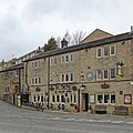
Category:Holmbridge
Jump to navigation
Jump to search
village in West Yorkshire, England | |||||
| Upload media | |||||
| Instance of | |||||
|---|---|---|---|---|---|
| Location | Holme Valley, Kirklees, West Yorkshire, Yorkshire and the Humber, England | ||||
 | |||||
Subcategories
This category has only the following subcategory.
H
Media in category "Holmbridge"
The following 25 files are in this category, out of 25 total.
-
After the grape harvest Holmfirth vineyard - geograph.org.uk - 3193361.jpg 1,024 × 577; 159 KB
-
Austonley School - geograph.org.uk - 104418.jpg 640 × 480; 129 KB
-
Boundary Stone (2), Holmbridge.jpg 450 × 600; 89 KB
-
Clutter - geograph.org.uk - 836326.jpg 640 × 491; 100 KB
-
Digley Road, Holmbridge (3374015560).jpg 3,599 × 2,243; 9.39 MB
-
Former Sunday School at Holmbridge - geograph.org.uk - 3043015.jpg 2,048 × 1,536; 555 KB
-
Hinchliffe Mill - geograph.org.uk - 3076910.jpg 5,184 × 3,456; 4.38 MB
-
Holmbridge Cricket Club - geograph.org.uk - 1277578.jpg 640 × 480; 66 KB
-
Holme Bridge - geograph.org.uk - 1414090.jpg 640 × 480; 161 KB
-
Holmfirth Vineyard rose wine for men^ - geograph.org.uk - 3650948.jpg 1,024 × 768; 164 KB
-
Holmfirth Vineyard vines - geograph.org.uk - 2466908.jpg 1,024 × 768; 182 KB
-
Kirklees Way, nr Ramsden Lane - geograph.org.uk - 138364.jpg 640 × 480; 118 KB
-
Last of The Summer Wine^ - geograph.org.uk - 2466919.jpg 1,024 × 768; 150 KB
-
Linshaws Road - geograph.org.uk - 138379.jpg 640 × 480; 90 KB
-
Milestone, Holmbridge.jpg 1,393 × 1,704; 466 KB
-
Moxon Village Yew Tree Mills.JPG 3,648 × 2,736; 3.53 MB
-
On the bend in Nether Lane - geograph.org.uk - 503180.jpg 640 × 480; 88 KB
-
Outside seating at Holmfirth Vineyard - geograph.org.uk - 2892141.jpg 1,024 × 768; 274 KB
-
Ramsden Road - geograph.org.uk - 138367.jpg 640 × 480; 82 KB
-
Riverside walk, Holmbridge - geograph.org.uk - 1296605.jpg 640 × 480; 152 KB
-
TDF milestone (geograph 4208158).jpg 773 × 1,024; 273 KB
-
The Bridge, Holmbridge (33067970311).jpg 2,480 × 2,480; 4.38 MB


