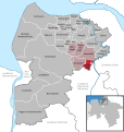
Category:Hollnseth
Jump to navigation
Jump to search
Landkreis Cuxhaven  Armstorf · Belum · Beverstedt · Bülkau · Cadenberge · Cuxhaven · Geestland · Hagen im Bremischen · Hechthausen · Hemmoor · Hollnseth · Ihlienworth · Lamstedt · Loxstedt · Mittelstenahe · Neuenkirchen · Neuhaus (Oste) · Nordleda · Oberndorf · Odisheim · Osten (Oste) · Osterbruch · Otterndorf · Schiffdorf · Steinau · Stinstedt · Wanna · Wingst · Wurster Nordseeküste ·
municipality of Germany | |||||
| Upload media | |||||
| Instance of |
| ||||
|---|---|---|---|---|---|
| Location | |||||
| Population |
| ||||
| Area |
| ||||
| Elevation above sea level |
| ||||
| official website | |||||
 | |||||
Subcategories
This category has the following 6 subcategories, out of 6 total.
Media in category "Hollnseth"
The following 4 files are in this category, out of 4 total.
-
Hollnseth in CUX.svg 1,771 × 1,870; 457 KB
-
Hollnseth Mehebrücke.jpg 2,816 × 2,112; 2.11 MB
-
Wappen Hollnseth.png 4,985 × 6,163; 45.2 MB
-
Öörd in de Gemeen Hollnseth.svg 1,303 × 1,139; 9 KB


