Category:Hochwaldbahn
Jump to navigation
Jump to search
railway line in Germany | |||||
| Upload media | |||||
| Instance of | |||||
|---|---|---|---|---|---|
| Location |
| ||||
| Date of official opening |
| ||||
| Length |
| ||||
| |||||
Deutsch: Die Hochwaldbahn war eine 50 km lange Bahnstrecke von Trier nach Hermeskeil in Rheinland-Pfalz. Sie wurde 1889 eröffnet und ab 1998 größtenteils abgerissen. Auf der Trasse befindet sich heute ein Radweg.
English: The Hochwaldbahn (Hochwald line) was a railway line of 50 km in Rhineland-Palatinate, Germany. It was opened in 1889 and mostly removed in 1998. See also Category:Ruwer-Hochwald-Radweg
Subcategories
This category has the following 7 subcategories, out of 7 total.
B
- Bahnhof Kell (Bz Trier) (4 F)
- Bahnhof Reinsfeld (6 F)
- Bahnhof Türkismühle (57 F)
R
- Ruwer (DB) train station (3 F)
W
- Bahnhof Waldrach (5 F)
Media in category "Hochwaldbahn"
The following 36 files are in this category, out of 36 total.
-
1957Kbs641a.jpg 900 × 1,071; 268 KB
-
Aerial view of the Grüneberg, Germany, on 25 January 1945 (312329355).jpg 2,689 × 2,668; 5.68 MB
-
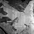
Aerial view of the Kasel, Germany, on 25 January 1945 (312329061).jpg 2,644 × 2,646; 4.92 MB
-
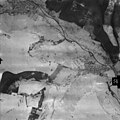
Aerial view of the Waldrach, Germany, on 25 January 1945 (312329059).jpg 2,635 × 2,661; 6.26 MB
-
Bahnhof Reinsfeld.jpg 2,816 × 2,112; 798 KB
-
Bahnhof-bierfeld-streetside.JPG 1,200 × 1,600; 442 KB
-
Bahnhof-bierfeld-trackside 01.JPG 1,600 × 1,200; 366 KB
-
Bahnhof-Pluwigerhammer.JPG 1,600 × 1,200; 368 KB
-
Bahnhof-Zerf.JPG 1,600 × 1,200; 346 KB
-
Current-end-of-Hochwaldbahn.JPG 1,600 × 1,200; 349 KB
-
DB 3131 railway map.png 1,613 × 1,144; 1.33 MB
-
Fahrplan6 70nachm.gif 2,500 × 3,537; 649 KB
-
Fahrplan6 70vorm.gif 2,500 × 3,537; 626 KB
-
FahrplanRuwertalSommer1985.jpg 900 × 394; 163 KB
-
Former-level-crossing-in-Trier-Ruwer.JPG 1,600 × 1,200; 375 KB
-
Fpl1907a.jpg 750 × 1,334; 231 KB
-
Fpl1907b.jpg 750 × 1,346; 236 KB
-
Germany Rail 035 Saar.jpg 2,350 × 1,346; 1.56 MB
-
Hochwaldbahn Hermeskeil mit CFL5519 1994.jpg 1,019 × 669; 370 KB
-
Hochwaldbahn höhenprofil.jpg 1,219 × 513; 48 KB
-
Hochwaldbahn in Trier-Nord in July 2016.JPG 3,072 × 2,304; 2.59 MB
-
Hochwaldbahn Kilometerstein 2005.JPG 1,728 × 2,304; 1.38 MB
-
Hochwaldbahn Radweg im Bau bei Waldrach 2005.JPG 1,728 × 2,304; 1.46 MB
-
Hochwaldbahn Trasse bei Waldrach 2005.JPG 1,728 × 2,304; 1.23 MB
-
Hochwaldbahn1 mit CFL5519 1994.jpg 687 × 1,013; 257 KB
-
Hochwaldbahn2 mit CFL5519 1994.jpg 1,015 × 677; 223 KB
-
Karte der Bahnstrecke Trier–Türkismühle.png 1,500 × 928; 284 KB
-
KBS625 Winter1972-73.jpg 800 × 470; 173 KB
-
Logo Hochwaldbahn Gruppe.jpg 148 × 121; 4 KB
-
Lösterbachtalbrücke-hochwaldbahn.JPG 1,600 × 1,200; 326 KB
-
Memorial-locomotive-Reinsfeld-1.JPG 1,600 × 1,200; 376 KB
-
Nonnweiler-Viadukt.jpg 4,608 × 3,456; 3.16 MB
-
Railway-bridge-south-hermeskeil.JPG 1,600 × 1,200; 369 KB
-
Silo-trier-ruwer.JPG 1,200 × 1,600; 268 KB
-
Viadukt Sommerau.jpg 4,896 × 2,752; 7.47 MB


