Category:History of Somerset
Jump to navigation
Jump to search
Ceremonial counties of England: Bedfordshire · Berkshire · Buckinghamshire · Cambridgeshire · Cheshire · Cornwall · Cumbria · Derbyshire · Devon · Dorset · Durham · East Riding of Yorkshire · East Sussex · Essex · Gloucestershire · Greater London · Greater Manchester · Hampshire · Herefordshire · Hertfordshire · Isle of Wight · Kent · Lancashire · Leicestershire · Lincolnshire · Merseyside · Norfolk · North Yorkshire · Northamptonshire · Northumberland · Nottinghamshire · Oxfordshire · Rutland · Shropshire · Somerset · South Yorkshire · Staffordshire · Suffolk · Surrey · Tyne and Wear · Warwickshire · West Midlands · West Sussex · West Yorkshire · Wiltshire · Worcestershire
City-counties: Bristol · City of London
Former historic counties: Cumberland · Huntingdonshire · Middlesex · North Riding of Yorkshire · Sussex · West Riding of Yorkshire · Westmorland · Yorkshire
Other former counties: Humberside ·
City-counties: Bristol · City of London
Former historic counties: Cumberland · Huntingdonshire · Middlesex · North Riding of Yorkshire · Sussex · West Riding of Yorkshire · Westmorland · Yorkshire
Other former counties: Humberside ·
aspect of history | |||||
| Upload media | |||||
| Instance of |
| ||||
|---|---|---|---|---|---|
| |||||
Subcategories
This category has the following 22 subcategories, out of 22 total.
*
B
C
- Caratacus Stone (24 F)
D
F
H
M
O
- Old county maps of Somerset (23 F)
R
- RAF Charmy Down (35 F)
- RAF Weston Zoyland (10 F)
S
- Somersetshire Bank (2 F)
W
- West Somerset Yeomanry (6 F)
- Worlebury hill fort (23 F)
Media in category "History of Somerset"
The following 20 files are in this category, out of 20 total.
-
 1645map Winterstoke100.jpg 800 × 442; 109 KB
-
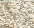
 Abdick and Bulstone hundred.png 370 × 300; 333 KB
-
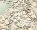
 Andersfield Hundred.png 370 × 300; 325 KB
-
 Bempstone Hundred.png 370 × 300; 313 KB
-
 Burnham-on-Sea beach and Stert Island, Somerset. View from the jetty.jpg 4,845 × 1,957; 1.52 MB
-
 Cover general view of the agriculture of Somerset.jpg 180 × 267; 7 KB
-
 John Thomas Straffen Bath Somerset 1951 Mugshot.jpg 204 × 263; 23 KB
-
 Records by Spade and Terrier (1918) (14769155975).jpg 3,088 × 2,348; 1.15 MB
-
 Remains of the Somerset ^ Dorset Joint Railway - geograph.org.uk - 4869817.jpg 4,130 × 3,193; 3.18 MB
-
 Results for Yeovil since 1983.svg 574 × 376; 602 KB
-
 Somerset Historical Essays.djvu 2,507 × 3,999, 174 pages; 5.29 MB
-
 Somersettensis Comitatus - Somerset Shire - btv1b530563217 (2 of 2).jpg 6,072 × 4,728; 4.45 MB
-
 St Andrew Church, Loxton, Somerset, 15th C. Looking west from graveyard.jpg 4,407 × 2,706; 2.12 MB
-
 St Andrew's Church, Loxton, Somerset. Looking south in the graveyard.jpg 4,896 × 2,752; 2.75 MB
-
 St Andrew's Church, Loxton, Somerset. Looking south-east in the graveyard.jpg 4,841 × 2,751; 1.68 MB
-
 St Andrew's Church, Loxton, Somerset. The 1926 restoration markers site.jpg 4,896 × 2,752; 4.96 MB
-
 St Andrew's Church, Loxton, Somerset. The interior.jpg 4,896 × 2,752; 4.77 MB
-
 St Andrew's lychgate, Loxton, Somerset. Looking East towards graveyard.jpg 3,370 × 2,608; 1.76 MB
-
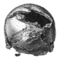 Worlebury broken skull.PNG 181 × 181; 41 KB
-
 Worlebury plan SE view.png 745 × 479; 518 KB


_(14769155975).jpg)


.jpg)


