Category:Historical flag maps of the United Kingdom
Jump to navigation
Jump to search
Subcategories
This category has only the following subcategory.
B
Media in category "Historical flag maps of the United Kingdom"
The following 26 files are in this category, out of 26 total.
-
British America flag map.png 1,614 × 2,359; 250 KB
-
Flag map of Anglo-Egyptian Sudan (United Kingdom) 1899-1956.png 1,495 × 2,646; 121 KB
-
Flag Map of British Canada (1866).png 1,346 × 1,095; 73 KB
-
Flag Map of British Canada (1867).png 1,346 × 1,095; 73 KB
-
Flag Map of British Canada (1868).png 1,346 × 1,095; 78 KB
-
Flag map of British North Africa (1914).png 2,079 × 2,774; 146 KB
-
Flag map of British North America (1763-1783).png 1,557 × 1,780; 57 KB
-
Flag map of England (1521).png 672 × 696; 10 KB
-
Flag map of Great Britan (1707–1801).png 985 × 1,178; 43 KB
-
Flag map of great Britian(1707 - 1801).png 329 × 518; 23 KB
-
Flag Map of Kingdom of Hanover (United Kingdom).png 389 × 352; 8 KB
-
Flag map of New Guinea Island (1884-1919).png 655 × 334; 39 KB
-
Flag map of New South Wales (1788–1801).png 258 × 507; 9 KB
-
Flag map of Nootka Territory (Great Britain, 1791).png 426 × 920; 14 KB
-
Flag map of the Angevin Empire.png 292 × 621; 107 KB
-
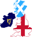
Flag map of the British Isles (1700).png 988 × 1,118; 62 KB
-
Flag map of the United Kingdom (1801–1919).png 985 × 1,178; 67 KB
-
Flag map of the United Kingdom 1801-1922 (reduced map).svg 1,227 × 1,506; 258 KB
-
Flag map of the United Kingdom 1801-1922.svg 1,227 × 2,053; 265 KB
-
Flag-map of Cyprus (United Kingdom).png 4,639 × 2,802; 67 KB
-
Flag-map of the Commonwealth of England.svg 352 × 431; 130 KB
-
Flag-map of the Kingdom of England.svg 371 × 473; 20 KB
-
Flag-map of the Kingdom of Great Britain (1707-1801).svg 338 × 573; 90 KB
-
Flag-Map of the Oregon Territory.png 1,176 × 1,156; 32 KB
-
Flag Map of British Hong Kong (1841 - 1997).png 2,020 × 1,569; 48 KB
-
Flag map of the Roman Empire.png 1,598 × 1,030; 102 KB


