Category:Historical flag maps of Europe
Jump to navigation
Jump to search
Subcategories
This category has the following 15 subcategories, out of 15 total.
A
F
G
I
R
Media in category "Historical flag maps of Europe"
The following 26 files are in this category, out of 26 total.
-
Flag Map of Europe (1812).png 1,024 × 822; 177 KB
-
Flag Map of Europe (1860).png 1,024 × 822; 180 KB
-
Flag Map of Europe (1914).png 890 × 595; 46 KB
-
Flag map of Europe (1938).png 847 × 723; 57 KB
-
1939 Europe Map Flag.png 7,500 × 7,600; 25.25 MB
-
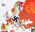
WW2 Map.png 1,094 × 1,117; 513 KB
-
Flag map of Europe 1955.png 571 × 618; 154 KB
-
Europe 1980 FlagMap.png 11,589 × 7,635; 3.63 MB
-
Europe map 2020.png 896 × 640; 75 KB
-
Coats of arms of Europe.png 1,984 × 1,736; 9.87 MB
-
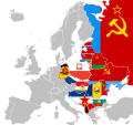
Eastern block flags.png 1,024 × 1,014; 414 KB
-
EGKS.png 541 × 717; 67 KB
-
Europe Eastern Bloc flag map.svg 1,017 × 960; 2.13 MB
-
Flag map of Eastern Bloc Countries (1945-1993).png 1,908 × 2,041; 253 KB
-
Fascist Europe.jpg 720 × 744; 112 KB
-
Flag Map of Germany after the Treaty of Brest Litovsk.png 423 × 226; 4 KB
-
Flag Map of the Europe 1914.png 6,432 × 4,639; 3.13 MB
-
Flag Map of the First French Empire (areas of influence).png 2,661 × 1,856; 633 KB
-
Flag Map of the First French Empire (areas of influence).svg 2,660 × 1,860; 110 KB
-
Flag map of the First French Empire.png 1,303 × 1,074; 193 KB
-
Flag map of the Roman Empire.svg 1,556 × 998; 117 KB
-
Flaga + mapa krajów post-carskich.png 2,117 × 1,535; 522 KB
-
Jutland map.png 1,564 × 3,840; 193 KB
-
Flag map of the Roman Empire.png 1,598 × 1,030; 102 KB
-
Serbian.Empire.png 985 × 1,459; 171 KB
-
World War II 1942.jpg 1,088 × 998; 791 KB


