Category:Hipped dormers in the United Kingdom
Jump to navigation
Jump to search
Media in category "Hipped dormers in the United Kingdom"
The following 43 files are in this category, out of 43 total.
-
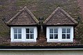 Paired dormer windows, Letchworth (geograph 4237604).jpg 1,600 × 1,056; 488 KB
-
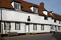 1564 School Room at Felsted Essex England.jpg 3,000 × 2,000; 3.67 MB
-
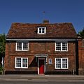
 1603 Serene House cottage in Serene Place at Broadstairs Kent England.jpg 2,000 × 3,000; 5.49 MB
-
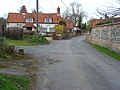
 Back lane houses north of church Barfrestone Kent England.jpg 5,472 × 2,947; 13.44 MB
-
 Houses on Church End, Great Canfield, Essex, England.jpg 3,500 × 2,333; 6.7 MB
-
 A gate and house at Theydon Mount Essex England.JPG 5,408 × 3,568; 12.76 MB
-
 A house roof at Theydon Mount Essex England.JPG 5,247 × 3,648; 9.93 MB
-
 Abingdon OckStreet 83.jpg 1,280 × 1,280; 808 KB
-
 Aston&Cote SchoolSE.jpg 1,280 × 719; 467 KB
-
 Church Road, Blewbury - geograph.org.uk - 721287.jpg 640 × 480; 163 KB
-

-
 Campbell's Temperance Hotel, Corry - geograph.org.uk - 992329.jpg 640 × 484; 133 KB
-
 Carlisle WarwickRd CrescentInn.jpg 1,280 × 1,024; 724 KB
-
 The White House, formerly Crescent Inn - geograph.org.uk - 650055.jpg 640 × 477; 310 KB
-
 Chilham, Kent-geograph-3844137-by-Marathon.jpg 4,000 × 3,000; 4.25 MB
-
 Halfway House, Chilthorne Dormer - geograph.org.uk - 1410366.jpg 640 × 480; 191 KB
-
 St Peter's Church, Cricklewood Lane, London NW2 - geograph.org.uk - 1744063.jpg 1,000 × 761; 251 KB
-
 'Cross Keys' inn - geograph.org.uk - 338422.jpg 640 × 480; 77 KB
-
 Daweswood Cottage, Tyler Hill - geograph.org.uk - 1144645.jpg 640 × 430; 96 KB
-
 East Knoyle Windmill - geograph.org.uk - 705345.jpg 640 × 407; 105 KB
-
 II St Margaret of Antioch, East Wellow, Hampshire, UK (2).jpg 3,725 × 2,493; 2.26 MB
-
 Wellow Church.JPG 1,280 × 960; 471 KB
-
-
 Elmstead Church - geograph.org.uk - 122883.jpg 640 × 480; 134 KB
-
 Converted Chapel near Hanbury - geograph.org.uk - 198917.jpg 640 × 480; 103 KB
-
 St Richard's Church, Haywards Heath.jpg 2,048 × 1,024; 995 KB
-
 Hazelwell Church - geograph.org.uk - 195163.jpg 640 × 480; 52 KB
-
 Horsmonden Post Office - geograph.org.uk - 1711020.jpg 2,048 × 1,536; 1.18 MB
-
 Kidlington MillLane 108.jpg 1,280 × 719; 543 KB
-
 Parish Church at Linton - geograph.org.uk - 385769.jpg 640 × 480; 92 KB
-
 Lydiard Church, Swindon.jpg 2,816 × 2,112; 1.82 MB
-
 Iffley Road - geograph.org.uk - 798422.jpg 640 × 480; 91 KB
-
 Wright StreetDeck SK66 HUV Oxford MagdalenSt.jpg 1,280 × 1,176; 679 KB
-
 St Mary Magdalen RC Church - geograph.org.uk - 1101944.jpg 640 × 426; 76 KB
-
 RotherfieldPeppard LittleGableCottage.jpg 1,280 × 719; 574 KB
-
 St Mary's Church, Sidlesham (NHLE Code 1233271).JPG 2,592 × 1,944; 1.79 MB
-
 W H Smith and T Mobile Shops in Staines - panoramio.jpg 3,648 × 2,736; 4.79 MB
-
 Stanwell HighSt 33–37.jpg 1,280 × 869; 543 KB
-
 All Hallows Church, Tillington - geograph.org.uk - 353443.jpg 640 × 480; 87 KB
-
 Wareham Church from the Old Quay - geograph.org.uk - 851985.jpg 640 × 457; 86 KB
-
 Weather vane by Harringworth Lodge (geograph 1834788).jpg 2,736 × 3,648; 2.14 MB
-
 St. Bartholomew's Church, Whittington.jpg 2,048 × 1,536; 1.09 MB
-
 An English Country Garden, Woolstone - geograph.org.uk - 504794.jpg 480 × 640; 471 KB
.jpg)


.jpg)


.JPG)


.jpg)

