Category:Hindi-language SVG maps
Jump to navigation
Jump to search
Subcategories
This category has only the following subcategory.
Media in category "Hindi-language SVG maps"
The following 45 files are in this category, out of 45 total.
-
2019 चुनाव चरण (लोक सभा).svg 1,350 × 1,545; 8.16 MB
-
2022 Uttar Pradesh Election-hi.svg 1,369 × 1,338; 9.47 MB
-
Agni missile range-hi.svg 1,382 × 700; 1.16 MB
-
Andhra Pradesh districts map from 2 June 2014-hi.svg 4,387 × 3,690; 243 KB
-
Andhra Pradesh districts map hi.svg 2,716 × 2,531; 296 KB
-
Arctic hi.svg 505 × 633; 1.47 MB
-
Assam Darrang locator map hi.svg 419 × 565; 311 KB
-
Assam-districts-2001-hi.svg 631 × 530; 214 KB
-
BD Map admin hi.svg 1,531 × 2,138; 187 KB
-
Benelux-map hi.svg 1,367 × 1,769; 1.57 MB
-
BiharDistricts hi.svg 1,600 × 1,200; 148 KB
-
Borobudur Map hi.svg 828 × 460; 129 KB
-
Central Asia - political map - 2000-hi.svg 995 × 790; 162 KB
-
Central Asia - political map 2008 -hi.svg 996 × 790; 167 KB
-
Delhi districts hi.svg 3,184 × 3,011; 226 KB
-
Delhi metro rail network hi.svg 3,646 × 2,926; 382 KB
-
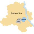
Delhi Municipalities-hi.svg 600 × 600; 31 KB
-
Distrikte von Madhya Pradesh 2021-hi.svg 512 × 350; 1,015 KB
-
Europe regions minimal cities hi.svg 1,500 × 1,307; 1.5 MB
-
Gambia Divisions hi.svg 635 × 247; 5 KB
-
India Union Territories FR-hi.svg 1,500 × 1,615; 1.66 MB
-
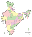
India-map-hi.svg 1,519 × 1,773; 279 KB
-
India-states-Hindi.svg 1,594 × 1,868; 304 KB
-
Karnataka 1956 Reorg-hi.svg 693 × 748; 691 KB
-
Kashmir map-hi.svg 2,160 × 1,696; 221 KB
-
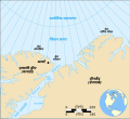
Lincoln Sea map-hi.svg 1,000 × 913; 200 KB
-
Maharashtra Divisions Hi.svg 3,106 × 2,453; 248 KB
-
Map Gulf of Finland-hi.svg 1,400 × 800; 133 KB
-
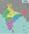
Map of India hi.svg 1,251 × 1,461; 940 KB
-
Naval bases of India-hi.svg 1,486 × 1,734; 459 KB
-
October 2023 Gaza−Israel conflict.svg 3,763 × 3,258; 8.42 MB
-
Orissa State map-hi.svg 2,184 × 1,769; 1.79 MB
-
Partition of India 1947-hi.svg 1,189 × 1,170; 221 KB
-
Political map of India HI.svg 1,594 × 1,868; 301 KB
-
Puducherry District - Local bodies-hi.svg 979 × 1,057; 46 KB
-
Sri Lanka provinces hi.svg 868 × 1,093; 28 KB
-
Tripura-district-map-hi.svg 545 × 688; 226 KB
-
Up-subregions2-hi.svg 2,400 × 2,515; 244 KB
-
Uttar Pradesh administrative divisions-hi.svg 1,500 × 1,500; 109 KB
-
Uttar Pradesh locator map hi.svg 2,400 × 2,515; 137 KB
-
UttarakhandDistricts numbered hi.svg 1,250 × 1,125; 143 KB
-
WestBengalDistricts numbered-hi.svg 576 × 601; 144 KB
-
Zonal Councils hi.svg 1,594 × 1,868; 226 KB
-
Zonal Councils-hi.svg 1,594 × 1,868; 226 KB
-
मुम्बई यात्रा मानचित्र.svg 757 × 1,351; 608 KB


