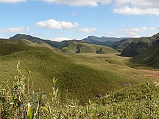
Category:Hills of Manipur
Jump to navigation
Jump to search
States of India: Andhra Pradesh · Arunachal Pradesh · Assam · Bihar · Chhattisgarh · Goa · Gujarat · Haryana · Himachal Pradesh · Jharkhand · Karnataka · Kerala · Madhya Pradesh · Maharashtra · Manipur · Meghalaya · Mizoram · Nagaland · Odisha · Rajasthan · Sikkim · Tamil Nadu · Telangana · Tripura · Uttar Pradesh · Uttarakhand · West Bengal
Union territories: Jammu and Kashmir · Ladakh ·
Former states of India:
Former union territories:
Union territories: Jammu and Kashmir · Ladakh ·
Former states of India:
Former union territories:
Wikimedia category | |||||
| Upload media | |||||
| Instance of | |||||
|---|---|---|---|---|---|
| Category combines topics | |||||
| Manipur | |||||
state in northeastern India | |||||
| Instance of | |||||
| Named after | |||||
| Culture | |||||
| Location | India | ||||
| Capital | |||||
| Legislative body |
| ||||
| Executive body |
| ||||
| Head of state | |||||
| Head of government | |||||
| Inception |
| ||||
| Population |
| ||||
| Area |
| ||||
| Different from | |||||
| official website | |||||
 | |||||
Media in category "Hills of Manipur"
The following 79 files are in this category, out of 79 total.
-
A home on Loktak Lake Moirang Manipur India.jpg 4,288 × 2,848; 2.09 MB
-
Another look at the hilltop village- love this scene! (50016325947).jpg 6,016 × 4,016; 16.66 MB
-
Beautiful Field View.jpg 276 × 206; 11 KB
-
Beautiful Mountain View.jpg 960 × 717; 141 KB
-
Descending was a breeze- there is that hilltop village again! (50016358461).jpg 6,016 × 4,016; 12.39 MB
-
Gadai but view.jpg 604 × 453; 161 KB
-
Green paddy.jpg 1,080 × 510; 66 KB
-
Green surrounding hills of Kalapahar.jpg 1,080 × 510; 74 KB
-
Hill Slope.JPG 977 × 696; 190 KB
-
Huishu Kaphung.jpg 3,944 × 2,778; 4.93 MB
-
Huishu Village.jpg 1,130 × 720; 87 KB
-
Huishu.jpg 1,280 × 960; 152 KB
-
I eventually found the strength to walk around a bit at Phangrei (50016303622).jpg 6,016 × 4,016; 14.53 MB
-
Kianthok in between two hills. - panoramio.jpg 2,272 × 1,704; 1.54 MB
-
Kohima Imphal Road Now.jpeg 2,048 × 1,536; 542 KB
-
Koirer Nyi (PYO natural lake and Fishery).jpg 1,280 × 960; 317 KB
-
Lake atop Phangrei hill (50100576178).jpg 6,016 × 4,016; 11.39 MB
-
Landscape of Valley.jpg 917 × 520; 91 KB
-
Langol Hills, Imphal, Manipur, India.jpg 1,080 × 678; 278 KB
-
Liyai Village.jpg 2,448 × 3,264; 3.09 MB
-
Location of the Salangthel Hill in Manipur.png 1,200 × 849; 523 KB
-
Lohtak Lake.JPG 3,280 × 2,186; 1.09 MB
-
Loktak Lake 01.png 1,440 × 1,080; 2.19 MB
-
Loktak Lake 02.jpg 2,624 × 1,998; 1.12 MB
-
Loktak Lake Fishing Boats Moirang Manipur India.jpg 4,288 × 2,848; 2 MB
-
Loktak Lake from Sendra point, December 2016.jpg 1,632 × 921; 390 KB
-
Loktak Lake Manipur 11.jpg 2,592 × 1,944; 1.73 MB
-
Loktak Lake View.jpg 3,264 × 2,448; 3.05 MB
-
Loktak Lake, Manipur.jpg 1,024 × 575; 63 KB
-
Loktak Lake1.jpg 528 × 352; 118 KB
-
Loktak.jpg 960 × 640; 41 KB
-
Lovely scenes like this were a distraction at times (50016061376).jpg 6,016 × 4,016; 11.96 MB
-
Lubanglong Baptist Church.jpg 640 × 480; 51 KB
-
Machi view.jpg 1,280 × 720; 678 KB
-
Manipur Monsoon.jpg 800 × 601; 31 KB
-
Manipur.jpg 2,560 × 1,536; 1.5 MB
-
Maram Khullen - A View.JPG 2,048 × 1,536; 829 KB
-
Mni phrasebook banner.jpg 4,000 × 571; 641 KB
-
More pleasant Himalayan views on the way down (50016487907).jpg 4,032 × 3,024; 1.8 MB
-
Nature Geography of Manipur India near Imphal 2011.jpg 3,888 × 2,592; 3.88 MB
-
Noney Market - panoramio.jpg 2,816 × 2,112; 1.53 MB
-
Nungba Manipur India.jpg 4,288 × 2,848; 2.63 MB
-
Old British Bridge.jpg 4,608 × 3,456; 7.86 MB
-
Partial View of North-Eastern Ukhrul Town 01.JPG 3,456 × 2,304; 1.3 MB
-
Partial View of North-Eastern Ukhrul Town 02.JPG 3,456 × 2,304; 1.08 MB
-
Peniel Layout.JPG 2,048 × 1,536; 1.01 MB
-
Phalee Village.jpg 1,555 × 866; 391 KB
-
Phungcham.jpg 590 × 200; 35 KB
-
SENDRA.jpg 3,120 × 4,208; 2.01 MB
-
Shore of the Loktak lake in Moirang 1.jpg 3,264 × 2,448; 1.59 MB
-
Shore of the Loktak Lake in Moirang 2.jpg 3,264 × 2,448; 1.48 MB
-
Shore of the Loktak Lake in Moirang 3.jpg 3,264 × 2,448; 2.66 MB
-
Shore of the Loktak Lake in Moirang 4.jpg 3,264 × 2,448; 2.44 MB
-
Shore of the Loktak Lake in Moirang.jpg 3,264 × 2,448; 2.18 MB
-
Sunset at Loktak Lake.jpg 1,920 × 1,080; 964 KB
-
TagaramphungView.jpg 4,000 × 3,000; 2.19 MB
-
The Dzukou Valley.JPG 1,024 × 768; 137 KB
-
The famous Kacha Khou at Magulong.jpg 604 × 453; 161 KB
-
The first rest stop- I was initially surprised at myself (50015732498).jpg 4,032 × 3,024; 4.62 MB
-
The hilltop town of Ukhrul, now viewed from the other side (50015752188).jpg 3,024 × 4,032; 2.54 MB
-
The Saidan Mountain.jpg 4,160 × 3,120; 1.75 MB
-
Thoubal Manipur India.jpg 4,288 × 2,848; 1.26 MB
-
Ukhrul -South View.jpg 3,456 × 2,304; 1.36 MB
-
Ukhrul Banner.jpg 3,456 × 494; 546 KB
-
Ukhrul.JPG 1,600 × 1,200; 994 KB
-
Ukhrul01270.png 640 × 480; 533 KB
-
View-of-New-Karong.jpg 1,920 × 1,280; 1.21 MB
-
View-of-Senapati.jpg 1,920 × 1,280; 1.08 MB
-
Waterfall of Phungtha.jpg 2,048 × 1,536; 251 KB
-
Yangoupokpi Lokchao WLS Manipur by Dr Raju Kasambe (1) 01.jpg 3,648 × 2,736; 2.5 MB
-
Yangoupokpi Lokchao WLS Manipur by Dr Raju Kasambe (1) 02.jpg 3,648 × 2,736; 2.25 MB
-
Yangoupokpi Lokchao WLS Manipur by Dr Raju Kasambe (1) 03.jpg 3,648 × 2,736; 2.32 MB


