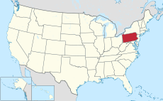
Category:Hiking trails in Pennsylvania
Jump to navigation
Jump to search
States of the United States: Alaska · Arizona · California · Colorado · Connecticut · Delaware · Florida · Georgia · Hawaii · Idaho · Illinois · Indiana · Iowa · Kansas · Kentucky · Maine · Maryland · Massachusetts · Michigan · Minnesota · Mississippi · Missouri · Montana · Nebraska · Nevada · New Hampshire · New Jersey · New Mexico · New York · North Carolina · North Dakota · Ohio · Oregon · Pennsylvania · Rhode Island · South Carolina · Tennessee · Texas · Utah · Vermont · Virginia · Washington · West Virginia · Wisconsin · Wyoming
Wikimedia category | |||||
| Upload media | |||||
| Instance of | |||||
|---|---|---|---|---|---|
| Category combines topics | |||||
| Pennsylvania | |||||
state of the United States of America | |||||
| Pronunciation audio | |||||
| Instance of |
| ||||
| Part of | |||||
| Named after | |||||
| Location |
| ||||
| Located in or next to body of water |
| ||||
| Capital | |||||
| Legislative body | |||||
| Executive body | |||||
| Highest judicial authority | |||||
| Anthem |
| ||||
| Head of government |
| ||||
| Inception |
| ||||
| Highest point | |||||
| Population |
| ||||
| Area |
| ||||
| Elevation above sea level |
| ||||
| Follows |
| ||||
| Replaces |
| ||||
| Maximum temperature record |
| ||||
| Minimum temperature record |
| ||||
| official website | |||||
 | |||||
Subcategories
This category has the following 49 subcategories, out of 49 total.
A
B
- Beech Bottom Trail (8 F)
- Black Forest Trail (43 F)
- Bob Webber Trail (13 F)
C
D
- Dale's Ridge Trail (12 F)
- Darlington Trail (1 F)
- Donut Hole Trail (11 F)
E
- Elk Knob Trail (6 F)
F
- Frank Gantz Trail (11 F)
G
- Gas Line Trail (3 F)
H
- Half Dome Trail (7 F)
K
L
M
- Mason-Dixon Trail (6 F)
N
O
- Old Route 611 Trail (10 F)
P
- Pine Trail (3 F)
- Pitch Pine Loop Trail (7 F)
R
- Rough Hill Trail (23 F)
S
- Sober's Run Loop Trail (6 F)
T
- Teaberry Trail (4 F)
- Thousand Step Trail (9 F)
- Thunder Swamp Trail (3 F)
- Twin Sisters Trail (21 F)
Y
- Yost Run Trail Loop (18 F)
Z
Media in category "Hiking trails in Pennsylvania"
The following 54 files are in this category, out of 54 total.
-
BakerTrail Redbank1.jpg 1,600 × 1,200; 815 KB
-
Beaver Pond Rock Run.jpg 2,560 × 1,920; 2.3 MB
-
Bikers 2.jpg 3,072 × 2,304; 4.24 MB
-
Bridge on Greenway.jpg 3,072 × 2,304; 4.18 MB
-
Bridge over Boston Run.JPG 3,088 × 2,056; 1.47 MB
-
BucktailPathN.jpg 1,600 × 1,200; 790 KB
-
Elk Trail elk 2.jpg 3,264 × 2,448; 1.35 MB
-
Fort Necessity National Battlefield, hiking trail map LOC 94681780.jpg 5,328 × 4,298; 2.48 MB
-
GlacierRidgeTr 1.jpg 1,600 × 1,200; 1,004 KB
-
HickoryCreekTrail1.jpg 1,600 × 1,200; 886 KB
-
HorseShoeTrail1.jpg 3,072 × 4,096; 5.3 MB
-
JPG2 Paulhamus Sign.jpg 4,160 × 2,340; 2.9 MB
-
Kinzua Bridge State Park 001.jpg 1,152 × 768; 522 KB
-
Leonard Harrison State Park Turkey Path 5.jpg 3,648 × 2,736; 4.63 MB
-
LHTrhodo.jpg 3,888 × 5,184; 6.66 MB
-
Lower Jerry Run Natural Area (16) (18127706980).jpg 5,184 × 3,456; 21.44 MB
-
MillCreekTrail3.jpg 1,600 × 1,200; 513 KB
-
Minister Creek Trail 3.jpg 3,072 × 4,096; 3.15 MB
-
Mocanaqua Loop Trail 1.JPG 2,112 × 2,816; 2.72 MB
-
Mocanaqua Loop Trail 2.JPG 2,816 × 2,112; 3.11 MB
-
Mocanaqua Loop Trail 3.JPG 2,112 × 2,816; 2.88 MB
-
MorrisonTrail1.jpg 1,600 × 1,200; 488 KB
-
MST Detweiler2.jpg 3,072 × 4,096; 3.31 MB
-
NCT PA kiosk1.jpg 791 × 1,001; 448 KB
-
Open trail SVRG.JPG 4,000 × 3,000; 1.93 MB
-
Palmer Bikeway 1.jpg 2,048 × 1,536; 517 KB
-
Palmer Bikeway 2.jpg 1,536 × 2,048; 557 KB
-
Pennsylvania State Game Lands Number 55 entrance.JPG 3,088 × 2,056; 3.36 MB
-
Pinchot Trail meadow.jpg 4,160 × 2,340; 5.68 MB
-
Pinchot Trail plants.jpg 4,160 × 2,340; 6.91 MB
-
Power Line Trail west of PA 152.jpeg 3,264 × 2,448; 3.18 MB
-
QT sec 05 Wykoff Run bridge 2.jpg 3,264 × 2,448; 4.73 MB
-
Ralphs Pretty Good 2014.jpg 2,560 × 1,920; 1.76 MB
-
RocktonMtnTrhead.jpg 1,600 × 1,200; 634 KB
-
RRTS 2 Jct Tr bridge WIKI.jpg 4,096 × 3,072; 8.53 MB
-
SlipperyRockGorgeTr 4.jpg 4,096 × 3,072; 5.9 MB
-
StandingStone ASeeger1.jpg 3,072 × 4,096; 5.6 MB
-
STS 1-2 Fish Trail (cropped).jpg 2,514 × 1,872; 2.03 MB
-
STS 1-2 Fish Trail.jpg 4,160 × 2,340; 4.04 MB
-
TanbarkTrail.jpg 1,600 × 1,200; 786 KB
-
TerraceMtnTr 1.jpg 4,096 × 3,072; 5.94 MB
-
ThousandSteps.JPG 3,648 × 2,736; 2.26 MB
-
Tower Road Overlook - 53141140633.jpg 4,032 × 3,024; 5.26 MB
-
TracyRidgeSTrailhead.jpg 1,600 × 1,200; 870 KB
-
Trail in Pennsylvania State Game Lands Number 55.JPG 3,088 × 2,056; 3.04 MB
-
Trail in Shikellamy State Park.JPG 2,056 × 3,088; 2.19 MB
-
Trail marking.JPG 4,000 × 3,000; 1.95 MB
-
TSquared sign B.jpg 2,339 × 3,184; 2.69 MB
-
TST LittleBushkillBridge.jpg 4,096 × 3,072; 5.68 MB
-
TwinLakesTrail2.jpg 1,600 × 1,200; 727 KB
-
Ward Crawford Trail (8736531045).jpg 3,325 × 4,678; 11.62 MB
-
Weiser State Forest Walking Path.jpg 2,288 × 2,284; 1.48 MB


