Category:Hiking trails in Germany
Jump to navigation
Jump to search
Wikimedia category | |||||
| Upload media | |||||
| Instance of | |||||
|---|---|---|---|---|---|
| Category combines topics |
| ||||
| |||||
Subcategories
This category has the following 14 subcategories, out of 14 total.
Media in category "Hiking trails in Germany"
The following 37 files are in this category, out of 37 total.
-
Birkenhainer Strasse near Lohrhaupten.JPG 3,264 × 2,448; 4.27 MB
-
Detour Sign Eselsweg.JPG 2,448 × 3,264; 2.58 MB
-
Deutscher Limes Radweg Beispiel.jpg 3,264 × 2,448; 3.44 MB
-
E1 route map.png 616 × 645; 320 KB
-
E11 route map.png 180 × 219; 30 KB
-
E4 route map.png 180 × 219; 30 KB
-
E8 route map.png 482 × 586; 32 KB
-
Flyer Pforzheim AUSSEN.jpg 6,314 × 2,279; 2.51 MB
-
Germany (28275503987).jpg 3,024 × 4,032; 7.78 MB
-
Hanau Flyer Hugenotten-3.pdf 1,752 × 1,239, 2 pages; 1.26 MB
-
Harzer Naturistenstieg beginn 300 meter.jpg 4,000 × 3,000; 2.26 MB
-
Harzer Naturistenstieg beginn nach 550 meter.jpg 4,000 × 3,000; 2.22 MB
-
J35 599 Obere Hemmersuppenalm, Gumwand.jpg 5,931 × 3,954; 9.87 MB
-
J35 601 Wegweiser »Almgenuss«.jpg 3,817 × 5,725; 10.06 MB
-
J35 602 Weg zum Straubinger Haus.jpg 3,958 × 5,937; 10.44 MB
-
J35 606 Eggenalm Ri Hemmersuppenalm.jpg 5,934 × 3,956; 8.22 MB
-
J35 608 Hemmersuppenalm–Eggenalm.jpg 5,850 × 3,900; 8.25 MB
-
J35 609 Hemmersuppenalm, Richtung Eggenalm.jpg 5,934 × 3,956; 8.69 MB
-
J35 611 Mühlprachkopf.jpg 5,611 × 3,741; 6.2 MB
-
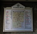
Kloster Kreuzberg InfoTafel.jpg 2,913 × 2,702; 1.21 MB
-
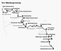
Nibelungensteig Karte Zwingenbegr-Grasellenbach.jpg 565 × 475; 45 KB
-
Oberteich Kasseedorf Blick von Aussichtsplattform.jpg 4,272 × 2,848; 2.81 MB
-
Oud-Zevenaar (Gld,NL) klompenweg Sauerland-Arnheim.JPG 2,304 × 3,072; 2.63 MB
-
Route Deutschland.jpg 2,677 × 6,456; 2.21 MB
-
RWW Zeichen.JPG 2,560 × 1,920; 2.84 MB
-
Schalkenmehren, Schalkenmehrener Maar, 2012-08 CN-01.jpg 2,600 × 1,730; 2.82 MB
-
VM-Weg, Ehrenbach.jpg 3,850 × 2,888; 2.34 MB
-
WaldlichtungLieserpfad.JPG 2,048 × 1,536; 831 KB
-
Wanderschilder auf dem Ecker Sattel.JPG 2,048 × 1,536; 1.5 MB
-
Wanderweg durch die Natur.jpg 1,692 × 2,000; 2.03 MB
-
Wanderweg im Niendorfer Gehege.jpg 3,888 × 5,184; 7.28 MB
-
Wegzeichen - Bodensee-Rundweg.svg 500 × 625; 17 KB
-
Wegzeichen Ostweg.svg 319 × 222; 1 KB
-
Westerwaldsteig Wegmarkierung.jpeg 92 × 34; 2 KB
-
Wz nw.jpg 180 × 109; 12 KB


