Category:Hiking trails in Corsica
Jump to navigation
Jump to search
Administrative regions and territorial collectivity of Metropolitan France (‡ since start of 2016):
Auvergne-Rhône-Alpes‡ · Bourgogne-Franche-Comté‡ · Brittany · Centre-Val de Loire · Corsica · Grand Est‡ · Hauts-de-France‡ · Île-de-France · Normandy‡ · Nouvelle-Aquitaine‡ · Occitania‡ · Pays de la Loire · Provence-Alpes-Côte d'Azur
Former administrative regions of Metropolitan France (until end of 2015):
Rhône-Alpes
Overseas departments and regions: French Guiana · Réunion
Sui generis territories: New Caledonia
Français : Catégorie:Sentiers de Randonnée pédestre en Corse
Subcategories
This category has the following 3 subcategories, out of 3 total.
Media in category "Hiking trails in Corsica"
The following 32 files are in this category, out of 32 total.
-
Abri proche du sommet du Monte Stellu.jpg 3,264 × 2,448; 2.38 MB
-
Chapelle de San Ghjuvà à Bucca di san Ghjuvà.JPG 3,264 × 2,448; 3.31 MB
-
Chapelle San Eliseu (Monti Cardu).JPG 2,448 × 3,264; 2.85 MB
-
Cima à e Follicce.JPG 3,264 × 2,448; 2.25 MB
-
Corsica Sant Antonino footpath signs.jpg 6,000 × 4,000; 4.04 MB
-
Croix au "Faux Sommet" de Cima à e Follicce.JPG 3,264 × 2,448; 1.95 MB
-
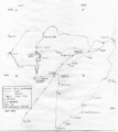
Giuncheto.Carte.png 703 × 789; 343 KB
-
L'Omu di Cagna vu de la Bucca Monaca.JPG 3,264 × 2,448; 1.7 MB
-
Les bergeries de Naseu (Entrée).JPG 3,264 × 2,448; 2.21 MB
-
Les bergeries de Naseu (Sud).JPG 3,264 × 2,448; 2.75 MB
-
Les bergeries de Naseu avec vue sur L'omu di Cagna et Punta Monacu.JPG 3,264 × 2,448; 1.86 MB
-
Les bergeries de Naseu avec vue sur L'omu di Cagna.JPG 2,448 × 3,264; 1.74 MB
-
Monte Stellu vu de Cima à e Follicce.JPG 3,264 × 2,448; 1.7 MB
-
Monte Stellu.jpg 3,264 × 2,448; 2.19 MB
-
Old road in mountains of Corsica.jpg 2,848 × 4,288; 5.72 MB
-
On track to Lac de Nino, Corsica (8132758834).jpg 2,848 × 4,288; 10.31 MB
-
On track to Lac de Nino, Corsica (8132760566).jpg 2,805 × 4,224; 9.86 MB
-
PanneauPNRCSolaroGhisoni.jpg 4,128 × 3,096; 3.62 MB
-
Punta Artica.JPG 3,264 × 2,448; 2.03 MB
-
Punta d'Uvacce, Monte Tignosu et Cima di U Malpassu.JPG 3,264 × 2,448; 1.5 MB
-
Punta d'Uvacce.JPG 3,264 × 2,448; 1.79 MB
-
Punta di Monacu et Punta d'Uvacce vus des bergeries de Naseu.JPG 3,264 × 2,448; 1.67 MB
-
Punta di Monacu.JPG 3,264 × 2,448; 2.2 MB
-
Punta Furcata et Capeddu vus de Bucca di i Tonari.JPG 3,264 × 2,448; 1.26 MB
-
Puscaghia distances à pied.jpg 1,620 × 1,080; 986 KB
-
Rocher de Pruberzulu.JPG 3,264 × 2,448; 1.95 MB
-
San cervone - détail de la statue.JPG 2,448 × 3,264; 2.11 MB
-
San cervone - vue de la chapelle du sommet 01.JPG 3,264 × 2,448; 2.05 MB
-
San cervone - vue de la croix dans la chapelle.JPG 3,264 × 2,448; 1.51 MB
-
San cervone - vue des restes de la chapelle.JPG 3,264 × 2,448; 1.98 MB
-
Sentier de la Transhumance (transhumance trail), Corsica.jpg 1,920 × 1,440; 1.3 MB
-
Sommet du Monti Cardu.JPG 3,264 × 2,448; 1.63 MB


