Category:Hiking trails in Côtes-d'Armor
Jump to navigation
Jump to search
Departments of Metropolitan France: Allier [03] · Alpes-de-Haute-Provence [04] · Hautes-Alpes [05] · Alpes-Maritimes [06] · Ardennes [08] · Ariège [09] · Aveyron [12] · Bouches-du-Rhône [13] · Charente [16] · Charente-Maritime [17] · Corrèze [19] · Haute-Corse [2B]† · Côte-d’Or [21] · Côtes-d'Armor [22] · Creuse [23] · Dordogne [24] · Doubs [25] · Drôme [26] · Eure [27] · Eure-et-Loir [28] · Finistère [29] · Gard [30] · Haute-Garonne [31] · Gers [32] · Hérault [34] · Ille-et-Vilaine [35] · Indre [36] · Isère [38] · Jura [39] · Landes [40] · Lot [46] · Lozère [48] · Maine-et-Loire [49] · Manche [50] · Mayenne [53] · Meurthe-et-Moselle [54] · Meuse [55] · Morbihan [56] · Moselle [57] · Nièvre [58] · Nord [59] · Oise [60] · Pas-de-Calais [62] · Puy-de-Dôme [63] · Pyrénées-Atlantiques [64] · Hautes-Pyrénées [65] · Pyrénées-Orientales [66] · Bas-Rhin [67] · Haut-Rhin [68] · Haute-Saône [70] · Saône-et-Loire [71] · Sarthe [72] · Savoie [73] · Haute-Savoie [74] · Seine-Maritime [76] · Seine-et-Marne [77] · Yvelines [78] · Deux-Sèvres [79] · Somme [80] · Var [83] · Vienne [86] · Vosges [88] · Territoire de Belfort [90] · Essonne [91] · Hauts-de-Seine [92] · Val-d'Oise [95]
Overseas departments and regions: French Guiana [973] · Réunion [974]
Sui generis territories: New Caledonia [988]
Overseas departments and regions: French Guiana [973] · Réunion [974]
Sui generis territories: New Caledonia [988]
Subcategories
This category has the following 2 subcategories, out of 2 total.
G
Media in category "Hiking trails in Côtes-d'Armor"
The following 89 files are in this category, out of 89 total.
-
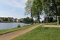
 Allineuc - Lac de Bosméléac (sentier) 01.jpg 4,272 × 2,848; 9.36 MB
-
 Allineuc - Lac de Bosméléac (sentier) 02.jpg 4,272 × 2,848; 7.8 MB
-
 Allineuc - Lac de Bosméléac (sentier) 03.jpg 4,272 × 2,848; 10.61 MB
-
 Allineuc - Lac de Bosméléac (sentier) 04.jpg 4,272 × 2,848; 6.44 MB
-
 Allineuc - Lac de Bosméléac (sentier) 05.jpg 4,272 × 2,848; 11.18 MB
-
 Allineuc - Lac de Bosméléac (sentier) 06.jpg 4,272 × 2,848; 8.65 MB
-
 Allineuc - Lac de Bosméléac (sentier) 07.jpg 4,272 × 2,848; 7.5 MB
-
 Allineuc - Lac de Bosméléac (sentier) 08.jpg 4,272 × 2,848; 8.46 MB
-
 Allineuc - Lac de Bosméléac (sentier) 09.jpg 4,272 × 2,848; 9 MB
-
 Allineuc - Lac de Bosméléac (sentier) 10.jpg 4,272 × 2,848; 9.04 MB
-
 Châtelaudren - Étang (sentier) 01.jpg 4,272 × 2,848; 5.9 MB
-
 Châtelaudren - Étang (sentier) 02.jpg 4,272 × 2,848; 6.61 MB
-
 Châtelaudren - Étang (sentier) 03.jpg 4,272 × 2,848; 6.32 MB
-
 Châtelaudren - Étang (sentier) 04.jpg 4,272 × 2,848; 4.65 MB
-
 Châtelaudren - Étang (sentier) 05.jpg 4,272 × 2,848; 4.66 MB
-
 Châtelaudren - Étang (sentier) 06.jpg 4,272 × 2,848; 6.11 MB
-
 Châtelaudren - Étang (sentier) 07.jpg 4,272 × 2,848; 5.5 MB
-
 Hillion + Morieux - Vallée du Gouëssant (sentier et mare) 01.jpg 4,272 × 2,848; 6.94 MB
-
 Hillion + Morieux - Vallée du Gouëssant (sentier et passerelle) 01.jpg 4,272 × 2,848; 6.66 MB
-
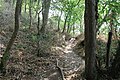
 Hillion + Morieux - Vallée du Gouëssant (sentier) 01.jpg 4,272 × 2,848; 8.77 MB
-
 Hillion + Morieux - Vallée du Gouëssant (sentier) 02.jpg 4,272 × 2,848; 9.35 MB
-
 Hillion + Morieux - Vallée du Gouëssant (sentier) 03.jpg 4,272 × 2,848; 9.53 MB
-
 Hillion + Morieux - Vallée du Gouëssant (sentier) 04.jpg 4,272 × 2,848; 9.77 MB
-
 Hillion + Morieux - Vallée du Gouëssant (sentier) 05.jpg 4,272 × 2,848; 9.64 MB
-
 Hillion + Morieux - Vallée du Gouëssant (sentier) 06.jpg 4,272 × 2,848; 7.9 MB
-
 Hillion + Morieux - Vallée du Gouëssant (sentier) 07.jpg 4,272 × 2,848; 7.35 MB
-
 Hillion + Morieux - Vallée du Gouëssant (sentier) 08.jpg 4,272 × 2,848; 7.11 MB
-
 Hillion + Morieux - Vallée du Gouëssant (sentier) 09.jpg 4,272 × 2,848; 7.43 MB
-
 Hillion + Morieux - Vallée du Gouëssant (sentier) 10.jpg 4,272 × 2,848; 8.18 MB
-
 Hillion + Morieux - Vallée du Gouëssant (sentier) 11.jpg 4,272 × 2,848; 9.16 MB
-
 Hillion + Morieux - Vallée du Gouëssant (sentier) 12.jpg 4,272 × 2,848; 9.39 MB
-
 Hillion + Morieux - Vallée du Gouëssant (sentier) 13.jpg 4,272 × 2,848; 9.02 MB
-
 Hillion + Morieux - Vallée du Gouëssant (sentier) 14.jpg 4,272 × 2,848; 8.1 MB
-
 Hillion + Morieux - Vallée du Gouëssant (sentier) 15.jpg 4,272 × 2,848; 8.1 MB
-
 Hillion + Morieux - Vallée du Gouëssant (sentier) 16.jpg 4,272 × 2,848; 8.21 MB
-
 Hillion + Morieux - Vallée du Gouëssant (sentier) 17.jpg 4,272 × 2,848; 7.28 MB
-
 Hillion + Morieux - Vallée du Gouëssant (sentier) 18.jpg 4,272 × 2,848; 8.66 MB
-
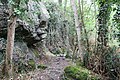
 La Méaugon - Vallée du Gouët (sentier) 01.jpg 4,272 × 2,848; 8.17 MB
-
 La Méaugon - Vallée du Gouët (sentier) 02.jpg 4,272 × 2,848; 8.56 MB
-
 La Méaugon - Vallée du Gouët (sentier) 03.jpg 4,272 × 2,848; 7.78 MB
-
 La Méaugon - Vallée du Gouët (sentier) 04.jpg 4,272 × 2,848; 8.52 MB
-
 La Méaugon - Vallée du Gouët (sentier) 05.jpg 4,272 × 2,848; 8.89 MB
-
 La Méaugon - Vallée du Gouët (sentier) 06.jpg 4,272 × 2,848; 8.53 MB
-
 La Méaugon - Vallée du Gouët (sentier) 07.jpg 4,272 × 2,848; 7.17 MB
-
 La Méaugon - Vallée du Gouët (sentier) 08.jpg 4,272 × 2,848; 7.63 MB
-
 La Méaugon - Vallée du Gouët (sentier) 09.jpg 4,272 × 2,848; 6.29 MB
-
 Lamballe - Parc de la Ville Gaudu.jpg 4,272 × 2,848; 8.55 MB
-
 Langueux + Saint-Brieuc - Vallée de Douvenant - Sentier 01.jpg 4,272 × 2,848; 7 MB
-
 Langueux + Saint-Brieuc - Vallée de Douvenant - Sentier 02.jpg 4,272 × 2,848; 7.33 MB
-
 Langueux - Parc du Grand Pré (sentier) 01.jpg 4,272 × 2,848; 5.69 MB
-
 Langueux - Parc du Grand Pré (sentier) 02.jpg 4,272 × 2,848; 5.29 MB
-
 Langueux - Parc du Grand Pré (sentier) 03.jpg 4,272 × 2,848; 4.24 MB
-
 Langueux - Vallée de Boutdeville (sentier et pont) 01.jpg 4,272 × 2,848; 8.54 MB
-
 Langueux - Vallée de Boutdeville (sentier) 01.jpg 4,272 × 2,848; 8.09 MB
-
 Langueux - Vallée de Boutdeville (sentier) 02.jpg 4,272 × 2,848; 5.76 MB
-
 Langueux - Vallée de Boutdeville (sentier) 03.jpg 4,272 × 2,848; 9.86 MB
-
 Langueux - Vallée de Boutdeville (sentier) 04.jpg 4,272 × 2,848; 8.6 MB
-
 Langueux - Vallée de Boutdeville (sentier) 05.jpg 4,272 × 2,848; 7.49 MB
-
 Langueux - Vallée de Boutdeville (sentier) 06.jpg 4,272 × 2,848; 8.12 MB
-
 Ploufragan - Vallée du Gouët (sentier de la retenue d'eau) 01.jpg 4,096 × 3,072; 8.08 MB
-
 Ploufragan - Vallée du Gouët (sentier de la retenue d'eau) 02.jpg 4,096 × 3,072; 8.28 MB
-
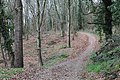
 Plédran - Bois (sentier) 01.jpg 4,272 × 2,848; 8.45 MB
-
 Plédran - Bois (sentier) 02.jpg 4,272 × 2,848; 8.36 MB
-
 Plédran - Bois (sentier) 03.jpg 4,272 × 2,848; 7.96 MB
-
 Plédran - Bois (sentier) 04.jpg 4,272 × 2,848; 8.65 MB
-
 Plédran - Bois (sentier) 05.jpg 4,272 × 2,848; 9.5 MB
-
 Plédran - Bois (sentier) 06.jpg 4,272 × 2,848; 8.45 MB
-
 Plédran - Bois (sentier) 07.jpg 4,272 × 2,848; 9.2 MB
-
 Plédran - Bois (sentier) 08.jpg 4,272 × 2,848; 8.56 MB
-
 Plédran - Bois (sentier) 09.jpg 4,272 × 2,848; 7.67 MB
-
 Plédran - Bois (sentier) 10.jpg 4,272 × 2,848; 8 MB
-
 Plédran - Bois (sentier) 11.jpg 4,272 × 2,848; 7.49 MB
-
 Plédran - Bois (sentier) 12.jpg 4,272 × 2,848; 8.25 MB
-
 Plédran - Bois (sentier) 13.jpg 4,272 × 2,848; 8.26 MB
-
 Plédran - Bois (sentier) 14.jpg 4,272 × 2,848; 9.03 MB
-
 Plédran - Bois (sentier) 15.jpg 4,272 × 2,848; 7.49 MB
-
 Plédran - Bois (sentier) 16.jpg 4,272 × 2,848; 9.12 MB
-
 Plémy - Ancienne voie des Chemins de fer des Côtes-du-Nord.jpg 4,160 × 3,120; 5.58 MB
-
 Pléneuf-Val-André - Dahouët - Étang du Vauclair (sentier) 01.jpg 4,272 × 2,848; 5.92 MB
-
 Pléneuf-Val-André - Dahouët - Étang du Vauclair (sentier) 02.jpg 4,272 × 2,848; 4.28 MB
-
 Pléneuf-Val-André - Dahouët - Étang du Vauclair (sentier) 03.jpg 4,272 × 2,848; 6.05 MB
-
 Pléneuf-Val-André - Dahouët - Étang du Vauclair (sentier) 04.jpg 4,272 × 2,848; 3.99 MB
-
 Pléneuf-Val-André - Dahouët - Étang du Vauclair (sentier) 05.jpg 4,272 × 2,848; 5.5 MB
-
 Pordic - Vallée du Parfond du Gouët 01.jpg 4,272 × 2,848; 8.59 MB
-
 Pordic - Vallée du Parfond du Gouët 02.jpg 4,272 × 2,848; 8 MB
-
 Pordic - Vallée du Parfond du Gouët 03.jpg 4,272 × 2,848; 7.62 MB
-
 Pordic - Vallée du Parfond du Gouët 04.jpg 4,272 × 2,848; 9.1 MB
-
 Voie de l'Abbaye de Beauport hiking route km 0 sign.jpg 2,304 × 3,456; 2.15 MB
-
 Voie de l'Abbaye de Beauport hiking route map.jpg 3,456 × 2,304; 1.02 MB
_01.jpg)
_02.jpg)
_03.jpg)
_04.jpg)
_05.jpg)
_06.jpg)
_07.jpg)
_08.jpg)
_09.jpg)
_10.jpg)
_01.jpg)
_02.jpg)
_03.jpg)
_04.jpg)
_05.jpg)
_06.jpg)
_07.jpg)
_01.jpg)
_01.jpg)
_01.jpg)
_02.jpg)
_03.jpg)
_04.jpg)
_05.jpg)
_06.jpg)
_07.jpg)
_08.jpg)
_09.jpg)
_10.jpg)
_11.jpg)
_12.jpg)
_13.jpg)
_14.jpg)
_15.jpg)
_16.jpg)
_17.jpg)
_18.jpg)
_01.jpg)
_02.jpg)
_03.jpg)
_04.jpg)
_05.jpg)
_06.jpg)
_07.jpg)
_08.jpg)
_09.jpg)


_01.jpg)
_02.jpg)
_03.jpg)
_01.jpg)
_01.jpg)
_02.jpg)
_03.jpg)
_04.jpg)
_05.jpg)
_06.jpg)
_01.jpg)
_02.jpg)
_01.jpg)
_02.jpg)
_03.jpg)
_04.jpg)
_05.jpg)
_06.jpg)
_07.jpg)
_08.jpg)
_09.jpg)
_10.jpg)
_11.jpg)
_12.jpg)
_13.jpg)
_14.jpg)
_15.jpg)
_16.jpg)

_01.jpg)
_02.jpg)
_03.jpg)
_04.jpg)
_05.jpg)


