Category:Hiking and footpath signs in Upper Austria
Jump to navigation
Jump to search
States of Austria:  Burgenland ·
  Carinthia ·
  Lower Austria ·
  Salzburg ·
  Styria ·
  Tyrol ·
  Upper Austria ·
  Vienna ·
  Vorarlberg
Subcategories
This category has the following 2 subcategories, out of 2 total.
Media in category "Hiking and footpath signs in Upper Austria"
The following 61 files are in this category, out of 61 total.
-
 Almuferweg Wegweiser Scharnstein 20200531.jpg 3,648 × 5,472; 14.33 MB
-
 Austria august2010 0209.jpg 2,272 × 1,704; 941 KB
-
 B38 Leonfeldner Straße auf Höhe der Firma Hochreiter, Gewerbezeile.jpg 5,000 × 3,333; 15.23 MB
-
 Beschilderung Traunstein Umkehrplatz 20230509a.jpg 2,019 × 3,057; 5.16 MB
-
 Braunau am Inn —Auenpark (Wegweiser).jpg 1,800 × 3,200; 1.45 MB
-
 Bräuhausgasse.jpg 2,333 × 3,286; 2.66 MB
-
 Dachstein map.jpg 2,400 × 1,666; 3.21 MB
-
 Das Ende von IBM - panoramio.jpg 4,000 × 3,000; 4.32 MB
-
 Das Ziel des SalzAlpenSteigs in Obertraun.jpg 900 × 600; 341 KB
-
 Eidenberg - Kammerschlag - Wegweiser nach Urfahr.jpg 5,715 × 3,810; 13.71 MB
-
 Footpath Reichental - Hohe Mandling.jpg 2,000 × 3,008; 2.76 MB
-
 Franking - Dorfibm - 2019 04 01-6.jpg 3,260 × 4,890; 2.16 MB
-
 Franking - Holzöstersee - 03.jpg 3,648 × 2,736; 2.82 MB
-
 Hallstatt train station - hiking signs.jpg 4,224 × 2,970; 6.57 MB
-
 Hinterstoder Flötzersteig Schilderwald.jpg 6,000 × 4,000; 9.11 MB
-

-
 Jerusalemweg-Friedenstaube in Linz.jpg 3,024 × 4,032; 3.08 MB
-
 Jerusalemweg-Friedenstaube vor dem Neuen Linzer Rathaus.jpg 3,024 × 4,032; 4.61 MB
-
 Kefermarkt Gasthaus Zur Goldenen Sense 4393.JPG 1,600 × 1,200; 657 KB
-
 Kirchberg ob der Donau - Ortsbildmesse - 01.jpg 3,777 × 5,666; 12.11 MB
-
 Klaus ad Pyhrnbahn Pertlgrabenbrücken Fischersteig-4950.jpg 5,000 × 3,333; 3.22 MB
-
 Klaus ad Pyhrnbahn Pertlgrabenbrücken Wegweiser-4953.jpg 4,291 × 2,861; 1.82 MB
-
 Kremsmünster Kirchberg Pfarrhaus Sankt Stephan-8866.jpg 5,345 × 3,563; 7.98 MB
-
 Liebenau - Tanner Moor - 01.jpg 6,000 × 4,000; 19.23 MB
-
 Linz-Pöstlingberg - Abzweigung von der Gründbergstraße.jpg 4,000 × 3,000; 8.52 MB
-
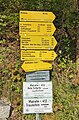
 Linz-Pöstlingberg - Hinweisschild Wanderweg 140 Richtung Giselawarte am Lichtenberg.jpg 2,453 × 3,271; 4.62 MB
-
 Maria Bründl - Wegweiser von Wulln.jpg 4,000 × 3,000; 3.91 MB
-
 Munderfing - Kobernaußer Wald - Motiv - 2022 08 13-2.jpg 6,960 × 4,640; 6.63 MB
-
 Munderfing - Kobernaußer Wald - Motiv - 2022 08 13-4.jpg 6,960 × 4,640; 5.42 MB
-
 Naturfreundesteig Abstieg Traunstein Traunsee 20100407.jpg 3,648 × 2,736; 4.99 MB
-
 Naturpark Obst-Hügelland Wanderwege.jpg 5,863 × 3,908; 8.9 MB
-
 NDOÖ 152 Pettenbach Seisenburg Eibe hk.jpg 4,000 × 6,000; 10.39 MB
-
 NDOÖ 152 Pettenbach Seisenburg Eibe Wegweiser.jpg 6,000 × 4,000; 10.43 MB
-
 NDOÖ 268 Sankt Pankraz Teufelskirche Wegweiser.jpg 2,993 × 1,994; 1.63 MB
-
 NSGOÖ 095 Laudachsee Rundweg Wegweiser.jpg 5,781 × 3,926; 10.72 MB
-
 Obernberg am Inn Wegweiser-0264.jpg 3,457 × 5,186; 8.9 MB
-
 Oberneukirchen Wegeschilder.JPG 4,288 × 2,848; 4.81 MB
-
 Ottensheim Bleicherbach Steg-8062.jpg 5,571 × 3,714; 27.32 MB
-
 Ottensheim Bleicherbachtal Schmied in der Leitn-8067.jpg 5,879 × 3,912; 29.57 MB
-
 Perwang - Oberröd - Motiv 2 - 2019 08 06 - a.jpg 3,235 × 4,853; 3.68 MB
-
 Perwang - Oberröd - Motiv 2 - 2019 08 06 - b.jpg 5,184 × 3,456; 2.66 MB
-
 Perwang - Ort - Straßenmotiv - 2019 08 06 - 1.jpg 5,184 × 3,456; 2.61 MB
-
 Pettenbach Seisenburg Eibe Wegweiser.jpg 6,000 × 4,000; 5.5 MB
-
 Pierbach - Mosaik-Wegweiser zur Burgruine Ruttenstein.jpg 4,407 × 2,938; 10.47 MB
-
 Rechberg Pfarrkirche Friedhofsmauer-3576-2.jpg 5,459 × 3,632; 14.15 MB
-
 Schild-Weißenbachtalradweg.png 392 × 573; 306 KB
-
 Schönegg - Wasserkapelle 2 Wegweiser.jpg 2,592 × 3,976; 1.91 MB
-
 Spital aP hiking sign Arlingalm Karleckrunde.jpg 6,000 × 4,000; 7.59 MB
-
 St Leonhard bei Freistadt-KG Maasch - Verbots- und Hinweisschild.jpg 3,629 × 5,443; 10.49 MB
-
 Steyrling station, hiking sign.jpg 2,649 × 1,884; 3.5 MB
-
 Tarsdorf - Eckldorf - 2017 10 07-2.jpg 5,184 × 3,456; 2.36 MB
-
 Temlberg from Fleischbanksattel.jpg 4,694 × 2,986; 7.16 MB
-
 Wanderstein FR.JPG 1,704 × 2,272; 852 KB
-
 Wanderwegtafel Linz Ottensheimer Straße.jpg 2,107 × 2,809; 1.15 MB
-
 Wegweiser Reichraminger Hintergebirge 20240629a.jpg 4,000 × 6,000; 15.95 MB
-
 Wegweiser Reichraminger Hintergerbirge 20050305a.jpg 1,704 × 2,272; 1.01 MB
-
 Wegweiser Wanderwege Franking 01.jpg 6,000 × 4,000; 3.45 MB
-
 Wegweiser Wanderwege Franking 02.jpg 5,331 × 2,985; 1.64 MB
-
 Wilhering Wegweiser Prinzensteig.jpg 5,390 × 3,593; 5.53 MB
-
 Windischgarsten Schärhaus und Brunnen-3984.jpg 4,399 × 3,299; 11.72 MB
-
 Wolfsschluchtplan.jpg 3,414 × 2,143; 4.04 MB


.jpg)


