Category:Hiking and footpath signs in France
Jump to navigation
Jump to search
Français : Panneaux de sentiers de randonnée en Île-de-France
Subcategories
This category has the following 6 subcategories, out of 6 total.
Media in category "Hiking and footpath signs in France"
The following 87 files are in this category, out of 87 total.
-
01 Chemin Romieu.jpg 3,648 × 2,736; 2.35 MB
-
Accous-pelegrine-sign.JPG 908 × 1,360; 1.14 MB
-
Avertissement sapins dépérissants Molières.jpg 4,608 × 3,072; 7.82 MB
-
Balisage FFRP mauvaise route.jpg 4,608 × 3,072; 4.52 MB
-
Balisage GR et variante.jpg 3,072 × 4,608; 7.56 MB
-
Balisage sentier GRP.jpg 960 × 720; 17 KB
-
BalisageGR.png 320 × 200; 7 KB
-
Balise GR.png 250 × 125; 987 bytes
-
Beaulieu randonnée.jpg 5,184 × 3,456; 6.25 MB
-
Bei Altwis.jpg 2,573 × 3,873; 7.38 MB
-
Bénifontaine.- le chemin du Marais (1).jpg 2,048 × 1,151; 2.46 MB
-
Bénifontaine.- le chemin du Marais (4).jpg 4,896 × 2,752; 8.82 MB
-
Cabane de saunères (3).JPG 2,272 × 1,704; 1.77 MB
-
Cantal balisage PR-GR-compostelle r.jpg 719 × 678; 441 KB
-
Cattle and hiking sign.jpg 4,650 × 3,648; 4.49 MB
-
Cenon-sur-Vienne, balisage jacquaire et GR.JPG 3,648 × 2,736; 4.23 MB
-
Chamonix - trail signs 2.jpg 2,266 × 3,715; 1.84 MB
-
Chamonix - trail signs 3.jpg 2,402 × 3,842; 2.71 MB
-
Chamonix - trail signs 4.jpg 3,648 × 4,863; 4.12 MB
-
Chemin d'Assise 20200914 03.jpg 5,312 × 2,988; 6.07 MB
-
Chevaux2 GR76A.jpg 1,600 × 1,149; 876 KB
-
Col de Bassachaux (panneau).JPG 2,376 × 1,056; 332 KB
-
Col de Fenestre-pancarte.jpg 512 × 384; 209 KB
-
Col des Corbeaux panneau.jpg 4,608 × 3,456; 2.96 MB
-
Comines Sainte Marguerite circuit des chouettes.jpg 4,896 × 3,672; 6.73 MB
-
Commercy Fontaine Royale panneaux.jpg 4,000 × 3,000; 8.83 MB
-
Commercy Fontaine Royale Route Forestière.jpg 4,000 × 3,000; 4.95 MB
-
Commercy Le Cormier flèche.jpg 3,000 × 4,000; 5.11 MB
-
Crena12.jpg 1,024 × 768; 255 KB
-
Crêtes d'Herbeys 3.JPG 2,288 × 1,712; 1.26 MB
-
Des randonnées depuis Bilhères.jpg 2,048 × 1,536; 774 KB
-
Fontaine-Chalendray Rando.jpg 3,072 × 2,304; 1.5 MB
-
FR-48-Luc01.JPG 1,600 × 1,200; 470 KB
-
FranceNormandieSaintSeverCalvadosCheminMontoisRepere.jpg 1,474 × 1,684; 1.95 MB
-
Gr dirección incorrecta.jpg 2,272 × 1,704; 1.06 MB
-
GR1-PR19 - forêt de Coye.jpg 536 × 712; 560 KB
-
GR5 markings on Ballon d'Alsace.jpg 3,456 × 2,304; 831 KB
-
GRP Massif des Bauges balisage.jpg 4,608 × 3,456; 8.54 MB
-
GRP sign.svg 110 × 75; 188 bytes
-
Herzeele chemin des moines GR 130.jpg 1,168 × 1,032; 433 KB
-
Hike sign in France.jpg 5,472 × 3,648; 6.06 MB
-
Hiking trail signs.jpg 5,472 × 3,648; 6.61 MB
-
Installation signalisation exploitation Molières 01.jpg 3,072 × 4,608; 6.72 MB
-
La Duis CNS DSC 5854.jpg 3,008 × 2,000; 394 KB
-
La molière printemps1.JPG 2,288 × 1,712; 748 KB
-
La molière printemps2.JPG 2,288 × 1,712; 773 KB
-
La molière printemps3.JPG 2,288 × 1,712; 820 KB
-
La Rixouse - Panneau randonnées (juil 2018).jpg 3,016 × 4,032; 4.94 MB
-
La Tuiliere CNS DSC 5703.jpg 3,008 × 2,000; 397 KB
-
Le Moingt à Moingt (Montbrison), avec balisage PR.JPG 3,072 × 2,304; 3 MB
-
Lez Fontaines, circuit du Verre Eté2017 (4).jpg 4,896 × 3,672; 6.64 MB
-
Moulin-du-pont 02.jpg 4,288 × 2,848; 1.8 MB
-
Moumour (Pyr-Atl, Fr) panneau indicateur Chemin de St.Jacques.JPG 4,000 × 3,000; 4.21 MB
-
Nevers ver vert 01.jpg 640 × 480; 125 KB
-
OrientationVicq-Exemplet.jpg 2,453 × 1,821; 247 KB
-
Ota Sentier Tra Mare e Monti.jpg 4,032 × 3,024; 13.08 MB
-
Panneau du parc.jpg 4,585 × 3,439; 3.18 MB
-
Panneau du sentier du littoral - img 40108.jpg 5,616 × 3,744; 8.52 MB
-
Parc de la Combe à la Serpent Pancartes 06.jpg 6,016 × 4,016; 13.3 MB
-
Parcours kerglonou2.jpg 850 × 637; 210 KB
-
Parcours kerglonou3.jpg 850 × 637; 228 KB
-
Pas des Ladres-pancarte.jpg 512 × 384; 171 KB
-
Passo del Cornà.png 2,663 × 3,832; 15.08 MB
-
Plan des Roches CNS DSC 6116.jpg 3,008 × 2,000; 344 KB
-
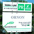
PR Ornon.jpg 1,371 × 1,388; 662 KB
-
PR pasparla.jpg 1,536 × 2,048; 1.07 MB
-
Randonnée Nedde.jpg 4,608 × 3,072; 444 KB
-
Randonnée Tertre Ganne.JPG 1,536 × 1,024; 783 KB
-
Refuge de la Martin 4.jpg 7,096 × 2,973; 4.87 MB
-
Réserve naturelle régionale du mont de Couple (5).jpg 4,912 × 2,379; 3.1 MB
-
Sailly-le-Sec Ete2017 (3).jpg 4,896 × 3,672; 6.72 MB
-
Saint Etienne de Baïgorry Col Harrieta (1).jpg 3,008 × 2,000; 3.45 MB
-
Saint Etienne de Baïgorry GR10 Harrieta.jpg 3,008 × 2,000; 2.87 MB
-
Saint Etienne de Baïgorry GR10.jpg 2,000 × 3,008; 2.45 MB
-
Sermano randonnées.jpg 4,032 × 3,024; 7.75 MB
-
Sign Ruisseau du chevril.jpg 3,632 × 4,714; 4.87 MB
-
Site-Peyrassoulat 15.jpg 4,288 × 2,848; 1.35 MB
-
St-Gildas chemin-cotier 0708.jpg 2,988 × 2,000; 3.38 MB
-
Stgermconf gr48.JPG 1,600 × 1,200; 438 KB
-
Tignes - hike trail signs.jpg 5,472 × 3,648; 3.12 MB
-
Tour Cezallier 0707A.jpg 2,688 × 1,800; 3.76 MB
-
Tour Cezallier 0707B.jpg 2,688 × 1,800; 3.99 MB
-
Trail signs in Vanoise National Park.jpg 3,736 × 3,024; 3.43 MB
-
Val d'Isere - trail signs.jpg 5,000 × 3,361; 5.48 MB
-
Versailles Etoile des Gonards P1060825.JPG 4,000 × 3,000; 4.88 MB
-
Versailles Route des Boulangers P1060823.JPG 3,000 × 4,000; 4.04 MB
-
Versailles Route du Petit Montreuil P1060830.JPG 4,000 × 3,000; 4.7 MB


