Category:Hiking and footpath signs in Cheshire
Jump to navigation
Jump to search
Ceremonial counties of England: Bedfordshire · Berkshire · Buckinghamshire · Cheshire · Cornwall · Cumbria · Derbyshire · Dorset · East Riding of Yorkshire · East Sussex · Essex · Greater London · Hampshire · Hertfordshire · Kent · Norfolk · North Yorkshire · Northumberland · Oxfordshire · Rutland · Somerset · Surrey · Warwickshire · West Sussex · West Yorkshire · Wiltshire ·
City-counties:
Former historic counties:
Other former counties:
City-counties:
Former historic counties:
Other former counties:

Media in category "Hiking and footpath signs in Cheshire"
The following 23 files are in this category, out of 23 total.
-
 Cheshire Footpath - geograph.org.uk - 541334.jpg 427 × 640; 118 KB
-
 Crewe+Nantwich Circular Walk symbol.jpg 250 × 241; 52 KB
-
 Delamere Way Waymarker.JPG 3,648 × 2,736; 2.62 MB
-
 Footpath Marker Post - geograph.org.uk - 335702.jpg 640 × 428; 97 KB
-

-

-
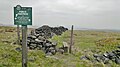
 Gate, Stile and Fingerpost - geograph.org.uk - 750360.jpg 640 × 479; 71 KB
-
 Longster Trail Sign - geograph.org.uk - 715846.jpg 640 × 480; 94 KB
-
 Maelor Way Marker.jpg 287 × 290; 19 KB
-
 Mile Post at Coppermine Lane - geograph.org.uk - 3175063.jpg 2,024 × 1,518; 734 KB
-
 Peak & Northern Footpath Sign No 301 - geograph.org.uk - 6601409.jpg 3,024 × 4,032; 3.29 MB
-
 Peak & Northern Footpaths Society, Sign No 266 - geograph.org.uk - 6601885.jpg 3,024 × 4,032; 3.73 MB
-
 River Bollin - geograph.org.uk - 77956.jpg 640 × 480; 186 KB
-
 Rural Craft - geograph.org.uk - 405469.jpg 427 × 640; 99 KB
-
 Sandstone Trail and Marches Way.JPG 3,648 × 2,736; 1.9 MB
-
 Signpost on the viewpoint near Sponds Hill - geograph.org.uk - 2820012.jpg 3,872 × 2,592; 3.83 MB
-
 Spoilt for choice! - geograph.org.uk - 3511755.jpg 4,000 × 2,248; 4.83 MB
-
 Stilised Stile - geograph.org.uk - 404896.jpg 427 × 640; 94 KB
-
 The Longster Trail Waymarker.JPG 3,648 × 2,736; 2.51 MB
-
 Waymark, Arrowe Park - Parkgate Circular Walk, Storeton Lane.jpg 4,365 × 3,447; 9.19 MB
-
 Waymarks on the Sandstone Trail, Bickerton Hill - geograph.org.uk - 5076116.jpg 1,024 × 678; 135 KB
-
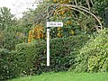
 Welsh Road signpost in Saughall 01.jpg 4,000 × 3,000; 4.47 MB
-
 Welsh Road signpost in Saughall 02.jpg 4,000 × 3,000; 4.73 MB


