Category:Hiking and footpath signs in Baden-Württemberg
Jump to navigation
Jump to search
Federal states of Germany:
Subcategories
This category has the following 34 subcategories, out of 34 total.
Media in category "Hiking and footpath signs in Baden-Württemberg"
The following 42 files are in this category, out of 42 total.
-
2010-09-04 Schwaebische Alb HW1 HW2 Donauwoerth.jpg 1,536 × 2,048; 682 KB
-
Albrandweg Streckenverlauf Donauwörth.jpg 734 × 1,024; 545 KB
-
Beschilderung FSWW I.JPG 2,816 × 2,112; 2.34 MB
-
Beschilderung FSWW II.JPG 2,112 × 2,816; 2.2 MB
-
Beschilderung FSWW.JPG 2,816 × 2,112; 2.44 MB
-
D-BW - Höchsten - Wegeschild HW7.JPG 2,816 × 2,112; 2.41 MB
-
D-BW-Bodenseekreis - Jubiläumsweg - Wegzeichen klein, alt.jpg 2,592 × 1,944; 922 KB
-
D-BW-Bodenseekreis - Jubiläumsweg Bodenseekreis, Wegmarkierung.jpg 2,592 × 1,944; 1.24 MB
-
D-BW-Kressbronn aB - Wanderparkplatz Argen.JPG 2,112 × 2,816; 2.59 MB
-
Farnwitte.JPG 2,816 × 2,112; 2.67 MB
-
Frankenweg Entfernungstafel Heilbronn 20080428.jpg 2,000 × 2,000; 836 KB
-
Glockenweg Wegmarke am alten Eichamt.JPG 5,184 × 3,456; 8.58 MB
-
Gresgen5.jpg 4,201 × 3,062; 4.17 MB
-
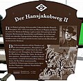
Hansjakobweg II.jpg 2,802 × 2,706; 2.11 MB
-
Haßmersheim - Neckarmühlbach - Garnberg - Wegzeichen mit Eichhörnchen.jpg 8,443 × 5,887; 20.67 MB
-
Heidelberg - Stadtwald - Wegweiserstein.jpg 3,000 × 2,050; 2.7 MB
-
Hinweis Schwedenhöhlen Reutlingendorf.jpg 3,264 × 1,836; 2.59 MB
-
Information Schwedenhöhlen Reutlingendorf.jpg 3,264 × 1,836; 1.66 MB
-
Jakobsweg Linzgau Uni Konstanz.jpg 3,456 × 4,608; 4.92 MB
-
Jubiläumsweg Frauenberg Schorndorf 2012.jpg 2,736 × 3,648; 2.79 MB
-
Logo Besinnungsweg Ehinger Alb.png 337 × 324; 31 KB
-
Logo Glaubenswege.JPG 3,968 × 2,976; 1.38 MB
-
Neuenbuerg (Enz) - Wilhelm-Ganzhorn-Weg 2006-07-02.jpg 2,048 × 1,536; 1,017 KB
-
NSG Stammberg Bannwald (2014).JPG 2,560 × 1,920; 1.86 MB
-
QuerwegWegweiser1.jpg 2,112 × 2,816; 1.48 MB
-
Raetia-Secunda07.JPG 2,048 × 1,536; 825 KB
-
Rundweg Schwedenhoehlen Reutlingendorf.jpg 3,264 × 1,836; 2.15 MB
-
Römerpfadlogo (an einer Kiefer am Marspfad).jpg 2,160 × 3,840; 3.34 MB
-
Schild Eschelhof.jpg 3,024 × 4,032; 3.77 MB
-
Schwaderloch 2142.JPG 1,500 × 2,000; 2.67 MB
-
SchwAlbNordrandWeg.jpg 4,000 × 3,000; 7.47 MB
-
Soldatenfriedhof Obermarchtal.jpg 3,264 × 1,836; 4.02 MB
-
Straubenhardt-Schwann - Wilhelm-Ganzhorn-Weg 2006-07-02.jpg 2,048 × 1,536; 928 KB
-
Unterer Dossenwald Baum mit Wandermarkierungen.JPG 2,736 × 3,648; 4.19 MB
-
Wander- und Radwegweiser Hirschlanden Süd.jpg 2,604 × 4,624; 7.53 MB
-
WanderwegweiserAspach.jpg 3,232 × 1,843; 2.63 MB
-
Wegtafel Hansjakobweg I.JPG 3,000 × 3,200; 1.76 MB
-
Wegweiser Temmenhausen.jpg 4,000 × 2,667; 11.66 MB
-
Wegweiser Wutachschlucht.JPG 3,000 × 4,000; 2.96 MB
-
Wegweiser.JPG 3,072 × 2,304; 997 KB
-
Traufgang Zollernburg Stempelstelle 2 2021.jpg 2,276 × 2,355; 501 KB


