Category:Hiking and footpath fingerposts in Trutnov District
Jump to navigation
Jump to search
Subcategories
This category has the following 2 subcategories, out of 2 total.
Media in category "Hiking and footpath fingerposts in Trutnov District"
The following 57 files are in this category, out of 57 total.
-
 Bohuslavice (Trutnov), Dolní Panská, turistické značení.jpg 2,976 × 3,968; 2.48 MB
-
 Bohuslavice (Trutnov), Horní Panská, turistické značení.jpg 3,968 × 2,976; 2.49 MB
-
 Cerny Dul NS Svate Barbory 4301.jpg 2,448 × 3,264; 1.89 MB
-
 Chapel of Saint Odile (Žireč) 02.JPG 1,984 × 1,488; 649 KB
-
 Cyklosměrovka MTB.jpg 2,048 × 1,536; 684 KB
-
 Dvůr-Králové-nad-Labem-nádraží-rozcestník2020.jpg 3,712 × 5,568; 10.66 MB
-
 Dívčí kameny (03).jpg 2,592 × 1,944; 3.14 MB
-
 Dívčí kameny, směrovník.jpg 2,592 × 1,944; 2.72 MB
-
 Havlovice rozcestnik Podhradi.jpg 3,120 × 4,160; 4.76 MB
-
 Havlovice rozcestnik u Vizmburku.jpg 3,120 × 4,160; 6 MB
-
 Horská silnice, rozcestí nad Shnilou vodou, rozcestník, odbočka na Tetřeví boudy.jpg 2,592 × 1,944; 3.37 MB
-
 Horská silnice, rozcestí nad Shnilou vodou, rozcestník.jpg 1,944 × 2,592; 3.56 MB
-
 Horská silnice, rozcestí Rejdiště.jpg 2,592 × 1,944; 3.33 MB
-
 Hradecek rozcestnik.jpg 2,448 × 3,264; 2.01 MB
-
 Hrnčířské Boudy, rozcestník a Hájenka.jpg 1,944 × 2,592; 814 KB
-
 Hrnčířské Boudy, rozcestník a čp. 179.jpg 1,944 × 2,592; 791 KB
-
 Janske Lazne 2022 P02 Hiking arrow signs.jpg 3,888 × 5,184; 6.04 MB
-
 Janske Lazne 2022 P76 SkiTour route Sedlo Pod Kolínskou boudou hiking arrow signs.jpg 3,888 × 5,184; 6.99 MB
-
 Janske Lazne 2022 P77 SkiTour route Sedlo Pod Kolínskou boudou hiking arrow signs.jpg 3,888 × 5,184; 7.66 MB
-
 Janske Lazne K19A K19B.jpg 3,120 × 4,160; 6.28 MB
-
 Janské Lázně, přístřešek u rozcestí Václavák.jpg 2,592 × 1,944; 4.78 MB
-
 Janské Lázně, rozcestí pod Černou boudou.jpg 2,592 × 1,944; 3.96 MB
-
 Lesni bouda, rozcestnik.JPG 3,872 × 2,592; 2.24 MB
-
 Lhota (Trutnov), rozcestí, turistické značení.jpg 3,968 × 2,976; 2.97 MB
-
 Luciny, rozcestnik.JPG 3,872 × 2,592; 2.28 MB
-
 Lysečinská b. - rozcestník.JPG 3,648 × 2,736; 1.88 MB
-
 Malá Úpa, rozcestí.jpg 3,312 × 4,416; 3.78 MB
-
 Malé Svatoňovice, náměstí, turistické značení.jpg 2,482 × 3,454; 2.16 MB
-
 Okolica Jańskiego Wierchu - panoramio.jpg 3,872 × 2,592; 4.53 MB
-
 Pomezní Boudy, konec cesty česko-polského přátelství.jpg 2,920 × 2,190; 1.34 MB
-
 Portášovy boudy, rozcestník.jpg 2,300 × 3,066; 1.25 MB
-
 Poříčí (Trutnov), turistické značení.jpg 2,976 × 3,968; 1.87 MB
-
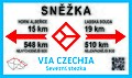 Rozcestnik-ViaCzechia.jpg 2,000 × 1,178; 975 KB
-
 Rozcestník kousek od Braunova betlému.jpg 3,312 × 4,416; 2.3 MB
-
 Rozcestník Pod Kolínskou boudou, bod záchrany TK 135.jpg 2,592 × 1,944; 3.33 MB
-
 Rozcestník Pod Kolínskou boudou.jpg 1,944 × 2,592; 4.92 MB
-
 Rozcestník Pod Větrníkem.jpg 2,048 × 1,536; 720 KB
-
 Rozcestník Rejdiště.jpg 1,944 × 2,592; 3.19 MB
-
 Rozcestník Václavák - naučná stezka.jpg 1,944 × 2,592; 3.01 MB
-
 Rozcestí u Pražské boudy.jpg 2,592 × 1,944; 3.29 MB
-
 Rozcestí v Jestřebích horách.jpg 2,816 × 2,112; 3.81 MB
-
 Rtyně v Podkrkonoší, železniční zastávka, turistické značení.jpg 3,968 × 2,976; 2.59 MB
-
 Sněžka 2020.jpg 746 × 503; 147 KB
-
 Sněžka Krkonoše ukazatel 2020.jpg 735 × 495; 150 KB
-
 Sněžka Krkonoše.jpg 745 × 469; 136 KB
-
 Svoboda nad Úpou, kryté schodiště.JPG 3,968 × 2,976; 4.65 MB
-
 Trail of Czech-Polish Friendship, Krkonoše, Czechia 03.jpg 5,082 × 3,401; 5.84 MB
-
 Trutnov, náměstí Republiky, turistické značení.JPG 2,976 × 3,968; 4.97 MB
-
 Turistické odpočívadlo, Krkonoše.jpg 3,648 × 2,736; 2.61 MB
-
 Voletiny Voletinsky okruh.jpg 3,264 × 2,448; 1.98 MB
-
 Vrchlabi Lanovska rozcestnik.jpg 3,120 × 4,160; 3.91 MB
-
 Černý Důl, náměstí, zastávka (01).jpg 2,505 × 1,722; 802 KB
-
 Černý Důl, náměstí, zastávka (02).jpg 2,592 × 1,944; 3.15 MB
-
 Černý Důl, rozcestník Hrnčířské Boudy.jpg 1,944 × 2,592; 4.9 MB
-
 Černý Důl, rozcestí nad Hrnčířskými Boudami, směrovky.jpg 1,944 × 2,592; 1.56 MB
-
 Černý Důl, rozcestí nad Hrnčířskými Boudami.jpg 2,592 × 1,944; 4.49 MB
-
 Čížkovy kameny, turistické značení.jpg 2,479 × 3,340; 1.91 MB
,_Doln%C3%AD_Pansk%C3%A1,_turistick%C3%A9_zna%C4%8Den%C3%AD.jpg)
,_Horn%C3%AD_Pansk%C3%A1,_turistick%C3%A9_zna%C4%8Den%C3%AD.jpg)

_02.JPG)


.jpg)


,_rozcest%C3%AD,_turistick%C3%A9_zna%C4%8Den%C3%AD.jpg)


,_turistick%C3%A9_zna%C4%8Den%C3%AD.jpg)


.jpg)
.jpg)


