Category:Hiking and footpath fingerposts in Prague-East District
Jump to navigation
Jump to search
Media in category "Hiking and footpath fingerposts in Prague-East District"
The following 54 files are in this category, out of 54 total.
-
 Dol, tabule u přívozu.jpg 1,536 × 2,048; 734 KB
-
 Dolní Lomnice, rozcestník.jpg 2,448 × 3,264; 1.37 MB
-
 Drahanské údolí, rozcestník u Vltavy (01).jpg 2,448 × 3,264; 422 KB
-
 Drahanské údolí, rozcestník u Vltavy.jpg 2,448 × 3,264; 2.02 MB
-
 Hiking guidepost KCT Pareziny.jpg 1,335 × 2,078; 752 KB
-
 Hiking guidepost of KČT.jpg 873 × 936; 232 KB
-
 Kamenice (PH), náměstí, turistické značení.jpg 3,672 × 4,896; 7.4 MB
-
 Kamenice-Ládví, rozcestník.jpg 2,448 × 3,264; 2.04 MB
-
 Klecany křížem krážem, směrovky.jpg 2,048 × 1,536; 648 KB
-
 Klecany, Klecanský háj, rozcestník a odbočky.JPG 2,136 × 2,848; 3.03 MB
-
 Klecany, Klecánky, místní značení.JPG 1,664 × 2,316; 1.75 MB
-
 Klecánky, Povltavská, rozcestník u přívozu.jpg 2,448 × 3,264; 938 KB
-
 Klecánky, rozcestník u Přemyšlenského potoka.jpg 3,888 × 5,184; 5.96 MB
-
 Klecánky, rozcestník u zastávky.jpg 2,448 × 3,264; 559 KB
-
 Klecánky, směrová šipka.jpg 1,967 × 1,369; 557 KB
-

-

-
 Kozojedy, Pod Martinem, rozcestník.jpg 1,536 × 2,048; 779 KB
-
 Lojovice, rozcestník, červené směrovky.jpg 3,264 × 2,448; 988 KB
-
 Lojovice, rozcestník.jpg 3,264 × 2,448; 1.48 MB
-
 Ládeves, rozcestník.jpg 2,448 × 3,264; 2.79 MB
-
 Lázně Toušeň, turistické značení.jpg 3,672 × 4,896; 6.61 MB
-
 Mikešova cesta, směrovka.jpg 2,048 × 1,536; 623 KB
-
 Mokřany (VP), rozcestník.jpg 2,448 × 3,264; 727 KB
-
 Máslovice, Pražská, směrovky k přívozu u čp. 6.jpg 5,184 × 3,888; 5.26 MB
-
 Máslovice, směrovka Převoz přes Vltavu.jpg 5,184 × 3,888; 4.86 MB
-
 Máslovice, Vltavská, směrovka k přívozu.jpg 3,888 × 5,184; 3.98 MB
-
 Máslovice-Dol, rozcestník Na Dole.jpg 3,888 × 5,184; 8.49 MB
-
 Máslovická stezka, mapa.jpg 5,184 × 3,888; 6.25 MB
-
 Na Biči, turistická místní tabulka.jpg 2,048 × 1,536; 288 KB
-
 Na Přezvůrce, rozcestník.jpg 2,048 × 1,536; 692 KB
-
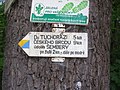 Na Šembeře, směrovka.jpg 2,048 × 1,536; 681 KB
-
 Rozcestník U posledního jelena.jpg 3,264 × 2,448; 1.75 MB
-
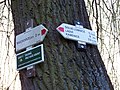
 Rozcestí u Klecan.jpg 4,416 × 3,312; 6.51 MB
-
 Senohraby, rozcestník u če. 59 (01).jpg 3,264 × 2,448; 1.82 MB
-
 Senohraby, rozcestník u če. 59.jpg 2,448 × 3,264; 2.79 MB
-
 Senohraby, turistický rozcestník u nádraží.jpg 2,448 × 3,264; 953 KB
-
 Stříbrná Skalice, rozcestník Na Marjánce.jpg 2,448 × 3,264; 1.18 MB
-
 Svätý Donát, smerovník.jpg 3,264 × 2,448; 2.37 MB
-
 Turistický rozcestník, Zvánovice.jpg 3,120 × 4,160; 3.52 MB
-
 Vlčí halíř, rozcestník a infotabule.JPG 2,048 × 1,536; 670 KB
-
 Výžerky, pamětní kámen a turistické značení.jpg 2,048 × 1,536; 711 KB
-
 Výžerky, pamětní kámen, turistické značení.jpg 1,536 × 2,048; 487 KB
-
 Všešímy, rozcestník.jpg 3,264 × 2,448; 2.05 MB
-
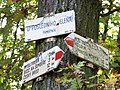
 Zdiby, Přemyšlení, parčík.JPG 2,848 × 2,136; 3.06 MB
-
 Úvaly, Hostín, směrovka po okraji pole.jpg 2,048 × 1,536; 539 KB
-
 Úvaly, rozcestník u nádraží.jpg 2,048 × 1,536; 697 KB
-
 Čerčany, nekompletní rozcestník u nádraží.jpg 2,048 × 1,536; 707 KB
-
 Čerčany, rozcestník u mostu, detail.jpg 530 × 368; 47 KB
-
 Čerčany, rozcestník u mostu.jpg 2,048 × 1,536; 758 KB
-
 Řež, rozcestník u ÚJV.jpg 3,888 × 5,184; 6.28 MB
-
 Řež, rozcestník.jpg 1,536 × 2,048; 275 KB
-
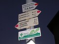
 Říčany-Radošovice, koupaliště, směrovka.jpg 2,048 × 1,536; 719 KB
-
 Škvorec, rozcestník u svatého Donáta.jpg 1,536 × 2,048; 416 KB


.jpg)


,_n%C3%A1m%C4%9Bst%C3%AD,_turistick%C3%A9_zna%C4%8Den%C3%AD.jpg)


_(1).jpg)
_(2).jpg)


,_rozcestn%C3%ADk.jpg)


.jpg)


