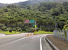
Category:Highway 28 (Taiwan)
Jump to navigation
Jump to search
road in Taiwan | |||||
| Upload media | |||||
| Instance of | |||||
|---|---|---|---|---|---|
| Location | |||||
| Transport network | |||||
| Maintained by | |||||
| Start time |
| ||||
| Length |
| ||||
| |||||
English: Provincial Highway 28 (Taiwan).
日本語: 台28省道。
中文(臺灣):臺28省道。
中文(中国大陆):台28省道。
Subcategories
This category has only the following subcategory.
B
Media in category "Highway 28 (Taiwan)"
The following 9 files are in this category, out of 9 total.
-
End of Taiwan Provincial Highway 28.jpg 4,224 × 3,136; 5.58 MB
-
TW PHW28 RouteMap.svg 500 × 400; 1.01 MB
-
TW PHW28.png 480 × 480; 51 KB
-
TW PHW28.svg 875 × 875; 15 KB
-
旗六公路 Qishan-Liugui Highway - panoramio.jpg 2,593 × 1,807; 1.95 MB
-
旗六公路 Qishan-Liugui Road - panoramio.jpg 3,000 × 2,250; 2.71 MB
-
高雄市旗山區 中學路街景 - panoramio.jpg 3,264 × 2,448; 1.92 MB
-
高雄市田寮區 台28線 - panoramio.jpg 3,264 × 2,448; 1.78 MB
-
高雄市田寮區 福爾摩沙高速公路 田寮交流道 - panoramio.jpg 3,264 × 2,448; 1.92 MB


