Category:Highfield, Southampton
Jump to navigation
Jump to search
English: Highfield is a suburb of Southampton, in the Southampton district, in the county of Hampshire, England.
suburb in Southampton, Hampshire, UK | |||||
| Upload media | |||||
| Instance of | |||||
|---|---|---|---|---|---|
| Location | Southampton, City of Southampton, Hampshire, South East England, England | ||||
 | |||||
Media in category "Highfield, Southampton"
The following 102 files are in this category, out of 102 total.
-
 2016, a year on Geograph (Day 41) - geograph.org.uk - 4821588.jpg 640 × 480; 60 KB
-
 A3035 towards Portswood - geograph.org.uk - 4420625.jpg 640 × 480; 115 KB
-
 A33 The Avenue at Banister Park - geograph.org.uk - 4237130.jpg 640 × 480; 94 KB
-
 A33 The Avenue at milestone on right - geograph.org.uk - 4237133.jpg 640 × 481; 110 KB
-
 Across Southampton Common - geograph.org.uk - 5171358.jpg 640 × 427; 125 KB
-
 Approaching Highfield Road, Southampton - geograph.org.uk - 2274966.jpg 2,112 × 2,816; 2.13 MB
-
 Blenheim Avenue - geograph.org.uk - 5882052.jpg 1,600 × 1,200; 247 KB
-
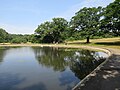
 Boating lake - geograph.org.uk - 5171360.jpg 640 × 427; 96 KB
-
 Building 34 - geograph.org.uk - 5172272.jpg 427 × 640; 118 KB
-
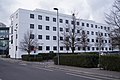
 Building on Brookvale Road, Southampton - geograph.org.uk - 5908955.jpg 1,024 × 684; 253 KB
-

-

-
 Chemistry Buildings - geograph.org.uk - 5172270.jpg 640 × 427; 116 KB
-
 Cycle path across Southampton Common - geograph.org.uk - 2055306.jpg 640 × 480; 133 KB
-
 EEE Building - geograph.org.uk - 3872680.jpg 4,912 × 3,264; 7.59 MB
-
 Fairground on Southampton Common - geograph.org.uk - 5171373.jpg 640 × 427; 104 KB
-
 Footpath across Southampton Common - geograph.org.uk - 2055351.jpg 640 × 480; 123 KB
-
 Furzedown Road, Southampton - geograph.org.uk - 2055375.jpg 640 × 480; 163 KB
-
 Glebe Court sign - geograph.org.uk - 994235.jpg 480 × 640; 87 KB
-
 Glebe Court.jpg 640 × 480; 62 KB
-
 Highfield Campus at the University of Southampton - geograph.org.uk - 3168891.jpg 4,752 × 3,168; 2.83 MB
-
 Highfield Church - geograph.org.uk - 6468348.jpg 674 × 800; 149 KB
-
 Highfield church spire, Southampton - geograph.org.uk - 2308772.jpg 2,112 × 2,816; 2.09 MB
-
 Highfield Lane - geograph.org.uk - 4420631.jpg 640 × 480; 49 KB
-
 Highfield Lane - geograph.org.uk - 4420633.jpg 640 × 468; 54 KB
-
 Highfield Lane, A3035, Highfield - geograph.org.uk - 1949466.jpg 640 × 480; 78 KB
-
 Highfield News - geograph.org.uk - 2907068.jpg 1,024 × 760; 126 KB
-
 Highfield, Avenue Campus - geograph.org.uk - 2907092.jpg 1,024 × 768; 313 KB
-
 Highfield, boarded-up shops - geograph.org.uk - 2907075.jpg 1,024 × 753; 188 KB
-
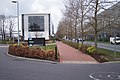
 Highfield, bus interchange - geograph.org.uk - 2909940.jpg 1,024 × 768; 130 KB
-
 Highfield, church centre - geograph.org.uk - 2907063.jpg 1,024 × 768; 151 KB
-
 Highfield, Crown Inn - geograph.org.uk - 2907053.jpg 1,024 × 768; 131 KB
-
 Highfield, Garden Court - geograph.org.uk - 2909919.jpg 1,024 × 757; 186 KB
-
 Highfield, Hartley Library - geograph.org.uk - 2909912.jpg 1,024 × 768; 186 KB
-
 Highfield, library - geograph.org.uk - 2909955.jpg 1,024 × 758; 140 KB
-
 Highfield, Life Sciences Building - geograph.org.uk - 2909925.jpg 1,024 × 756; 142 KB
-
 Highfield, Nightingale Building - geograph.org.uk - 2909949.jpg 1,024 × 768; 233 KB
-
 Highfield, Nuffield Theatre - geograph.org.uk - 2909931.jpg 1,024 × 768; 230 KB
-
 Highfield, sports centre - geograph.org.uk - 2909904.jpg 1,024 × 762; 249 KB
-
 Highfield, The Stile - geograph.org.uk - 2909989.jpg 1,024 × 768; 150 KB
-

-

-
 Life Sciences Building - geograph.org.uk - 4082397.jpg 1,600 × 1,063; 429 KB
-

-

-
 Model boating lake, Southampton Common - geograph.org.uk - 5882062.jpg 1,600 × 1,200; 370 KB
-
 New Zepler Building - Salisbury Road - geograph.org.uk - 3872693.jpg 4,912 × 3,264; 5.38 MB
-
 Nightingale Building - geograph.org.uk - 3872696.jpg 4,912 × 3,264; 4.09 MB
-
 Nightingale Building - north end - geograph.org.uk - 3872699.jpg 1,600 × 1,063; 248 KB
-
 Nuffield Theatre - geograph.org.uk - 4082396.jpg 1,600 × 1,063; 572 KB
-

-
 Path across the common - geograph.org.uk - 5171359.jpg 640 × 427; 138 KB
-
 Path alongside University Road - geograph.org.uk - 3872673.jpg 1,600 × 1,063; 407 KB
-
 Path alongside University Road - geograph.org.uk - 3872678.jpg 4,912 × 3,264; 5.75 MB
-
 Path alongside University Road - geograph.org.uk - 3872681.jpg 1,600 × 1,063; 454 KB
-

-
 Path in the common - geograph.org.uk - 5171375.jpg 640 × 427; 139 KB
-
 Path through Southampton Common - geograph.org.uk - 2055386.jpg 640 × 480; 212 KB
-
 Paths on Southampton Common - geograph.org.uk - 1958988.jpg 480 × 640; 130 KB
-
 Postbox, Blenheim Avenue - geograph.org.uk - 5882057.jpg 1,600 × 1,276; 367 KB
-
 Redundant facilities at a university^ - geograph.org.uk - 3872525.jpg 4,912 × 3,264; 7.13 MB
-
 Road markings - geograph.org.uk - 5171366.jpg 640 × 427; 115 KB
-
 Road markings in Southampton Common - geograph.org.uk - 5171369.jpg 640 × 427; 113 KB
-
 Roselands Gardens, Highfield - geograph.org.uk - 1949473.jpg 640 × 480; 97 KB
-
 Sainsbury's Superstore, Portswood - geograph.org.uk - 5048428.jpg 640 × 480; 526 KB
-

-
 Site of recently-demolished John Hansard Gallery - geograph.org.uk - 6245443.jpg 1,024 × 576; 257 KB
-
 Southampton Common - geograph.org.uk - 5882065.jpg 1,600 × 1,200; 466 KB
-
 Southampton Common path - geograph.org.uk - 5171376.jpg 427 × 640; 137 KB
-
 Southampton Common, car park - geograph.org.uk - 2906599.jpg 1,024 × 768; 269 KB
-
 Southampton Common, cycle route - geograph.org.uk - 2906587.jpg 1,024 × 768; 246 KB
-
 Southampton Common, cycle route - geograph.org.uk - 2907040.jpg 1,024 × 768; 209 KB
-
 Southampton Common, cycle route - geograph.org.uk - 2907081.jpg 1,024 × 768; 265 KB
-
 Southampton Common, ditch - geograph.org.uk - 2907035.jpg 1,024 × 768; 317 KB
-
 Southampton Common, subway - geograph.org.uk - 2907044.jpg 1,024 × 733; 194 KB
-
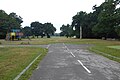
 Southampton Common, The Avenue - geograph.org.uk - 2907027.jpg 1,024 × 768; 257 KB
-
 Southampton Common, The Cowherds - geograph.org.uk - 2906897.jpg 1,024 × 764; 139 KB
-
 Southampton, looking up Church Lane - geograph.org.uk - 450786.jpg 426 × 640; 80 KB
-
 Student memories^ - geograph.org.uk - 3872707.jpg 4,912 × 3,264; 7.31 MB
-
 Student Services Centre ^ Funds Office - geograph.org.uk - 3872665.jpg 1,600 × 1,063; 462 KB
-
 The Highfield, Highfield - geograph.org.uk - 1949461.jpg 640 × 480; 95 KB
-
 The Lake, Southampton Common - geograph.org.uk - 5882067.jpg 1,600 × 1,200; 393 KB
-
 The Life Sciences Building - geograph.org.uk - 3872709.jpg 4,912 × 3,264; 6.38 MB
-
 The Nuffield Theatre at the University of Southampton - geograph.org.uk - 3168886.jpg 4,752 × 3,168; 3.64 MB
-
 The Union building at Southampton University - geograph.org.uk - 3169267.jpg 4,752 × 3,168; 3.17 MB
-
 Trees adjacent A3035 - geograph.org.uk - 4421671.jpg 640 × 462; 151 KB
-
 Trees beside Highfield Avenue, Southampton - geograph.org.uk - 2274972.jpg 2,112 × 2,816; 2.41 MB
-
 Unilink bus top - geograph.org.uk - 3872705.jpg 4,912 × 3,264; 6.59 MB
-
 University bus stop - geograph.org.uk - 3872703.jpg 4,912 × 3,264; 4.72 MB
-
 University Library - side view - geograph.org.uk - 3872669.jpg 4,912 × 3,264; 6.94 MB
-

-

-
 University of Southampton Library - geograph.org.uk - 3872672.jpg 4,912 × 3,264; 7.53 MB
-
 University of Southampton Student Union - geograph.org.uk - 3872675.jpg 4,912 × 3,264; 6.28 MB
-

-

-
 University Road ^ Student Services Centre - geograph.org.uk - 3872661.jpg 4,912 × 3,264; 5.5 MB
-
 Valley Gardens - geograph.org.uk - 5578891.jpg 640 × 360; 94 KB
-
 View along Highfield Road - geograph.org.uk - 2055323.jpg 640 × 480; 174 KB
-
 View along Highfield Road - geograph.org.uk - 2055362.jpg 640 × 480; 168 KB
-
 View along Omdurman Road - geograph.org.uk - 2055336.jpg 640 × 480; 131 KB
-

_-_geograph.org.uk_-_4821588.jpg)


_-_geograph.org.uk_-_994224.jpg)


