Category:High Weald Landscape Trail
Jump to navigation
Jump to search

footpath in southern England  | |||||
| Upload media | |||||
| Instance of | |||||
|---|---|---|---|---|---|
| Location | East Sussex, South East England, England | ||||
| Length |
| ||||
| Terminus | |||||
| |||||
Media in category "High Weald Landscape Trail"
The following 200 files are in this category, out of 375 total.
(previous page) (next page)-

-
 A muddy high Weald Landscape Trail - geograph.org.uk - 1437443.jpg 640 × 480; 141 KB
-
 Across the Field to Slaugham - geograph.org.uk - 895637.jpg 479 × 640; 105 KB
-
 An unofficial path through High Wood - geograph.org.uk - 1300789.jpg 640 × 430; 135 KB
-
 Barn Hill Cottage - geograph.org.uk - 1710200.jpg 2,580 × 1,932; 1.28 MB
-
 Bate's Gill (looking downstream) - geograph.org.uk - 1744026.jpg 2,304 × 3,072; 3.16 MB
-
 Bend on High Weald Landscape Trail - geograph.org.uk - 1595937.jpg 640 × 427; 87 KB
-
 Bend on the Small Hythe Road - geograph.org.uk - 1742790.jpg 3,072 × 2,304; 1.82 MB
-
 Benenden School Playing fields - geograph.org.uk - 1499297.jpg 640 × 427; 49 KB
-

-
 Bluebell Wood - geograph.org.uk - 1877787.jpg 1,024 × 768; 404 KB
-
 Bluebells in Woodland - geograph.org.uk - 1877806.jpg 1,024 × 768; 432 KB
-
 Borde Hill Estate, Lodge gates.jpg 4,000 × 2,667; 3.12 MB
-

-
 Bridge over the Newmill Channel - geograph.org.uk - 1711438.jpg 2,580 × 1,932; 1.42 MB
-
-

-
 Broken stile on High Weald Landscape Trail - geograph.org.uk - 1711058.jpg 2,580 × 1,932; 1.55 MB
-

-

-
 Cloth Hall Oast House - geograph.org.uk - 1499217.jpg 640 × 427; 71 KB
-

-
 Crabtree Farmhouse - geograph.org.uk - 1499268.jpg 640 × 427; 87 KB
-

-
 Dingleden Oasthouse - geograph.org.uk - 1710221.jpg 2,580 × 1,932; 1.05 MB
-
 Division on Maypole Lane - geograph.org.uk - 1593619.jpg 640 × 427; 88 KB
-
 Double gates on the Rother Levels - geograph.org.uk - 1742880.jpg 3,072 × 2,304; 3.13 MB
-
 Dumbourne Farm Barn - geograph.org.uk - 1742616.jpg 3,072 × 2,304; 2.02 MB
-
 Earthwork and field near Newmill Channel - geograph.org.uk - 1711424.jpg 2,580 × 1,932; 1.32 MB
-

-

-

-

-
 Farmland on High Weald Walk - geograph.org.uk - 1409250.jpg 640 × 480; 86 KB
-

-

-

-

-
 Footbridge and stile near Belcot Manor Farm - geograph.org.uk - 1742347.jpg 3,072 × 2,304; 3.02 MB
-

-
 Footbridge in Dibley Shaw - geograph.org.uk - 1499284.jpg 640 × 427; 113 KB
-
 Footbridge in Hagues Gill - geograph.org.uk - 1499237.jpg 640 × 427; 96 KB
-
 Footbridge in Rectory Park - geograph.org.uk - 1515766.jpg 640 × 427; 97 KB
-
 Footbridge near Dumbourne Farm - geograph.org.uk - 1742728.jpg 3,072 × 2,304; 2.46 MB
-
 Footbridge near Oast House Wood - geograph.org.uk - 1742449.jpg 2,304 × 3,072; 3.29 MB
-
 Footbridge near Tilden Gill in Oasthouse Wood - geograph.org.uk - 1742462.jpg 2,304 × 3,072; 3.28 MB
-
 Footbridge on High Weald Landscape Trail - geograph.org.uk - 1436162.jpg 640 × 480; 125 KB
-
 Footbridge on High Weald Landscape Trail - geograph.org.uk - 1499258.jpg 640 × 427; 123 KB
-

-
-

-
 Footbridge on the High Weald Landscape Trail - geograph.org.uk - 1742321.jpg 2,304 × 3,072; 2.41 MB
-
 Footbridge on the Six Fields Path - geograph.org.uk - 1742296.jpg 2,304 × 3,072; 3.16 MB
-
 Footbridge on the Tilden Gill (2) - geograph.org.uk - 1742394.jpg 3,072 × 2,304; 3.22 MB
-
 Footbridge on the Tilden Gill - geograph.org.uk - 1742386.jpg 2,304 × 3,072; 2.68 MB
-
 Footbridge over Furnace Pond - geograph.org.uk - 1357079.jpg 640 × 480; 109 KB
-

-
 Footbridge over the Bate's Gill - geograph.org.uk - 1744027.jpg 3,072 × 2,304; 3.23 MB
-
 Footpath and byway junction near Dingleden Farm - geograph.org.uk - 1710219.jpg 2,580 × 1,932; 2.28 MB
-
 Footpath from Brenchley Church - geograph.org.uk - 1436149.jpg 640 × 480; 135 KB
-
 Footpath Joins Copyhold Lane - geograph.org.uk - 858135.jpg 479 × 640; 184 KB
-
 Footpath junction , High Wood - geograph.org.uk - 1300767.jpg 640 × 430; 131 KB
-
 Footpath junction in Snipe Wood - geograph.org.uk - 1409159.jpg 640 × 480; 124 KB
-

-
 Footpath junction is Snipe Wood - geograph.org.uk - 1409130.jpg 640 × 480; 128 KB
-
 Footpath Junction near Bates Gill - geograph.org.uk - 1744083.jpg 3,072 × 2,304; 2.88 MB
-
 Footpath junction near Dingleden Farm - geograph.org.uk - 1710211.jpg 2,580 × 1,932; 2.4 MB
-
 Footpath junction near Heronden - geograph.org.uk - 1747683.jpg 3,072 × 2,304; 2.13 MB
-
 Footpath junction near Rolvenden Layne - geograph.org.uk - 1711218.jpg 2,580 × 1,932; 2.22 MB
-
 Footpath junction near the Crayfish Lagoons - geograph.org.uk - 1711356.jpg 2,580 × 1,932; 2.22 MB
-
 Footpath Junction near Winton Farm - geograph.org.uk - 1711418.jpg 2,580 × 1,932; 1.78 MB
-
 Footpath junction near Wittersham Cemetery - geograph.org.uk - 1744030.jpg 3,072 × 2,304; 2.97 MB
-
 Footpath junction on High Weald Landscape Trail (2) - geograph.org.uk - 1710087.jpg 2,580 × 1,932; 1.94 MB
-

-
 Footpath junction on High Weald Walks - geograph.org.uk - 1410223.jpg 640 × 480; 141 KB
-

-

-

-

-
 Footpath junction on the High Weald Landscape Trail - geograph.org.uk - 1710076.jpg 2,580 × 1,932; 2.12 MB
-
-
 Footpath on High Woods Lane - geograph.org.uk - 1409287.jpg 640 × 480; 121 KB
-

-
 Footpath to Cranbrook - geograph.org.uk - 1593506.jpg 640 × 427; 125 KB
-
 Footpath to Puddingcake Lane - geograph.org.uk - 1711406.jpg 1,932 × 2,580; 2.7 MB
-
 Footpath to Seven Acre Shaw - geograph.org.uk - 1709715.jpg 2,580 × 1,932; 2.2 MB
-
 Footpath to Wittersham - geograph.org.uk - 1744032.jpg 3,072 × 2,304; 3.05 MB
-

-
 Footpath, River's Wood - geograph.org.uk - 856212.jpg 479 × 640; 143 KB
-
 Frog's Lane (2) - geograph.org.uk - 1711120.jpg 2,580 × 1,932; 2.09 MB
-

-
 Gate beside Willerd's Hill Wood - geograph.org.uk - 1710178.jpg 2,580 × 1,932; 1.95 MB
-
 Gate by the B2110 - geograph.org.uk - 1585823.jpg 640 × 430; 164 KB
-
 Gate in the Rother Levels - geograph.org.uk - 1742841.jpg 3,072 × 2,304; 1.9 MB
-
 Gate into Ratsbury Wood - geograph.org.uk - 1742438.jpg 2,304 × 3,072; 3.32 MB
-
 Gate on the High Weald Landscape Trail - geograph.org.uk - 1459870.jpg 640 × 430; 122 KB
-
 Gate on the High Weald Landscape Trail - geograph.org.uk - 1710176.jpg 1,932 × 2,580; 2.15 MB
-

-

-
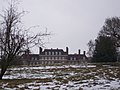 Great Maytham Hall - geograph.org.uk - 1711104.jpg 2,580 × 1,932; 974 KB
-
 Hagues Gill - geograph.org.uk - 1499253.jpg 427 × 640; 112 KB
-
 High Weald Landscape Trail (2) - geograph.org.uk - 1288309.jpg 640 × 430; 86 KB
-
 High Weald Landscape Trail - geograph.org.uk - 1288291.jpg 640 × 430; 108 KB
-
 High Weald Landscape Trail - geograph.org.uk - 1803572.jpg 640 × 430; 132 KB
-
 High Weald Landscape Trail - geograph.org.uk - 244472.jpg 640 × 548; 104 KB
-
 High Weald Landscape Trail - geograph.org.uk - 4190830.jpg 640 × 430; 72 KB
-
 High Weald Landscape Trail - geograph.org.uk - 4190863.jpg 640 × 430; 93 KB
-
 High Weald Landscape Trail - geograph.org.uk - 4190893.jpg 640 × 430; 86 KB
-
 High Weald Landscape Trail - geograph.org.uk - 4190896.jpg 640 × 430; 84 KB
-

-

-

-
 High Weald Landscape Trail beside St George's Church - geograph.org.uk - 1709730.jpg 2,580 × 1,932; 1.78 MB
-

-
-

-

-

-

-

-

-
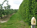
 High Weald Landscape Trail in an orchard - geograph.org.uk - 1510585.jpg 640 × 427; 104 KB
-

-
-

-

-
 High Weald Landscape Trail in Ratsbury Wood - geograph.org.uk - 1742407.jpg 2,304 × 3,072; 3.3 MB
-

-
 High Weald Landscape Trail in Snipe Wood - geograph.org.uk - 1409138.jpg 640 × 480; 144 KB
-

-

-

-

-

-

-
 High Weald Landscape Trail near Oasthouse Wood - geograph.org.uk - 1742458.jpg 3,072 × 2,304; 2.12 MB
-

-

-

-
 High Weald Landscape Trail near Usher Wood Lake - geograph.org.uk - 1742473.jpg 3,072 × 2,304; 2.26 MB
-

-

-

-

-
 High Weald Landscape Trail through an orchard to Wittersham - geograph.org.uk - 1744060.jpg 3,072 × 2,304; 3.58 MB
-

-

-

-

-

-

-
-

-

-
 High Weald Landscape Trail, High Wood - geograph.org.uk - 4198904.jpg 640 × 430; 164 KB
-
 High Weald Landscape Trail, High Wood - geograph.org.uk - 4198916.jpg 640 × 430; 109 KB
-

-
 High Weald Landscape Trail, Mill Wood - geograph.org.uk - 335351.jpg 479 × 640; 208 KB
-

-

-
 High Weald Path junction in Snipe Wood - geograph.org.uk - 1409150.jpg 640 × 480; 120 KB
-
 High Weald Paths in Snipes Wood - geograph.org.uk - 1409145.jpg 640 × 480; 150 KB
-
 High Weald Paths on Woodlands - geograph.org.uk - 1409162.jpg 640 × 480; 115 KB
-
 High Weald Walk - Tunbridge Wells Circular Marker - geograph.org.uk - 1732092.jpg 3,072 × 2,304; 1.49 MB
-
 High Weald Walks heading to Pembury - geograph.org.uk - 1409181.jpg 640 × 480; 123 KB
-
 High Weald Walks near the A21 - geograph.org.uk - 1409192.jpg 640 × 480; 114 KB
-

-

-
 Hononton Cottage - geograph.org.uk - 1357083.jpg 640 × 480; 70 KB
-
 Hop Picker ready for Monday - geograph.org.uk - 1516994.jpg 640 × 427; 101 KB
-
 Information Board in Rusthall Common - geograph.org.uk - 1731957.jpg 3,072 × 2,304; 2.23 MB
-

-
 Junction on Dingleden Lane - geograph.org.uk - 1710193.jpg 2,580 × 1,932; 1.71 MB
-
 Kingsgate Farmhouse - geograph.org.uk - 1742966.jpg 3,072 × 2,304; 2.01 MB
-
 Kingsgate Lane - geograph.org.uk - 1742998.jpg 3,072 × 2,304; 2.3 MB
-
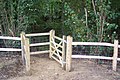
 Kissing Gate in Sprivers Garden Woodland - geograph.org.uk - 1517010.jpg 640 × 427; 118 KB
-
 Kissing gate near Great Maytham - geograph.org.uk - 1711099.jpg 2,580 × 1,932; 2.52 MB
-

-

-
-

-
 Kissing Gate on High Weald Landscape Trail - geograph.org.uk - 1709744.jpg 2,580 × 1,932; 978 KB
-

-

-
 Line of bushes - geograph.org.uk - 1803556.jpg 640 × 430; 141 KB
-
 Little Glassenbury Barn - geograph.org.uk - 1595877.jpg 640 × 427; 114 KB
-
 Long Distance Paths in Snipe Wood - geograph.org.uk - 1409124.jpg 640 × 480; 134 KB
-

-

-
 Maypole Lane - geograph.org.uk - 731614.jpg 640 × 426; 82 KB
-

-

-

-
 Muddy path - geograph.org.uk - 2939802.jpg 640 × 430; 106 KB
-

-
 Oak tree on High Weald Landscape Trail - geograph.org.uk - 1711083.jpg 2,580 × 1,932; 2.07 MB
-
 Oast House, Wittersham Street - geograph.org.uk - 1744033.jpg 3,072 × 2,304; 1.67 MB
-
 Old bridge, New Bridge, Tilden Gill - geograph.org.uk - 1742382.jpg 3,072 × 2,304; 3.36 MB
-
 Old Cloth Hall - geograph.org.uk - 1499225.jpg 640 × 427; 47 KB
-
 Old Orchard in Southfield Farm - geograph.org.uk - 1436165.jpg 640 × 480; 140 KB


_-_geograph.org.uk_-_1744026.jpg)


_-_geograph.org.uk_-_1742394.jpg)


_-_geograph.org.uk_-_1710087.jpg)


_-_geograph.org.uk_-_1711120.jpg)


_-_geograph.org.uk_-_1288309.jpg)


_-_geograph.org.uk_-_1690012.jpg)
_-_geograph.org.uk_-_1690020.jpg)


