Category:Herbetswil
Jump to navigation
Jump to search
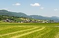
municipality in the canton of Solothurn in Switzerland    | |||||
| Upload media | |||||
| Instance of | |||||
|---|---|---|---|---|---|
| Location | Thal District, Thal-Gäu, Solothurn, Switzerland | ||||
| Official language | |||||
| Population |
| ||||
| Area |
| ||||
| Elevation above sea level |
| ||||
| official website | |||||
 | |||||
Subcategories
This category has the following 2 subcategories, out of 2 total.
C
S
- Schmiedenmatt (Jura) (12 F)
Media in category "Herbetswil"
The following 48 files are in this category, out of 48 total.
-
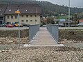
 Alte Landstrasse-Brücke über die Dünnern, Herbetswil SO 20210827-jag9889.jpg 4,608 × 3,456; 13.13 MB
-
 CHE Herbetswil Flag.svg 589 × 585; 42 KB
-
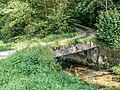
 Duennern apud Herbetswil 108.JPG 3,872 × 2,592; 4.64 MB
-
 Duennern apud Herbetswil 109.JPG 3,872 × 2,592; 4.49 MB
-
 Duennern apud Herbetswil 111.JPG 3,872 × 2,592; 4.47 MB
-
 Duennern apud Herbetswil 112.JPG 3,872 × 2,592; 3.53 MB
-
 Dünnerngätterliweg-Brücke über die Dünnern, Herbetswil SO 20210827-jag9889.jpg 4,608 × 3,456; 13.58 MB
-
 Dünnerngätterliweg-Brücke über die Dünnern, Herbetswil SO 20221025-jag9889.jpg 4,608 × 3,456; 10.1 MB
-
 Ebenfeld-Brücke über die Dünnern, Herbetswil SO 20210827-jag9889.jpg 4,608 × 3,456; 14.46 MB
-
-
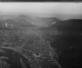
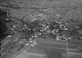 ETH-BIB-Herbetswil-LBS H1-018752.tiff 6,784 × 4,775; 92.85 MB
-
 ETH-BIB-Herbetswil-LBS H1-018753.tiff 6,803 × 4,769; 92.91 MB
-
 Flag of Herbetswil.gif 216 × 216; 2 KB
-
 Hammer (komunumo Herbetswil) 114.JPG 3,872 × 2,592; 4.77 MB
-
 Herbetswil 102.JPG 3,872 × 2,592; 4.5 MB
-
 Herbetswil 103.JPG 3,872 × 2,592; 4.2 MB
-
 Herbetswil 104.JPG 3,872 × 2,592; 4.36 MB
-
 Herbetswil 110.JPG 3,872 × 2,592; 2.91 MB
-
 Herbetswil 7890.jpg 3,888 × 2,592; 3.12 MB
-
 Herbetswil kantona chefvojo nr-o 30 bildo 106.JPG 3,872 × 2,592; 4.41 MB
-
 Herbetswil Schulhaus 7889.jpg 3,888 × 2,592; 2.9 MB
-
 Herbetswil vilagheniro 101.JPG 3,872 × 2,592; 3.74 MB
-
 Herbetswil-blason.png 267 × 300; 3 KB
-
 Herbetswil-blazon.svg 209 × 245; 3 KB
-
 Hinter-Brandberg, Welschenrohr - panoramio.jpg 4,912 × 1,080; 4.21 MB
-
 Karte Gemeinde Herbetswil 2007.png 1,476 × 982; 358 KB
-
 Karte Gemeinde Herbetswil.png 1,181 × 781; 160 KB
-
 Naturpark Thal mcassina 29.jpg 2,658 × 1,714; 4.71 MB
-
 Ried-Brücke über die Dünnern, Herbetswil SO – Aedermannsdorf SO 20210827-jag9889.jpg 4,608 × 3,456; 14.07 MB
-
 Schiessstand-Brücke über die Dünnern, Herbetswil SO 20210827-jag9889.jpg 4,608 × 3,456; 13.59 MB
-
 Schmiedenmattweg-Brücke über die Dünnern, Herbetswil SO 20210827-jag9889.jpg 4,608 × 3,456; 15.3 MB
-
 Steinbruch Hammer-Brücke über die Dünnern, Herbetswil SO 20210827-jag9889.jpg 4,608 × 3,456; 14.04 MB
-
 Swiss Hiking Network - Guidepost - Obere Tannmatt.jpg 4,032 × 3,024; 4.46 MB
-
 Swiss Hiking Network - Signpost - Hammerrain.jpg 4,032 × 3,024; 4.13 MB
-
 Thalstrasse-Brücke über die Dünnern, Herbetswil SO 20210827-jag9889.jpg 4,608 × 3,456; 12.88 MB
-
 Trockenmauer auf dem Probstenberg - panoramio.jpg 3,648 × 2,736; 10.2 MB
-
 Weid-Brücke über die Dünnern, Herbetswil SO 20210827-jag9889.jpg 4,608 × 3,456; 12.38 MB
-
 Wolfsschlucht, Welschenrohr - panoramio.jpg 3,648 × 2,736; 9.5 MB
-
 Zentralbibliothek Solothurn Ernst Klöti 0052.jpg 6,415 × 4,184; 21.77 MB
-
 Zentralbibliothek Solothurn Ernst Klöti 0063.jpg 6,415 × 4,184; 19.26 MB
-
 Zentralbibliothek Solothurn Ernst Klöti 0821 Mieschegg.jpg 6,415 × 4,184; 28.13 MB
-
 Zentralbibliothek Solothurn Ernst Klöti 0822 Hinter Brandberg.jpg 6,415 × 4,184; 26.1 MB
-
 Zentralbibliothek Solothurn Ernst Klöti 0823 Hinter Brandberg Welschenrohr.jpg 6,415 × 4,184; 19.46 MB
-
 Zentralbibliothek Solothurn Ernst Klöti 0824 Hinter Brandberg.jpg 6,415 × 4,184; 20.43 MB
-
 Zentralbibliothek Solothurn Ernst Klöti 0826 Harzer.jpg 6,415 × 4,184; 20.31 MB
-
 Zentralbibliothek Solothurn Ernst Klöti 0828 Harzer.jpg 4,184 × 6,415; 27.02 MB
-
 Zentralbibliothek Solothurn Ernst Klöti 1327 Mieschegg.jpg 6,415 × 4,184; 19.04 MB
-
 Zentralbibliothek Solothurn Ernst Klöti 1341 Erratischer Block.jpg 6,415 × 4,184; 21.3 MB


_114.JPG)


