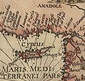
Category:Hendrik van Langren map of South Asia
Jump to navigation
Jump to search
A companion piece with the Hendrik and Arnold van Langren map of Southeast Asia.
Media in category "Hendrik van Langren map of South Asia"
The following 20 files are in this category, out of 20 total.
-
1596 map of the Indian Ocean.jpg 13,353 × 9,856; 32.4 MB
-
1596 map of the Middle East and the Indian Ocean.jpg 13,353 × 9,856; 32.4 MB
-
"Deliniantur in hac tabio , Orae maritimae Abexiae..." (26097240890).jpg 4,167 × 5,593; 2.96 MB
-
Deliniantur in hac tabula - Henricus F.ab Langren Sculpsit.png 858 × 507; 592 KB
-
Deliniantur in hac tabula.A.jpg 1,385 × 415; 518 KB
-
Deliniantur in hac tabula.B.jpg 1,025 × 391; 372 KB
-
Deliniantur in hac tabula.C.jpg 440 × 930; 398 KB
-
Deliniantur in hac tabula.D.jpg 479 × 454; 214 KB
-
Deliniantur in hac tabula.E.jpg 1,245 × 811; 986 KB
-
Deliniantur in hac tabula.F.jpg 523 × 482; 252 KB
-
Deliniantur in hac tabula.G.jpg 958 × 1,108; 981 KB
-
Deliniantur in hac tabula.JPG 4,303 × 3,136; 13.2 MB
-
Indostan on 1596 map.png 1,340 × 628; 2.29 MB
-
Jan Huighen van Linschoten, Henricus Florent Langren- 1596-Amsterdam.jpg 769 × 600; 135 KB
-
North Indian Ocean - from Ethiopia to Burma including the Caspian Sea RMG F0224.tiff 6,921 × 5,105; 101.08 MB
-
North Indian Ocean - from Ethiopia to Burma including the Caspian Sea RMG L6855-001.tiff 4,800 × 3,484; 47.85 MB
Categories:
- Hendrik van Langren
- Itinerario (Jan Huygen van Linschoten)
- Engraved maps
- Maps from Gallica by name
- 1595 maps of Asia
- 1595 maps of Africa
- 1590s maps of India
- 1590s maps of Iran
- 16th-century maps of Somalia
- 16th-century maps of Ethiopia
- 16th-century maps of Arabia
- 1590s maps of Turkey
- 16th-century maps of Iraq
- 16th-century maps of the Middle East
- Old maps of South Asia
- Compass roses on maps
- Maps with cartouches
- Monsters on maps
- Ships on maps
- Latin-language maps
- Dutch-language maps
- 16th-century maps of Sudan
- 16th-century maps of the Maldives
- 16th-century maps of the Andaman Islands
- 16th-century maps of the Indian Ocean
- 16th-century maps of the Red Sea
- Maps of the Arabian Sea
- Bay of Bengal
- Maps of the Gulf of Aden
- Maps of the Gulf of Oman
- Old maps of the Persian Gulf


