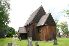
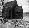
Category:Hedareds stavkyrka
Jump to navigation
Jump to search
| Object location | | View all coordinates using: OpenStreetMap |
|---|
|
This is a category about an ecclesiastical monument in Sweden, number 21300000002387 in the RAÄ buildings database.
|
church building in Borås Municipality, Västra Götaland County, Sweden | |||||
| Upload media | |||||
| Instance of | |||||
|---|---|---|---|---|---|
| Made from material | |||||
| Location | Hedared, Västergötland, Västra Götaland County, Sweden | ||||
| Diocese | |||||
| Connects with |
| ||||
| Has use |
| ||||
| Occupant | |||||
| Heritage designation |
| ||||
| official website | |||||
 | |||||
Subcategories
This category has only the following subcategory.
Media in category "Hedareds stavkyrka"
The following 118 files are in this category, out of 118 total.
-
Apostel-med-oidentifierat attribut.jpg 366 × 546; 71 KB
-
Hedared kyrka.jpg 3,888 × 2,592; 4.28 MB
-
Hedared Västergötland Sweden.jpg 1,999 × 3,007; 2.72 MB
-
Hedared-ca1510-hela.jpg 512 × 357; 56 KB
-
Hedared-Johannes och Bartolomeus.jpg 367 × 537; 68 KB
-
Hedared-Johannes.jpg 366 × 510; 60 KB
-
Hedared-Maria.jpg 367 × 506; 66 KB
-
Hedared-Marie-kröning.jpg 567 × 364; 69 KB
-
Hedared-oidentifierat-helgon med stav och radband.jpg 348 × 554; 68 KB
-
Hedareds Stavkyrka (Matthias Schalk).jpg 6,000 × 4,000; 13.41 MB
-
Hedareds stavkyrka - KMB - 16001000017301.jpg 764 × 513; 327 KB
-
Hedareds stavkyrka - KMB - 16001000017303.jpg 764 × 504; 257 KB
-
Hedareds stavkyrka - KMB - 16001000017305.jpg 386 × 584; 134 KB
-
Hedareds stavkyrka - KMB - 16001000023153.jpg 764 × 585; 303 KB
-
Hedareds stavkyrka - KMB - 16001000023155.jpg 764 × 585; 329 KB
-
Hedareds stavkyrka - KMB - 16001000023157.jpg 764 × 583; 294 KB
-
Hedareds stavkyrka - KMB - 16001000023159.jpg 432 × 570; 209 KB
-
Hedareds stavkyrka - KMB - 16001000163004.jpg 511 × 790; 94 KB
-
Hedareds stavkyrka - KMB - 16001000163024.jpg 780 × 500; 95 KB
-
Hedareds Stavkyrka klockstapeln (Matthias Schalk).jpg 6,000 × 4,000; 12.4 MB
-
Sandhult, Hedareds Stavkyrka - KMB - 16000200157918.jpg 839 × 600; 135 KB
-
Sandhult, Hedareds Stavkyrka - KMB - 16000200157919.jpg 847 × 600; 148 KB
-
Sandhult, Hedareds Stavkyrka - KMB - 16000200157920.jpg 465 × 600; 78 KB
-
Sandhult, Hedareds Stavkyrka - KMB - 16000200157921.jpg 409 × 600; 56 KB
-
Sandhult, Hedareds Stavkyrka - KMB - 16000200157922.jpg 432 × 600; 76 KB
-
Sandhult, Hedareds Stavkyrka - KMB - 16000200157923.jpg 399 × 600; 71 KB
-
Sandhult, Hedareds Stavkyrka - KMB - 16000200157924.jpg 821 × 600; 92 KB
-
Sandhult, Hedareds Stavkyrka - KMB - 16000200157925.jpg 441 × 600; 68 KB
-
Sandhult, Hedareds Stavkyrka - KMB - 16000200157926.jpg 811 × 600; 83 KB
-
Sandhult, Hedareds Stavkyrka - KMB - 16000200157927.jpg 479 × 600; 61 KB
-
Sandhult, Hedareds Stavkyrka - KMB - 16000200157928.jpg 450 × 600; 58 KB
-
Sandhult, Hedareds Stavkyrka - KMB - 16000200157929.jpg 802 × 600; 72 KB
-
Sandhult, Hedareds Stavkyrka - KMB - 16000200157930.jpg 441 × 600; 84 KB
-
Sandhult, Hedareds Stavkyrka - KMB - 16000200157931.jpg 970 × 600; 158 KB
-
Sandhult, Hedareds Stavkyrka - KMB - 16000200157932.jpg 819 × 600; 123 KB
-
Sandhult, Hedareds Stavkyrka - KMB - 16000200157933.jpg 439 × 600; 80 KB
-
Sandhult, Hedareds Stavkyrka - KMB - 16000200157934.jpg 818 × 600; 88 KB
-
Sandhult, Hedareds Stavkyrka - KMB - 16000200157935.jpg 920 × 600; 169 KB
-
Sandhult, Hedareds Stavkyrka - KMB - 16000200157936.jpg 918 × 600; 141 KB
-
Sandhult, Hedareds Stavkyrka - KMB - 16000200157937.jpg 394 × 600; 69 KB
-
Sandhult, Hedareds Stavkyrka - KMB - 16000200157938.jpg 434 × 600; 62 KB
-
Sandhult, Hedareds Stavkyrka - KMB - 16000200157939.jpg 804 × 600; 130 KB
-
Sandhult, Hedareds Stavkyrka - KMB - 16000200157940.jpg 438 × 600; 59 KB
-
Sandhult, Hedareds Stavkyrka - KMB - 16000200157941.jpg 812 × 600; 101 KB
-
Sandhult, Hedareds Stavkyrka - KMB - 16000200157942.jpg 403 × 600; 61 KB
-
Sandhult, Hedareds Stavkyrka - KMB - 16000200157943.jpg 406 × 600; 58 KB
-
Sandhult, Hedareds Stavkyrka - KMB - 16000200157945.jpg 470 × 600; 61 KB
-
Sandhult, Hedareds Stavkyrka - KMB - 16000200157946.jpg 624 × 600; 71 KB
-
Sandhult, Hedareds Stavkyrka - KMB - 16000200157947.jpg 746 × 600; 35 KB
-
Sandhult, Hedareds Stavkyrka - KMB - 16000200157948.jpg 815 × 600; 83 KB
-
Sandhult, Hedareds Stavkyrka - KMB - 16000200157949.jpg 601 × 600; 108 KB
-
Sandhult, Hedareds Stavkyrka - KMB - 16000200157950.jpg 607 × 600; 50 KB
-
Sandhult, Hedareds Stavkyrka - KMB - 16000200157951.jpg 596 × 600; 72 KB
-
Sandhult, Hedareds Stavkyrka - KMB - 16000200157952.jpg 593 × 600; 80 KB
-
Sandhult, Hedareds Stavkyrka - KMB - 16000200157953.jpg 605 × 600; 99 KB
-
Sandhult, Hedareds Stavkyrka - KMB - 16000200157954.jpg 600 × 600; 77 KB
-
Sandhult, Hedareds Stavkyrka - KMB - 16000200157955.jpg 605 × 600; 66 KB
-
Sandhult, Hedareds Stavkyrka - KMB - 16000200157956.jpg 603 × 600; 74 KB
-
Sandhult, Hedareds Stavkyrka - KMB - 16000200157957.jpg 598 × 600; 114 KB
-
Sandhult, Hedareds Stavkyrka - KMB - 16000200157958.jpg 603 × 600; 114 KB
-
Sandhult, Hedareds Stavkyrka - KMB - 16000200157959.jpg 600 × 600; 112 KB
-
Sandhult, Hedareds Stavkyrka - KMB - 16000200157960.jpg 600 × 600; 104 KB
-
Sandhult, Hedareds Stavkyrka - KMB - 16000200157961.jpg 604 × 600; 106 KB
-
Sandhult, Hedareds Stavkyrka - KMB - 16000200157962.jpg 607 × 600; 76 KB
-
Sandhult, Hedareds Stavkyrka - KMB - 16000200157963.jpg 606 × 600; 86 KB
-
Sandhult, Hedareds Stavkyrka - KMB - 16000200157964.jpg 598 × 600; 63 KB
-
Sandhult, Hedareds Stavkyrka - KMB - 16000200157965.jpg 601 × 600; 76 KB
-
Sandhult, Hedareds Stavkyrka - KMB - 16000200157966.jpg 610 × 600; 62 KB
-
Sandhult, Hedareds Stavkyrka - KMB - 16000200157967.jpg 609 × 600; 57 KB
-
Sandhult, Hedareds Stavkyrka - KMB - 16000200157968.jpg 601 × 600; 60 KB
-
Sandhult, Hedareds Stavkyrka - KMB - 16000200157969.jpg 598 × 600; 63 KB
-
Sandhult, Hedareds Stavkyrka - KMB - 16000200157970.jpg 608 × 600; 72 KB
-
Sandhult, Hedareds Stavkyrka - KMB - 16000200157971.jpg 592 × 600; 63 KB
-
Sandhult, Hedareds Stavkyrka - KMB - 16000200157972.jpg 602 × 600; 90 KB
-
Sandhult, Hedareds Stavkyrka - KMB - 16000200157974.jpg 605 × 600; 86 KB
-
Sandhult, Hedareds Stavkyrka - KMB - 16000200157975.jpg 608 × 600; 81 KB
-
Sandhult, Hedareds Stavkyrka - KMB - 16000200157976.jpg 607 × 600; 93 KB
-
Sandhult, Hedareds Stavkyrka - KMB - 16000200157977.jpg 600 × 600; 79 KB
-
Sandhult, Hedareds Stavkyrka - KMB - 16000200157978.jpg 597 × 600; 76 KB
-
Sandhult, Hedareds Stavkyrka - KMB - 16000200157979.jpg 601 × 600; 73 KB
-
Sandhult, Hedareds Stavkyrka - KMB - 16000200157980.jpg 486 × 600; 57 KB
-
Sandhult, Hedareds Stavkyrka - KMB - 16000200157981.jpg 874 × 600; 121 KB
-
Sandhult, Hedareds Stavkyrka - KMB - 16000200157982.jpg 780 × 600; 81 KB
-
Sandhult, Hedareds Stavkyrka - KMB - 16000200157983.jpg 841 × 600; 77 KB
-
Sandhult, Hedareds Stavkyrka - KMB - 16000200157984.jpg 464 × 600; 51 KB
-
Sandhult, Hedareds Stavkyrka - KMB - 16000200157985.jpg 839 × 600; 63 KB
-
Sandhult, Hedareds Stavkyrka - KMB - 16000200157986.jpg 438 × 600; 53 KB
-
Sandhult, Hedareds Stavkyrka - KMB - 16000200158079.jpg 380 × 600; 38 KB
-
Sandhult, Hedareds Stavkyrka - KMB - 16000200158081.jpg 397 × 600; 44 KB
-
Sandhult, Hedareds Stavkyrka - KMB - 16000200158084.jpg 456 × 600; 50 KB
-
Sandhult, Hedareds Stavkyrka - KMB - 16000200158086.jpg 607 × 600; 61 KB
-
Sandhult, Hedareds Stavkyrka - KMB - 16000200158087.jpg 608 × 600; 84 KB
-
Sandhult, Hedareds Stavkyrka - KMB - 16000200158094.jpg 437 × 600; 35 KB
-
Sandhult, Hedareds Stavkyrka - KMB - 16000200158096.jpg 424 × 600; 54 KB
-
Sandhult, Hedareds Stavkyrka - KMB - 16000200158098.jpg 606 × 600; 69 KB
-
Sandhult, Hedareds Stavkyrka - KMB - 16000200158114.jpg 439 × 600; 29 KB
-
Sandhult, Hedareds Stavkyrka - KMB - 16000200158115.jpg 418 × 600; 21 KB
-
Sandhult, Hedareds Stavkyrka - KMB - 16000200158116.jpg 415 × 600; 16 KB
-
Sandhult, Hedareds Stavkyrka - KMB - 16000200158117.jpg 1,400 × 273; 26 KB
-
Sandhult, Hedareds Stavkyrka - KMB - 16000200158118.jpg 273 × 600; 30 KB
-
Sandhult, Hedareds Stavkyrka - KMB - 16000200158120.jpg 357 × 600; 19 KB
-
Sandhult, Hedareds Stavkyrka - KMB - 16000200158122.jpg 419 × 600; 39 KB
-
Sandhult, Hedareds Stavkyrka - KMB - 16000200158123.jpg 887 × 600; 43 KB
-
Sandhult, Hedareds Stavkyrka - KMB - 16000200158128.jpg 440 × 600; 20 KB
-
Sandhult, Hedareds Stavkyrka - KMB - 16000200158130.jpg 505 × 600; 45 KB
-
Sandhult, Hedareds Stavkyrka - KMB - 16000200158133.jpg 243 × 600; 15 KB
-
Sandhult, Hedareds Stavkyrka - KMB - 16000200158135.jpg 402 × 600; 38 KB
-
Sandhult, Hedareds Stavkyrka - KMB - 16000200158153.jpg 788 × 600; 232 KB
-
Sandhult, Hedareds Stavkyrka - KMB - 16000200158155.jpg 832 × 600; 245 KB
-
Sandhult, Hedareds Stavkyrka - KMB - 16000200158156.jpg 718 × 600; 127 KB
-
Sandhult, Hedareds Stavkyrka - KMB - 16000200158157.jpg 725 × 600; 86 KB
-
Sandhult, Hedareds Stavkyrka - KMB - 16000200158158.jpg 729 × 600; 108 KB
-
Sandhult, Hedareds Stavkyrka - KMB - 16000200158159.jpg 839 × 600; 78 KB
-
Sandhult, Hedareds Stavkyrka - KMB - 16000200158161.jpg 430 × 600; 61 KB
-
Sandhult, Hedareds Stavkyrka - KMB - 16000200158162.jpg 433 × 600; 32 KB
-
Sandhult, Hedareds Stavkyrka - KMB - 16000200158163.jpg 459 × 600; 55 KB
-
StabkircheHedared-01-1.jpg 1,500 × 916; 747 KB
-
StabkircheHedared-01.jpg 1,371 × 1,500; 410 KB
Categories:
- Built in Borås Municipality in the 1500s
- 1500s churches in Sweden
- Churches in the Diocese of Skara
- Wooden churches in Borås Municipality
- Churches in Västergötland
- Hedared
- Medieval wooden churches in Sweden
- Listed churches in Borås Municipality
- Stave churches in Sweden
- Medieval churches in Västra Götaland County


