Category:Hebrew-language maps showing history
Jump to navigation
Jump to search
Subcategories
This category has only the following subcategory.
H
Media in category "Hebrew-language maps showing history"
The following 62 files are in this category, out of 62 total.
-
1956 Suez war - conquest of Sinai-HE.jpg 740 × 918; 215 KB
-
1973 sinai war 14-15 he.jpg 552 × 858; 120 KB
-
1973 sinai war 6-13 he.jpg 557 × 854; 294 KB
-
1973 sinai war maps he.jpg 1,165 × 894; 244 KB
-
1stMithritadicwar89BC-he.png 1,000 × 790; 257 KB
-
300px-Cimbrians and Teutons.png 806 × 524; 378 KB
-
7-sys.png 607 × 581; 98 KB
-
AeliaCapitolina22.jpg 697 × 900; 102 KB
-
AfricaandME WW2 He.jpg 1,387 × 1,292; 665 KB
-
African continent WW2 He-2.jpg 634 × 644; 146 KB
-
African continent WW2 He.jpg 1,387 × 1,292; 650 KB
-
Allied invasion to italy heb.jpg 658 × 789; 107 KB
-
Antiochia su Oronte-HE.PNG 1,646 × 1,993; 221 KB
-
Antiochmap skech.PNG 294 × 502; 11 KB
-
Atlit map.png 254 × 202; 6 KB
-
Austria-Hungary HE.jpg 757 × 600; 52 KB
-
BarrierMay2005Hebrew.png 358 × 592; 18 KB
-
Battle of Hastings-he.jpg 1,299 × 841; 127 KB
-
Battle of Naupactus.png 600 × 473; 55 KB
-
Battle of nineveh-mohammad hebrew.jpg 800 × 559; 64 KB
-
BritishMandatePalestine1920-HE.png 675 × 542; 13 KB
-
Byzantium1180he.png 300 × 205; 27 KB
-
Campaña del Caucaso-HE.png 1,500 × 1,078; 441 KB
-
Carte Phrygie-he.png 483 × 444; 59 KB
-
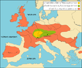
Celts he.PNG 719 × 600; 77 KB
-
Charleston Harbor 1861Heb.png 1,697 × 1,347; 283 KB
-
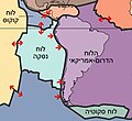
Chile 2010 tectonic2.JPG 248 × 227; 11 KB
-
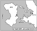
Chios201.jpg 371 × 314; 57 KB
-
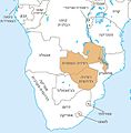
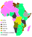
Colonial Africa 1914 map-he.png 296 × 341; 10 KB
-
Contre-attaque grecque heb.JPG 429 × 295; 24 KB
-
Crusade states in levant.PNG 291 × 504; 14 KB
-
Cyprus districts named he.PNG 630 × 420; 34 KB
-
Eastern Front 1942-11 to 1943-03 he.png 719 × 921; 212 KB
-
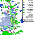
EastJerusalemMapHE.jpg 582 × 593; 228 KB
-
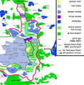
EastJerusalemMapHE1a.PNG 582 × 593; 369 KB
-
Empire almoravide-HE.PNG 1,000 × 1,220; 71 KB
-
Europe 1914-he.jpg 1,198 × 863; 325 KB
-
Fatimid Islamic Caliphate He.png 1,000 × 550; 115 KB
-
French India 1741-1754-HE.png 1,044 × 1,287; 214 KB
-
Independencewarmap.JPG 331 × 715; 31 KB
-
Italien och Illyrien 1084 heb.png 480 × 600; 102 KB
-
Jugurthine War.PNG 330 × 355; 12 KB
-
Kipros5.jpg 984 × 2,516; 1.31 MB
-
Korintin sodan osapuolet-HE.png 709 × 636; 186 KB
-
Louisiana Purchase Hebrew.jpg 1,280 × 900; 446 KB
-
Map of Ancient Rome 271 AD heb.png 2,050 × 1,213; 320 KB
-
Norman conquest 1066.JPG 761 × 754; 96 KB
-
Operation Gibor Hayil (Hebrew).png 1,424 × 1,032; 112 KB
-
Reame di Siagrio (486)-HE.png 1,440 × 1,344; 182 KB
-
The-British-Empire-he.jpg 2,753 × 1,400; 1.07 MB
-
אירופה בשנת 1618.png 2,500 × 1,790; 4.1 MB
-
אסיה הקטנה בשנת 89 לפנהס.png 791 × 625; 92 KB
-
הדרישות הטריטוריאליות של יוון בועידת פריז.png 828 × 418; 75 KB
-
החלוקה האתנית של בוסניה ב1991.png 1,000 × 1,047; 484 KB
-
מבצע קדש- מפה.jpg 250 × 310; 74 KB
-
מפת 11 הנקודות בנגב.jpg 700 × 592; 53 KB
-
מפת אימפריית צ'ינג בשנת 1820.png 1,610 × 1,175; 823 KB
-
מפת המושבות הראשונות.JPG 621 × 870; 131 KB
-
מפת הרפורמציה באירופה בין השנים 1545 - 1618.png 3,035 × 2,008; 1.19 MB
-
מפת הרפורמציה הפרוטסטנטית באירופה בין השנים 1545 - 1618.png 3,035 × 2,008; 1.18 MB
-
מפת התרחבות פרוסיה 1701 - 1871.png 1,800 × 1,444; 626 KB
-
מפת יוון המודרנית היסטוריה.PNG 300 × 321; 54 KB


