Category:Heage
Jump to navigation
Jump to search
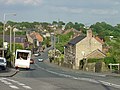
English: The village of Heage in Derbyshire is situated midway between Belper and Ripley and is today famous for its recently-restored six-sailed windmill. Work on building the mill started in 1791 and it was first recorded as working in 1797. The tower is built from local sandstone and after its recent renovation it is now back in working order.
village in United Kingdom  | |||||
| Upload media | |||||
| Instance of | |||||
|---|---|---|---|---|---|
| Location | Ripley, Amber Valley, Derbyshire, East Midlands, England | ||||
 | |||||
Subcategories
This category has the following 4 subcategories, out of 4 total.
H
- Heage Windmill (38 F)
L
- St Luke's church, Heage (6 F)
W
- The White Hart, Heage (2 F)
- The Windmill Inn, Heage (2 F)
Media in category "Heage"
The following 61 files are in this category, out of 61 total.
-
 4 Gunn Lane, Nether Heage.jpg 1,280 × 910; 363 KB
-

-
 Ambergate - Crossing the A610 - geograph.org.uk - 1191138.jpg 640 × 480; 63 KB
-
 Approaching Nether Heage - geograph.org.uk - 1201985.jpg 640 × 480; 92 KB
-
 Cottage Farm - geograph.org.uk - 1485121.jpg 640 × 479; 130 KB
-
 Derelict cottages - geograph.org.uk - 1485139.jpg 640 × 479; 101 KB
-
 Eagle Street - geograph.org.uk - 833805.jpg 640 × 480; 146 KB
-
 Eagle Tavern - geograph.org.uk - 1451110.jpg 640 × 479; 76 KB
-
 Farmland at Knob Farm - geograph.org.uk - 1485144.jpg 640 × 479; 72 KB
-
 Former Co-op store - geograph.org.uk - 1451114.jpg 479 × 640; 102 KB
-
 G R Wall Post Box - geograph.org.uk - 29749.jpg 427 × 640; 122 KB
-
 Heage - Black Boy Inn - geograph.org.uk - 1000090.jpg 640 × 480; 78 KB
-
 Heage - Bond Lane - geograph.org.uk - 1023823.jpg 640 × 480; 96 KB
-
 Heage - Bond Lane - geograph.org.uk - 1023836.jpg 640 × 480; 117 KB
-
 Heage - Bond Lane - geograph.org.uk - 1023848.jpg 640 × 480; 81 KB
-
 Heage - former Co-op shop - geograph.org.uk - 3485223.jpg 1,181 × 1,600; 532 KB
-
 Heage Bakers Hill 188804 d98b3600.jpg 640 × 480; 72 KB
-
 Heage Common Farm - geograph.org.uk - 3112421.jpg 1,024 × 768; 188 KB
-
 Heage Hall - geograph.org.uk - 11352.jpg 640 × 427; 131 KB
-
 Heage Methodist church and nearby houses - geograph.org.uk - 3112378.jpg 1,024 × 672; 186 KB
-
 Heage Primary School - geograph.org.uk - 3411970.jpg 640 × 476; 60 KB
-
 Houses on Ripley Road (B6374), Heage - geograph.org.uk - 4723760.jpg 640 × 480; 60 KB
-
 Kilburn Road, Openwoodgate - geograph.org.uk - 188787.jpg 640 × 480; 63 KB
-
 Knob Farm - geograph.org.uk - 1485132.jpg 640 × 479; 92 KB
-
 Knob Farm - geograph.org.uk - 1485137.jpg 640 × 479; 61 KB
-
 Lane to Pear Tree Farm - geograph.org.uk - 1023764.jpg 640 × 480; 129 KB
-
 Lodge at Buckland Hollow - geograph.org.uk - 1278368.jpg 640 × 479; 84 KB
-
 Main road through Heage - geograph.org.uk - 2046925.jpg 640 × 480; 67 KB
-
 Nether Heage - Brook Street View - geograph.org.uk - 736679.jpg 640 × 480; 66 KB
-
 Nether Heage - Dungley Hill View - geograph.org.uk - 736668.jpg 640 × 480; 71 KB
-
 Nether Heage recreation ground - geograph.org.uk - 833800.jpg 640 × 480; 137 KB
-
 Nettle Beds at Buckland Hollow - geograph.org.uk - 1023775.jpg 640 × 480; 105 KB
-
 Oranges and lemons - geograph.org.uk - 1451112.jpg 640 × 447; 172 KB
-
 Plumtree Cottage - geograph.org.uk - 1451107.jpg 640 × 479; 85 KB
-
 Postbox at Heage - geograph.org.uk - 841582.jpg 640 × 480; 101 KB
-
 Remedial work - geograph.org.uk - 833776.jpg 640 × 480; 217 KB
-
 Ripley Road - geograph.org.uk - 841589.jpg 640 × 480; 70 KB
-
 Ripley Road, Heage - geograph.org.uk - 1451106.jpg 640 × 474; 75 KB
-
 Rippling shadows - geograph.org.uk - 1451116.jpg 640 × 479; 103 KB
-
 Shop Lane - geograph.org.uk - 833729.jpg 640 × 480; 159 KB
-
 Stile in silhouette - geograph.org.uk - 1451121.jpg 479 × 640; 127 KB
-
 Stone footbridge - geograph.org.uk - 833754.jpg 505 × 640; 309 KB
-
 The Eagle, Heage - geograph.org.uk - 841580.jpg 640 × 480; 81 KB
-
 Valley of the Hartshay Brook - geograph.org.uk - 1450987.jpg 640 × 479; 108 KB
-
 A38 at Upper Hartshay - geograph.org.uk - 1451042.jpg 640 × 479; 106 KB
-
 Bales at Morley Park farm - geograph.org.uk - 1451092.jpg 640 × 480; 140 KB
-
 Bond Lane Farm - geograph.org.uk - 1451119.jpg 640 × 472; 84 KB
-
 Bridge over the A38 - geograph.org.uk - 1485158.jpg 640 × 479; 98 KB
-
 Bridge over the A38 - geograph.org.uk - 1485163.jpg 640 × 479; 111 KB
-
 Bridle Lane - geograph.org.uk - 1451027.jpg 640 × 472; 135 KB
-
 Bridle Lane - geograph.org.uk - 1451035.jpg 640 × 479; 122 KB
-
 Bridle Lane, Lower Hartshay - geograph.org.uk - 1451015.jpg 474 × 640; 141 KB
-
 Cattle trough - geograph.org.uk - 1485150.jpg 640 × 479; 81 KB
-
 Farmland west of Heage - geograph.org.uk - 232552.jpg 640 × 480; 97 KB
-
 Footpath at White Moor - geograph.org.uk - 232564.jpg 640 × 480; 131 KB
-
 Heage Village - geograph.org.uk - 674952.jpg 640 × 480; 78 KB
-
 Morley Close, Openwoodgate - geograph.org.uk - 188795.jpg 640 × 480; 86 KB
-
 Over Lane, Openwoodgate - geograph.org.uk - 188791.jpg 640 × 480; 70 KB
-
 Park Lane, Heage - geograph.org.uk - 188798.jpg 640 × 480; 109 KB
-
 Snowy footpath at Heage - geograph.org.uk - 674948.jpg 640 × 480; 103 KB
-
 Street Lane Methodists Church - geograph.org.uk - 11645.jpg 640 × 427; 90 KB


,_Heage_-_geograph.org.uk_-_4723760.jpg)


