Category:Harwood Forest
Jump to navigation
Jump to search
forest in Northumberland, England | |||||
| Upload media | |||||
| Instance of | |||||
|---|---|---|---|---|---|
| Location | Northumberland, North East England, England | ||||
| Area |
| ||||
 | |||||

Subcategories
This category has the following 2 subcategories, out of 2 total.
C
- Coquet Cairn (2 F)
F
- Fallowlees (6 F)
Media in category "Harwood Forest"
The following 71 files are in this category, out of 71 total.
-
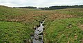
 Blanch Burn - geograph.org.uk - 825982.jpg 640 × 427; 128 KB
-
 Blanch Burn - geograph.org.uk - 826018.jpg 640 × 427; 133 KB
-
 Calves at Redpath Farm - geograph.org.uk - 1411541.jpg 640 × 480; 87 KB
-
 Clearing in Harwood Forest - geograph.org.uk - 541349.jpg 640 × 480; 69 KB
-
 Darden Rigg, Harwood Forest - geograph.org.uk - 541326.jpg 640 × 480; 79 KB
-
 Faerie Glen - geograph.org.uk - 23962.jpg 480 × 640; 170 KB
-
 Fallowlees Burn - geograph.org.uk - 1172660.jpg 640 × 480; 72 KB
-
 Fallowlees Burn - geograph.org.uk - 825883.jpg 640 × 335; 79 KB
-
 Fallowlees Burn - geograph.org.uk - 825899.jpg 640 × 356; 87 KB
-
 Flesh Law - geograph.org.uk - 826056.jpg 640 × 344; 86 KB
-

-

-
 Forest colours, Harwood Forest - geograph.org.uk - 541048.jpg 640 × 480; 95 KB
-
 Forestry Operations - geograph.org.uk - 826005.jpg 452 × 640; 112 KB
-
 Forestry road in Harwood Forest - geograph.org.uk - 528983.jpg 640 × 480; 87 KB
-
 Forestry road in Harwood Forest - geograph.org.uk - 529003.jpg 640 × 480; 118 KB
-
 From Weather Head - geograph.org.uk - 872545.jpg 640 × 427; 86 KB
-
 Gunner's Box - geograph.org.uk - 825744.jpg 640 × 427; 124 KB
-
 Gunner's Box - geograph.org.uk - 825750.jpg 640 × 427; 104 KB
-
 Harry's Wood - geograph.org.uk - 826222.jpg 640 × 427; 100 KB
-
 Harwood Forest - geograph.org.uk - 825837.jpg 640 × 427; 87 KB
-
 Harwood Forest - geograph.org.uk - 825860.jpg 640 × 427; 83 KB
-
 Harwood Forest - geograph.org.uk - 825867.jpg 427 × 640; 60 KB
-
 Harwood Forest - geograph.org.uk - 825870.jpg 640 × 427; 89 KB
-
 Harwood Forest - geograph.org.uk - 825891.jpg 640 × 427; 93 KB
-
 Harwood Forest - geograph.org.uk - 825905.jpg 640 × 427; 106 KB
-
 Harwood Forest - geograph.org.uk - 825925.jpg 640 × 427; 90 KB
-
 Harwood Forest - geograph.org.uk - 825938.jpg 640 × 390; 93 KB
-
 Harwood Forest - geograph.org.uk - 825964.jpg 427 × 640; 108 KB
-
 Harwood Forest - geograph.org.uk - 826033.jpg 411 × 640; 99 KB
-
 Harwood Forest - geograph.org.uk - 826062.jpg 640 × 427; 94 KB
-
 Harwood Forest - geograph.org.uk - 826097.jpg 640 × 427; 130 KB
-
 Harwood Forest - geograph.org.uk - 826116.jpg 640 × 427; 91 KB
-
 Harwood Forest - geograph.org.uk - 827107.jpg 640 × 427; 96 KB
-
 Harwood Forest. Steng Moss - geograph.org.uk - 5770.jpg 640 × 425; 89 KB
-
 Harwood Head - geograph.org.uk - 1549000.jpg 390 × 640; 89 KB
-

-
 Hemmel Hill, Harwood Forest - geograph.org.uk - 541352.jpg 640 × 480; 77 KB
-
 In Harwood Forest - geograph.org.uk - 872583.jpg 640 × 427; 95 KB
-
 In Harwood Forest - geograph.org.uk - 872587.jpg 427 × 640; 102 KB
-
 Into the forest - geograph.org.uk - 872581.jpg 640 × 427; 98 KB
-

-
 Mossy bog in Harwood Forest - geograph.org.uk - 1412770.jpg 640 × 480; 132 KB
-
 Near Weather Head - geograph.org.uk - 872539.jpg 640 × 427; 85 KB
-
 Newbiggin Burn - geograph.org.uk - 825953.jpg 640 × 427; 130 KB
-
 Newbiggin Burn - geograph.org.uk - 825992.jpg 640 × 427; 103 KB
-
 Off the forestry road - geograph.org.uk - 872543.jpg 427 × 640; 108 KB
-
 Old moorland near Weather Head - geograph.org.uk - 872571.jpg 427 × 640; 91 KB
-
 Old quarry at the Comb - geograph.org.uk - 1411582.jpg 640 × 480; 107 KB
-
 Ravens Heugh - geograph.org.uk - 733027.jpg 640 × 480; 55 KB
-
 Redpath - geograph.org.uk - 825857.jpg 640 × 330; 75 KB
-
 Redpath Farm - geograph.org.uk - 1411540.jpg 640 × 480; 65 KB
-
 Slopes of Tod Knowe, Harwood Forest - geograph.org.uk - 541319.jpg 640 × 480; 66 KB
-
 South-west corner of Harwood Forest - geograph.org.uk - 541041.jpg 640 × 480; 60 KB
-
 St Oswald's Way below Simonside - geograph.org.uk - 1412788.jpg 640 × 480; 83 KB
-
 St Oswald's Way below Simonside - geograph.org.uk - 1412792.jpg 640 × 480; 79 KB
-
 St Oswald's Way in Harwood Forest - geograph.org.uk - 1411545.jpg 640 × 480; 118 KB
-
 St Oswald's Way in Harwood Forest - geograph.org.uk - 1412773.jpg 640 × 480; 129 KB
-
 St Oswald's Way, north of Fallowlees - geograph.org.uk - 1411571.jpg 640 × 480; 128 KB
-

-
 Steng Cross - geograph.org.uk - 1549578.jpg 640 × 427; 140 KB
-
 Storm damage in Harwood Forest - geograph.org.uk - 529078.jpg 640 × 480; 158 KB
-
 Take your pick - geograph.org.uk - 872592.jpg 640 × 427; 103 KB
-

-
 The Comb - geograph.org.uk - 1412774.jpg 640 × 480; 109 KB
-
 The Comb - geograph.org.uk - 825999.jpg 640 × 346; 67 KB
-
 Tutehill Moss - geograph.org.uk - 825790.jpg 427 × 640; 65 KB
-
 Valley of the Fallowlees Burn - geograph.org.uk - 1411544.jpg 640 × 480; 94 KB
-
 Valley of the Fallowlees Burn - geograph.org.uk - 1411548.jpg 640 × 480; 106 KB
-
 Wind Monitoring Mast - geograph.org.uk - 825775.jpg 425 × 640; 41 KB
-
 Windblow in Harwood Forest - geograph.org.uk - 541494.jpg 640 × 480; 93 KB


