Category:Harwood, Greater Manchester
Jump to navigation
Jump to search
English: Harwood is a suburb to the north-northeast of Bolton, Greater Manchester, bordering Bury in North West England.
suburb in Bolton, Greater Manchester, UK | |||||
| Upload media | |||||
| Instance of | |||||
|---|---|---|---|---|---|
| Location | Bolton, Greater Manchester, North West England, England | ||||
 | |||||
Media in category "Harwood, Greater Manchester"
The following 200 files are in this category, out of 398 total.
(previous page) (next page)-
 "The Hill" in Harwood - geograph.org.uk - 4795034.jpg 1,280 × 960; 1.19 MB
-
 A bend in the road - geograph.org.uk - 5864476.jpg 1,024 × 768; 271 KB
-
 A choice of routes - geograph.org.uk - 1897261.jpg 3,872 × 2,499; 4.6 MB
-
 A Harwood cul - de -sac - geograph.org.uk - 2322387.jpg 4,000 × 3,000; 5.32 MB
-
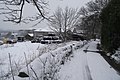
 A snowy day in Harwood - geograph.org.uk - 4850369.jpg 1,280 × 960; 1.22 MB
-
 A view from Arthur Lane - geograph.org.uk - 6644874.jpg 1,024 × 768; 825 KB
-
 A view of Cheetham Close - geograph.org.uk - 6766181.jpg 3,648 × 2,736; 5.66 MB
-
 A year in the life of two trees April 2014 (10) - geograph.org.uk - 6625685.jpg 1,600 × 1,328; 734 KB
-
 A year in the life of two trees August 2013 (2) - geograph.org.uk - 6625659.jpg 1,600 × 1,200; 567 KB
-
 A year in the life of two trees December 2013 (6) - geograph.org.uk - 6625673.jpg 1,600 × 1,414; 746 KB
-
 A year in the life of two trees February 2014 (8) - geograph.org.uk - 6625683.jpg 1,600 × 1,329; 717 KB
-

-
 A year in the life of two trees July 2013 (1) - geograph.org.uk - 6625656.jpg 1,600 × 1,200; 494 KB
-
 A year in the life of two trees June 2014 (12) - geograph.org.uk - 6625689.jpg 1,600 × 1,459; 593 KB
-
 A year in the life of two trees March 2014 (9) - geograph.org.uk - 6625684.jpg 1,600 × 1,347; 717 KB
-
 A year in the life of two trees May 2014 (11) - geograph.org.uk - 6625686.jpg 1,600 × 1,312; 650 KB
-
 A year in the life of two trees November 2013 (5) - geograph.org.uk - 6625671.jpg 1,600 × 1,330; 690 KB
-
 A year in the life of two trees October 2013 (4) - geograph.org.uk - 6625668.jpg 1,600 × 1,270; 555 KB
-
 A year in the life of two trees September 2013 (3) - geograph.org.uk - 6625663.jpg 1,600 × 1,058; 636 KB
-
 Abandoned farm machinery - geograph.org.uk - 3763164.jpg 1,024 × 767; 771 KB
-
 Access to the golf course - geograph.org.uk - 4680651.jpg 1,600 × 1,200; 905 KB
-
 After the storm - geograph.org.uk - 5533160.jpg 1,280 × 1,010; 821 KB
-
 An enthusiastic patriot - geograph.org.uk - 5822822.jpg 1,024 × 633; 176 KB
-
 And they're off - geograph.org.uk - 5856559.jpg 891 × 639; 552 KB
-
 Arthur Lane - geograph.org.uk - 6547095.jpg 1,513 × 1,031; 370 KB
-
 Arthur Lane, Harwood - geograph.org.uk - 3035484.jpg 800 × 600; 712 KB
-
 Ashdene Crescent in Bolton - geograph.org.uk - 6546057.jpg 1,024 × 756; 144 KB
-
 Autumnal shades on Hardy Mill Road - geograph.org.uk - 6651558.jpg 1,600 × 1,199; 473 KB
-
 Baci Bar ^ Restaurant - geograph.org.uk - 5903854.jpg 640 × 480; 56 KB
-
 Baci Italian Ristorante - geograph.org.uk - 2367784.jpg 2,990 × 2,159; 3.3 MB
-
 Baci Restaurant, Harwood - geograph.org.uk - 5816745.jpg 1,024 × 711; 213 KB
-
 Barn conversion at Asmus Farm - geograph.org.uk - 3367929.jpg 1,024 × 637; 581 KB
-
 Barn in Harwood - geograph.org.uk - 4328356.jpg 3,588 × 1,997; 4.87 MB
-
 Barn reconstruction at Asmus Farm - geograph.org.uk - 1897246.jpg 3,872 × 2,485; 3.21 MB
-
 Belmont View, Harwood - geograph.org.uk - 2367721.jpg 4,000 × 3,000; 6.28 MB
-
 Belmont View, Harwood - geograph.org.uk - 5172466.jpg 2,668 × 1,998; 2.26 MB
-
 Belmont View, Harwood, Bolton - geograph.org.uk - 2406930.jpg 4,000 × 3,000; 4.58 MB
-
 Bench in the park - geograph.org.uk - 6636826.jpg 1,024 × 768; 758 KB
-
 Big sky above "The Hill" - geograph.org.uk - 6638046.jpg 1,024 × 837; 432 KB
-
 Blackshaw Brook at Red Bridge - geograph.org.uk - 1707407.jpg 1,200 × 1,600; 1.25 MB
-
 Blue sky after rain - geograph.org.uk - 5533164.jpg 640 × 480; 71 KB
-
 Bolton from Harwood - geograph.org.uk - 4792999.jpg 1,280 × 639; 524 KB
-
 Bowling green - geograph.org.uk - 6808469.jpg 5,184 × 3,769; 4.57 MB
-
 Bowstone Hill - geograph.org.uk - 4788625.jpg 640 × 479; 41 KB
-
 Bowstone Hill Farm - geograph.org.uk - 1897232.jpg 3,872 × 2,499; 3.49 MB
-
 Bradshaw Brook, Longsight Park, Harwood - geograph.org.uk - 6514228.jpg 2,592 × 1,944; 1.1 MB
-
 Bradshaw Brook, Oakenbottom Bridge - geograph.org.uk - 6519132.jpg 5,504 × 3,096; 4 MB
-
 Bramhall Avenue - geograph.org.uk - 6648914.jpg 1,600 × 1,199; 276 KB
-
 Bramhall Avenue in Harwood - geograph.org.uk - 2407005.jpg 4,000 × 3,000; 5.25 MB
-
 Bramhall Avenue meets Hardy Mill Road - geograph.org.uk - 5451374.jpg 3,459 × 2,588; 5.05 MB
-
 Bramhall Avenue, Harwood - geograph.org.uk - 2791621.jpg 4,000 × 3,000; 5.33 MB
-
 Bramhall Avenue, Harwood - geograph.org.uk - 4738958.jpg 3,810 × 2,728; 4.04 MB
-
 Brookfold Farm on Brookfold Lane, Harwood - geograph.org.uk - 3304026.jpg 1,024 × 682; 607 KB
-
 Brookfold Farm, Harwood - geograph.org.uk - 118287.jpg 640 × 480; 118 KB
-
 Brookfold Farmhouse - geograph.org.uk - 2337010.jpg 2,362 × 1,702; 1.91 MB
-
 Brookfold Lane - geograph.org.uk - 5432376.jpg 1,280 × 960; 1.24 MB
-
 Brookfold Lane - geograph.org.uk - 5801186.jpg 1,024 × 768; 268 KB
-
 Brookfold Lane in the snow - geograph.org.uk - 3309355.jpg 1,024 × 682; 601 KB
-
 Brookfold Lane reaches Hardy Mill Road - geograph.org.uk - 1897282.jpg 3,872 × 2,480; 2.82 MB
-
 Brookfold Lane, Harwood - geograph.org.uk - 3304017.jpg 1,024 × 682; 623 KB
-
 Brookfold Lane, Harwood - geograph.org.uk - 3304022.jpg 1,024 × 682; 460 KB
-
 Brookfold Lane, Harwood - geograph.org.uk - 3304029.jpg 1,024 × 682; 620 KB
-
 Brookfold Lane, Harwood - geograph.org.uk - 3470928.jpg 1,024 × 682; 538 KB
-
 Brookfold Lane, Harwood - geograph.org.uk - 3763182.jpg 1,024 × 768; 660 KB
-
 Brookfold Lane, Harwood - geograph.org.uk - 4792997.jpg 898 × 1,280; 1.09 MB
-
 Brookfold Lane, Harwood - geograph.org.uk - 6028886.jpg 1,024 × 676; 122 KB
-
 Butcher's shop in Harwood - geograph.org.uk - 6808499.jpg 3,709 × 2,632; 2.84 MB
-
 Buttercup meadow - geograph.org.uk - 5432347.jpg 1,280 × 960; 1.3 MB
-
 Buttercups in Spring - geograph.org.uk - 5789717.jpg 1,280 × 960; 1.41 MB
-
 Castle Farm - geograph.org.uk - 5214707.jpg 1,280 × 960; 1.3 MB
-
 Castle Farm from Harwood - geograph.org.uk - 4795082.jpg 1,280 × 933; 1.26 MB
-
 Chale Green - geograph.org.uk - 6853999.jpg 1,600 × 977; 493 KB
-
 Cheetham Close from Harwood - geograph.org.uk - 4813915.jpg 3,266 × 2,445; 2.64 MB
-
 Christ Church Primary School, Harwood - geograph.org.uk - 118251.jpg 640 × 480; 143 KB
-
 Cottages in Harwood - geograph.org.uk - 3295514.jpg 1,024 × 527; 466 KB
-
 Cottages on Hardy Mill Road - geograph.org.uk - 2791577.jpg 3,920 × 2,361; 2.92 MB
-
 Cottages on Longsight - geograph.org.uk - 6808478.jpg 5,061 × 2,112; 2.07 MB
-
 Cottages on Stitch Mi Lane - geograph.org.uk - 6617325.jpg 1,024 × 768; 691 KB
-
 Cottages on Stitch-Mi-Lane, Harwood. - geograph.org.uk - 1848426.jpg 1,600 × 1,200; 361 KB
-
 Cows and horses together near Barrack Fold - geograph.org.uk - 3039694.jpg 3,872 × 2,592; 4.49 MB
-
 Davenport Fold Road - geograph.org.uk - 5216147.jpg 1,280 × 958; 764 KB
-
 Davenport Fold Road - geograph.org.uk - 6551843.jpg 1,600 × 1,072; 276 KB
-
 Davenport Fold Road in Harwood - geograph.org.uk - 3295507.jpg 1,024 × 682; 433 KB
-

-
 Disused quarry near The Height - geograph.org.uk - 2620458.jpg 3,592 × 2,598; 5.17 MB
-
 Division Stone Bolton - Turton boundary - geograph.org.uk - 3729550.jpg 609 × 474; 112 KB
-
 Dry Hillock - geograph.org.uk - 1848402.jpg 1,600 × 1,200; 633 KB
-
 Dry Hillock - geograph.org.uk - 1848408.jpg 1,600 × 1,200; 569 KB
-
 Dry stone wall near The Height - geograph.org.uk - 3367924.jpg 1,024 × 682; 555 KB
-
 Electricity pylon - geograph.org.uk - 5214716.jpg 1,280 × 960; 796 KB
-
 Farmland above Harwood - geograph.org.uk - 3367925.jpg 1,024 × 547; 476 KB
-
 Field in Harwood - geograph.org.uk - 5076578.jpg 2,668 × 1,998; 3.25 MB
-
 Field in Harwood - geograph.org.uk - 5537665.jpg 2,607 × 1,919; 3.46 MB
-
 Field off Arthur Lane - geograph.org.uk - 5864468.jpg 1,024 × 766; 285 KB
-
 Fields above Harwood - geograph.org.uk - 5076587.jpg 1,280 × 960; 878 KB
-
 Fields in Harwood - geograph.org.uk - 5486504.jpg 1,280 × 952; 1.07 MB
-
 Fields in Harwood - geograph.org.uk - 5486506.jpg 1,280 × 960; 1.08 MB
-
 Folly Brook - geograph.org.uk - 6638018.jpg 1,024 × 829; 1,022 KB
-
 Footpath above Harwood Quarry - geograph.org.uk - 3997532.jpg 768 × 1,024; 762 KB
-
 Footpath across a meadow - geograph.org.uk - 3367908.jpg 1,024 × 682; 551 KB
-
 Footpath at Longsight - geograph.org.uk - 3996880.jpg 869 × 1,024; 728 KB
-
 Footpath from Belmont View to Hough Fold Way - geograph.org.uk - 2367732.jpg 4,000 × 3,000; 6.29 MB
-
 Footpath in Harwood - geograph.org.uk - 2816774.jpg 3,263 × 2,255; 3.59 MB
-
 Footpath in Harwood - geograph.org.uk - 3470933.jpg 1,024 × 682; 533 KB
-
 Footpath in Harwood - geograph.org.uk - 5216149.jpg 1,280 × 960; 1.1 MB
-
 Footpath in Harwood - geograph.org.uk - 6644830.jpg 1,024 × 768; 950 KB
-
 Footpath off Stitch Mi Lane - geograph.org.uk - 2816772.jpg 4,000 × 3,000; 6.96 MB
-
 Footpath through a Spring meadow - geograph.org.uk - 5783235.jpg 5,184 × 3,888; 7.71 MB
-
 Footpath through the fields - geograph.org.uk - 3763169.jpg 1,024 × 768; 606 KB
-
 Footpath to Bowstone Hill - geograph.org.uk - 3367915.jpg 1,024 × 682; 640 KB
-
 Footpath to Brookfold Lane - geograph.org.uk - 2336980.jpg 4,000 × 3,000; 5.94 MB
-
 Footpath to Castle Farm - geograph.org.uk - 3367933.jpg 1,024 × 682; 600 KB
-
 Footpath to Old Holt's - geograph.org.uk - 3367904.jpg 4,000 × 2,664; 5.91 MB
-
 Footpath under a bedroom - geograph.org.uk - 2367740.jpg 4,000 × 3,000; 5.27 MB
-
 Free ranging hens - geograph.org.uk - 3997548.jpg 1,024 × 768; 686 KB
-
 Frost by Folly Brook - geograph.org.uk - 5237598.jpg 1,280 × 960; 1.29 MB
-
 Frosty hollow - geograph.org.uk - 5237591.jpg 1,280 × 960; 1.22 MB
-
 Gate on a footpath - geograph.org.uk - 4694821.jpg 1,024 × 768; 1.04 MB
-
 Gatepost, tree and wall - geograph.org.uk - 3295489.jpg 1,024 × 682; 581 KB
-
 Gateposts in the snow - geograph.org.uk - 4328336.jpg 4,000 × 3,000; 6.43 MB
-
 George V postbox on Longsight, Harwood - geograph.org.uk - 5904194.jpg 1,437 × 2,930; 792 KB
-
 Glowering sky over Harwood - geograph.org.uk - 6629470.jpg 1,024 × 768; 481 KB
-
 Grasses and trees - geograph.org.uk - 6868686.jpg 1,600 × 1,241; 942 KB
-
 Grasses in Longsight Park - geograph.org.uk - 6868695.jpg 1,600 × 1,099; 664 KB
-
 Grassland in Harwood - geograph.org.uk - 4794814.jpg 1,280 × 960; 812 KB
-
 Grassy field from Stitch Mi Lane - geograph.org.uk - 3039988.jpg 3,872 × 2,592; 4.77 MB
-
 Grassy footpath by the quarry - geograph.org.uk - 2337034.jpg 4,000 × 3,000; 6.86 MB
-
 Grazing near Springfield Farm - geograph.org.uk - 5903850.jpg 640 × 480; 74 KB
-
 Grazing off Harwood Road - geograph.org.uk - 5903847.jpg 640 × 480; 37 KB
-
 Greenwoods Lane - geograph.org.uk - 6640559.jpg 1,024 × 768; 1,007 KB
-
 Greenwoods Lane, Harwood - geograph.org.uk - 3304053.jpg 1,024 × 682; 596 KB
-
 Greenwoods Lane, Harwood - geograph.org.uk - 3812431.jpg 1,024 × 768; 653 KB
-
 Happy New Year^ - geograph.org.uk - 3796864.jpg 1,024 × 768; 280 KB
-
 Hardy Mill Quarry, Harwood - geograph.org.uk - 3304037.jpg 1,024 × 682; 470 KB
-
 Hardy Mill Road - geograph.org.uk - 5907561.jpg 1,024 × 791; 201 KB
-
 Hardy Mill Road - geograph.org.uk - 6028878.jpg 1,024 × 874; 208 KB
-
 Hardy Mill Road - geograph.org.uk - 6765081.jpg 3,412 × 1,933; 1.36 MB
-
 Hardy Mill Road at cherry blossom time - geograph.org.uk - 2367762.jpg 2,424 × 1,762; 2.17 MB
-
 Hardy Mill Road, Harwood - geograph.org.uk - 2791572.jpg 3,578 × 2,780; 3.87 MB
-
 Hardy Mill Road, Harwood - geograph.org.uk - 2791617.jpg 3,912 × 2,157; 3.66 MB
-
 Hardy Mill Road, Harwood - geograph.org.uk - 4262686.jpg 2,669 × 1,997; 2.77 MB
-
 Hardy Mill Road, Harwood - geograph.org.uk - 5172488.jpg 3,166 × 2,663; 4.46 MB
-
 Hardy Mill Road, Harwood - geograph.org.uk - 5172494.jpg 3,339 × 2,645; 5.23 MB
-
 Harwood - geograph.org.uk - 1848336.jpg 1,200 × 900; 487 KB
-
 Harwood - geograph.org.uk - 3035481.jpg 800 × 600; 728 KB
-
 Harwood field - geograph.org.uk - 3812437.jpg 1,024 × 768; 636 KB
-
 Harwood field - geograph.org.uk - 4813918.jpg 1,280 × 960; 1.18 MB
-
 Harwood Fields - geograph.org.uk - 3035473.jpg 800 × 601; 685 KB
-
 Harwood fields - geograph.org.uk - 4813911.jpg 3,267 × 2,445; 4.19 MB
-
 Harwood from "The Hill" - geograph.org.uk - 4792984.jpg 1,280 × 960; 1.19 MB
-
 Harwood Golf Course - geograph.org.uk - 3039878.jpg 3,872 × 2,592; 4.21 MB
-
 Harwood golf course - geograph.org.uk - 4795038.jpg 1,280 × 960; 1.31 MB
-
 Harwood golf course - geograph.org.uk - 4798862.jpg 4,000 × 3,000; 6.87 MB
-
 Harwood Golf Course - geograph.org.uk - 5216150.jpg 1,280 × 849; 1.3 MB
-
 Harwood Health Centre - geograph.org.uk - 2667907.jpg 3,687 × 1,997; 2.56 MB
-
 Harwood hedgerow - geograph.org.uk - 3812433.jpg 1,024 × 768; 591 KB
-
 Harwood House - geograph.org.uk - 1848342.jpg 1,200 × 900; 338 KB
-
 Harwood House - geograph.org.uk - 2816794.jpg 4,000 × 3,000; 5.79 MB
-
 Harwood in north Bolton - geograph.org.uk - 5177707.jpg 1,280 × 803; 607 KB
-
 Harwood Lodge - geograph.org.uk - 3295522.jpg 1,024 × 446; 288 KB
-
 Harwood Lodge - geograph.org.uk - 6670555.jpg 1,024 × 768; 909 KB
-
 Harwood Methodist Church - geograph.org.uk - 4679307.jpg 1,600 × 1,200; 487 KB
-
 Harwood Methodist Church - geograph.org.uk - 6808489.jpg 5,029 × 2,932; 2.54 MB
-
 Harwood Quarry - geograph.org.uk - 2337026.jpg 4,000 × 3,000; 6.16 MB
-
 Harwood Quarry - geograph.org.uk - 3997523.jpg 1,024 × 768; 515 KB
-
 Harwood quarry - geograph.org.uk - 5533168.jpg 1,280 × 958; 785 KB
-
 Harwood Quarry - geograph.org.uk - 6766186.jpg 2,434 × 1,824; 3.03 MB
-
 Harwood Road - geograph.org.uk - 5903849.jpg 640 × 480; 83 KB
-
 Harwood standing stone - geograph.org.uk - 2816781.jpg 4,000 × 1,990; 3.72 MB
-
 Hay field and trees in Harwood - geograph.org.uk - 4694808.jpg 3,882 × 2,445; 6.13 MB
-
 Haymaking in Harwood - geograph.org.uk - 5821460.jpg 1,024 × 768; 316 KB
-
 Heatons Farmhouse - geograph.org.uk - 5822826.jpg 1,024 × 767; 306 KB
-
 Hedgerow in Harwood - geograph.org.uk - 5214722.jpg 1,280 × 960; 1.37 MB
-
 Higher Bury Meadows - geograph.org.uk - 3763155.jpg 1,024 × 768; 454 KB
-
 Hill End Farm - geograph.org.uk - 119399.jpg 640 × 480; 96 KB
-
 Hill Farm - geograph.org.uk - 2337073.jpg 2,478 × 1,793; 2.66 MB
-
 Horse and tree - geograph.org.uk - 5237612.jpg 1,280 × 960; 1.29 MB
-
 Horse at a fence - geograph.org.uk - 5432372.jpg 1,280 × 960; 989 KB
-
 Horse in a field - geograph.org.uk - 4694829.jpg 1,024 × 768; 926 KB
-
 Horses in Harwood - geograph.org.uk - 4792980.jpg 1,280 × 958; 1.42 MB
-
 Horses in Harwood - geograph.org.uk - 6779994.jpg 1,465 × 1,077; 1.34 MB
-
 Horses on the hill - geograph.org.uk - 5076573.jpg 1,280 × 794; 950 KB
-
 Hough Fold Way - geograph.org.uk - 6546088.jpg 1,024 × 780; 141 KB
-
 Hough Fold Way, Harwood - geograph.org.uk - 4813914.jpg 1,280 × 958; 896 KB
-
 House on "The Hill" - geograph.org.uk - 3696253.jpg 4,000 × 3,000; 4.61 MB
-
 House Without A Name - geograph.org.uk - 1864375.jpg 1,200 × 900; 287 KB
-
 House without a Name, Harwood - geograph.org.uk - 2667927.jpg 2,820 × 2,317; 2.96 MB
-
 House Without A Name, Harwood - geograph.org.uk - 5277159.jpg 3,458 × 2,589; 5.61 MB
-
 Houses in Harwood - geograph.org.uk - 4798872.jpg 4,000 × 3,000; 5.9 MB
-
 Houses on Hardy Mill Road, Harwood - geograph.org.uk - 5903856.jpg 640 × 480; 62 KB
-
 Houses on Longsight, Harwood - geograph.org.uk - 5903863.jpg 640 × 480; 54 KB
-
 Hoyle's Fold - geograph.org.uk - 1864424.jpg 1,600 × 1,200; 459 KB
-
 Hoyles Fold Farm - geograph.org.uk - 119389.jpg 640 × 480; 100 KB
-
 Ingleton Close - geograph.org.uk - 6861912.jpg 1,600 × 988; 263 KB
-
 Just a - walkin' the dog - geograph.org.uk - 4850361.jpg 1,280 × 960; 1.02 MB
-
 Kayfields, Harwood - geograph.org.uk - 5486502.jpg 1,280 × 1,022; 939 KB
-
 King Street, Harwood - geograph.org.uk - 6643749.jpg 1,024 × 768; 615 KB
-
 Land off Arthur Lane, Harwood - geograph.org.uk - 4798868.jpg 4,000 × 3,000; 6.79 MB
-
 Lea Gate, Harwood - geograph.org.uk - 2791603.jpg 3,083 × 2,427; 2.72 MB
-
 Leafless trees on "The Hill" - geograph.org.uk - 3777037.jpg 1,024 × 768; 606 KB


_-_geograph.org.uk_-_6625685.jpg)
_-_geograph.org.uk_-_6625659.jpg)
_-_geograph.org.uk_-_6625673.jpg)
_-_geograph.org.uk_-_6625683.jpg)
_-_geograph.org.uk_-_6625679.jpg)
_-_geograph.org.uk_-_6625656.jpg)
_-_geograph.org.uk_-_6625689.jpg)
_-_geograph.org.uk_-_6625684.jpg)
_-_geograph.org.uk_-_6625686.jpg)
_-_geograph.org.uk_-_6625671.jpg)
_-_geograph.org.uk_-_6625668.jpg)
_-_geograph.org.uk_-_6625663.jpg)


