Category:Hartshill
Jump to navigation
Jump to search
village and civil parish in Warwickshire, United Kingdom  Adfeilion Castell Hartshill | |||||
| Upload media | |||||
| Instance of | |||||
|---|---|---|---|---|---|
| Location | North Warwickshire, Warwickshire, West Midlands, England | ||||
| Population |
| ||||
| Area |
| ||||
 | |||||
Subcategories
This category has the following 3 subcategories, out of 3 total.
H
- Hartshill Castle (15 F)
- Hartshill Hayes Country Park (14 F)
Media in category "Hartshill"
The following 184 files are in this category, out of 184 total.
-
 A snowy field near Caldecote - geograph.org.uk - 2226436.jpg 640 × 430; 118 KB
-
 A5 at Hawksmoor Kennels - geograph.org.uk - 4876099.jpg 640 × 480; 77 KB
-
 Abandoned earring fake jewel.jpg 3,472 × 4,624; 6.62 MB
-
 Apple Pie Lane bridge - geograph.org.uk - 5180478.jpg 5,184 × 3,456; 5.68 MB
-
 Atherstone sewage works (1) - geograph.org.uk - 4199876.jpg 1,024 × 768; 131 KB
-
 Atherstone sewage works (2) - geograph.org.uk - 4199878.jpg 1,024 × 768; 112 KB
-
 Atherstone Sewage Works - geograph.org.uk - 4902512.jpg 640 × 384; 52 KB
-
 Atherstone Sewage Works - geograph.org.uk - 6489229.jpg 1,024 × 681; 96 KB
-
 Atherstone Sewage Works - geograph.org.uk - 6511668.jpg 1,024 × 681; 109 KB
-
 Atherstone Sewage Works - geograph.org.uk - 6726059.jpg 1,024 × 473; 72 KB
-
 Bean crop near Hartshill, Warwickshire - geograph.org.uk - 2139260.jpg 480 × 640; 156 KB
-
 Bean field near Hartshill, Warwickshire - geograph.org.uk - 2139205.jpg 800 × 588; 279 KB
-
 Bean field near Hartshill, Warwickshire - geograph.org.uk - 2139351.jpg 640 × 470; 141 KB
-
 Bean field near Hartshill, Warwickshire - geograph.org.uk - 2139358.jpg 800 × 508; 238 KB
-
 Bridge 30 Coventry Canal - geograph.org.uk - 3845274.jpg 2,000 × 1,500; 708 KB
-
 Bridge 30, Coventry Canal - geograph.org.uk - 3844605.jpg 2,000 × 1,331; 835 KB
-
 Bridge 31 Coventry Canal - geograph.org.uk - 3845176.jpg 2,000 × 1,501; 752 KB
-
 Bridge 31 Coventry Canal - geograph.org.uk - 3845234.jpg 2,000 × 1,395; 720 KB
-
 Bridge 32 Coventry Canal - geograph.org.uk - 3845203.jpg 2,000 × 1,333; 868 KB
-
 Bridge Cottage, Apple Pie Lane, Hartshill - geograph.org.uk - 3813368.jpg 3,820 × 2,845; 2.31 MB
-

-
-
 British Waterways Yard - geograph.org.uk - 3500.jpg 640 × 480; 54 KB
-
 British Waterways' Hartshill Yard - geograph.org.uk - 1977638.jpg 640 × 480; 81 KB
-
-
 Canal maintenance depot - Hartshill - geograph.org.uk - 5971257.jpg 640 × 480; 74 KB
-
 Canal Maintenance Depot, Atherstone Road, Hartshill - geograph.org.uk - 3813374.jpg 3,509 × 2,620; 2.28 MB
-

-
 Coleshill Road, Chapel End - geograph.org.uk - 3355059.jpg 1,024 × 768; 157 KB
-
 Country lane - geograph.org.uk - 5281088.jpg 2,322 × 4,128; 2.79 MB
-
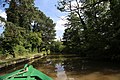
 Coventry Canal - canoeist - geograph.org.uk - 5973355.jpg 640 × 480; 79 KB
-
 Coventry Canal - geograph.org.uk - 33746.jpg 427 × 640; 89 KB
-
 Coventry Canal - geograph.org.uk - 3845327.jpg 2,000 × 1,500; 740 KB
-

-

-

-

-

-
-
-
-

-

-
-

-

-

-

-
 Coventry Canal, Hartshill - geograph.org.uk - 104020.jpg 640 × 480; 127 KB
-
 Coventry Canal, Hartshill - geograph.org.uk - 5971256.jpg 640 × 480; 125 KB
-

-

-

-
 Coventry Canal, Reach near Hartshill - geograph.org.uk - 3145028.jpg 640 × 480; 95 KB
-
 Cyclists on the towpath, Coventry Canal - geograph.org.uk - 5047651.jpg 640 × 427; 109 KB
-
 De Mulder ^ Sons Ltd - geograph.org.uk - 3845301.jpg 2,000 × 1,500; 743 KB
-

-

-
 Duckweed, Coventry Canal, 1975 - geograph.org.uk - 2716230.jpg 428 × 640; 123 KB
-
 Farm track through ripening barley - geograph.org.uk - 484962.jpg 640 × 484; 311 KB
-
 Farmland at the foot of the Penyard - geograph.org.uk - 484959.jpg 640 × 480; 340 KB
-
 Farmland by the West Coast Main Line - geograph.org.uk - 3652395.jpg 640 × 462; 46 KB
-
 Farmland in Hope Mansell - geograph.org.uk - 603729.jpg 640 × 484; 131 KB
-
 Farmland in the Anker Valley - geograph.org.uk - 4335303.jpg 640 × 515; 48 KB
-
 Farmland in the Anker Valley - geograph.org.uk - 4363166.jpg 640 × 430; 41 KB
-
 Farmland near Caldecot - geograph.org.uk - 4761440.jpg 640 × 426; 48 KB
-
 Farmland near Caldecote - geograph.org.uk - 2838255.jpg 640 × 430; 31 KB
-
-
 Fields east of Grange Road - geograph.org.uk - 3845429.jpg 2,000 × 1,500; 671 KB
-
 Flowers next to White House Bridge No 28 - geograph.org.uk - 4832311.jpg 800 × 581; 195 KB
-
-
 Grange Road - geograph.org.uk - 3845315.jpg 2,000 × 1,500; 698 KB
-
 Grange Road Bridge No 30 - geograph.org.uk - 4832478.jpg 800 × 594; 180 KB
-

-

-
-
-

-
 Hartshill boatyard - geograph.org.uk - 5180463.jpg 5,184 × 3,456; 5.33 MB
-
 Hartshill CV10, UK - panoramio (1).jpg 5,472 × 3,648; 7.92 MB
-
 Hartshill CV10, UK - panoramio (2).jpg 5,472 × 3,648; 8.42 MB
-
 Hartshill CV10, UK - panoramio (3).jpg 5,472 × 3,648; 8.01 MB
-
 Hartshill CV10, UK - panoramio (4).jpg 5,472 × 3,648; 10.61 MB
-
 Hartshill CV10, UK - panoramio (5).jpg 5,472 × 3,648; 7.11 MB
-
 Hartshill CV10, UK - panoramio.jpg 5,472 × 3,648; 9.18 MB
-
 Hartshill moorings Coventry Canal - geograph.org.uk - 3845241.jpg 2,000 × 1,443; 707 KB
-

-
 Hartshill Quarry (disused) - geograph.org.uk - 4910016.jpg 3,360 × 624; 779 KB
-
 Hartshill Sewage Treatment Works - geograph.org.uk - 2226426.jpg 640 × 430; 106 KB
-
 Hartshill Sewage Treatment Works - geograph.org.uk - 2838250.jpg 640 × 341; 33 KB
-
 Hartshill Sewage Treatment Works - geograph.org.uk - 2838252.jpg 640 × 342; 44 KB
-
 Hartshill Sewage Treatment Works - geograph.org.uk - 3652399.jpg 640 × 348; 42 KB
-
 Hartshill Sewage Treatment Works - geograph.org.uk - 3733931.jpg 640 × 430; 37 KB
-
 Hartshill Sewage Treatment Works 2 - geograph.org.uk - 2226429.jpg 640 × 430; 117 KB
-
 Hartshill Sewage Treatment Works 3 - geograph.org.uk - 2226430.jpg 640 × 392; 87 KB
-

-
 Hartshill Yard Coventry Canal - geograph.org.uk - 3845189.jpg 2,000 × 1,348; 869 KB
-

-
-
 Jees granite quarry workings and railway, Hartshill.jpg 794 × 504; 149 KB
-
 Junction on B4111 Nuneaton Road - geograph.org.uk - 3845438.jpg 2,000 × 1,333; 662 KB
-
 Low bridge - geograph.org.uk - 3844571.jpg 1,500 × 2,000; 751 KB
-
 Low bridge - geograph.org.uk - 3846196.jpg 2,000 × 1,305; 647 KB
-
 Mancetter, UK - panoramio.jpg 5,472 × 3,648; 7.11 MB
-

-

-
 Narrowboat near Anchor Bridge No 29 - geograph.org.uk - 4832468.jpg 800 × 600; 165 KB
-
 Old Toll House at Hartshill - geograph.org.uk - 1492380.jpg 640 × 427; 90 KB
-
 Overflow along the Coventry Canal - geograph.org.uk - 4832361.jpg 789 × 800; 189 KB
-
 Part of Hartshill Hayes Country Park - geograph.org.uk - 1582737.jpg 640 × 480; 57 KB
-
 Pig farming, Stancombe Down - geograph.org.uk - 228674.jpg 640 × 480; 150 KB
-

-
-

-

-

-
 Quarryman Plaque - geograph.org.uk - 1492344.jpg 386 × 640; 90 KB
-
 Railway Bridge - geograph.org.uk - 1416068.jpg 640 × 480; 62 KB
-
 Railway electrification gantry near Hartshill, Warwickshire - geograph.org.uk - 1928490.jpg 1,440 × 1,071; 1.76 MB
-
-
 Railway near Hartshill, Warwickshire - geograph.org.uk - 1953896.jpg 800 × 522; 285 KB
-
 Railway near Hartshill, Warwickshire - geograph.org.uk - 2139155.jpg 640 × 640; 187 KB
-
 Railway near Hartshill, Warwickshire - geograph.org.uk - 2139172.jpg 800 × 560; 289 KB
-
 Railway near Hartshill, Warwickshire - geograph.org.uk - 2139175.jpg 800 × 513; 241 KB
-

-
 Rural crossroad - geograph.org.uk - 5281109.jpg 4,128 × 2,322; 5.87 MB
-
 Sewage Works - geograph.org.uk - 3856465.jpg 640 × 361; 39 KB
-
 Sewage Works - geograph.org.uk - 3856469.jpg 640 × 430; 50 KB
-
 Solar panels, Atherstone Sewage Works - geograph.org.uk - 6511669.jpg 1,024 × 681; 127 KB
-
 Solar panels, Atherstone Sewage Works - geograph.org.uk - 6726060.jpg 1,024 × 684; 101 KB
-
 South end of Victoria Road, Hartshill - geograph.org.uk - 3355056.jpg 1,024 × 768; 142 KB
-
 St Lawrence's Wood - geograph.org.uk - 4211639.jpg 1,280 × 851; 468 KB
-
 Steam engine, Bill Mill - geograph.org.uk - 703236.jpg 640 × 425; 94 KB
-
 Stuck on the Mud^ - geograph.org.uk - 2118735.jpg 640 × 427; 128 KB
-
 Tea under the tree - geograph.org.uk - 6680346.jpg 640 × 480; 67 KB
-
 The A5 Watling Street - geograph.org.uk - 3837319.jpg 3,931 × 2,746; 4.74 MB
-
 The Anchor Inn at Hartshill - geograph.org.uk - 5973351.jpg 640 × 480; 71 KB
-
 The Coventry Canal near Hartshill - geograph.org.uk - 4832460.jpg 800 × 527; 143 KB
-
 The Coventry Canal near Hartshill Green - geograph.org.uk - 4833775.jpg 800 × 496; 106 KB
-
 The entrance to Glebe Farm, Fenny Drayton - geograph.org.uk - 6645781.jpg 1,910 × 1,266; 1.35 MB
-
 The Stag and Pheasant - geograph.org.uk - 5281069.jpg 4,128 × 2,322; 4.07 MB
-
 Trees and hedge - geograph.org.uk - 5704396.jpg 640 × 426; 38 KB
-
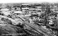
 Trent Valley Line, Nuneaton, Jee's Siding, Hartshill (Sept. 1921).jpg 1,200 × 587; 118 KB
-
 View from a Rugby-Crewe train - Atherstone Sewage Works - geograph.org.uk - 5819017.jpg 1,600 × 1,200; 397 KB
-
 Warwickshire CC - what a transformation - geograph.org.uk - 4915786.jpg 4,128 × 2,322; 4.55 MB
-
 Watling Street, Fenny Drayton - geograph.org.uk - 6645782.jpg 1,920 × 1,280; 932 KB
-
 West Coast Main Line - geograph.org.uk - 3845447.jpg 2,000 × 1,327; 778 KB
-
 West Coast Main Line - geograph.org.uk - 3845460.jpg 2,000 × 1,333; 696 KB
-
 White House Bridge No 28 - geograph.org.uk - 4832307.jpg 800 × 557; 139 KB
-
 Arable farmland on the Lambourn Downs - geograph.org.uk - 314010.jpg 640 × 480; 126 KB
-
 Arable farmland on the Lambourn Downs - geograph.org.uk - 314014.jpg 640 × 480; 118 KB
-
 Bockhampton Down - geograph.org.uk - 228679.jpg 640 × 480; 98 KB
-
 Buildings near Greendown Farm - geograph.org.uk - 67275.jpg 640 × 480; 104 KB
-
 Byway near Postdown Farm - geograph.org.uk - 312980.jpg 640 × 480; 136 KB
-
 Byway sign near Westcot Down, Oxfordshire - geograph.org.uk - 362101.jpg 640 × 480; 118 KB
-
 Byway, Stancombe Down - geograph.org.uk - 228675.jpg 640 × 480; 191 KB
-
 Crow Down - geograph.org.uk - 313988.jpg 640 × 480; 158 KB
-
 East Garston Down - geograph.org.uk - 228695.jpg 640 × 480; 139 KB
-
 Eastbury Bottom - geograph.org.uk - 228666.jpg 640 × 480; 173 KB
-
 Eastbury Down - geograph.org.uk - 228694.jpg 640 × 480; 152 KB
-
 Ewe Hill - geograph.org.uk - 228682.jpg 640 × 480; 110 KB
-
 Ewe Hill trig point - geograph.org.uk - 228683.jpg 640 × 480; 162 KB
-
 Farm Buildings near 'East Ditch' - geograph.org.uk - 67264.jpg 640 × 480; 94 KB
-
 Foxbury Bottom - geograph.org.uk - 312964.jpg 640 × 480; 110 KB
-
 Gallops on the Ridgeway. - geograph.org.uk - 67226.jpg 640 × 480; 111 KB
-
 Gallops, Faringdon Road Down - geograph.org.uk - 312955.jpg 640 × 480; 122 KB
-
 Harvesting near Sheepdrove - geograph.org.uk - 228681.jpg 640 × 480; 95 KB
-
 Lane at Sheepdrove - geograph.org.uk - 228685.jpg 480 × 640; 137 KB
-
 Moss Hill - geograph.org.uk - 57281.jpg 640 × 480; 140 KB
-
 Nut Wood - geograph.org.uk - 67248.jpg 640 × 480; 104 KB
-
 Old Warren near Seven Barrows - geograph.org.uk - 57284.jpg 640 × 480; 130 KB
-
 Post Down - geograph.org.uk - 314001.jpg 640 × 480; 144 KB
-
 Reservoir near Sheepdrove Farm - geograph.org.uk - 67257.jpg 640 × 480; 102 KB
-
 Scary Hill - geograph.org.uk - 57295.jpg 640 × 480; 138 KB
-
 Sevenbarrows House near Lambourne - geograph.org.uk - 57285.jpg 640 × 480; 167 KB
-
 Sheepdrove Farmhouse - geograph.org.uk - 67266.jpg 640 × 480; 192 KB
-
 Stancombe Farm - geograph.org.uk - 67251.jpg 640 × 480; 94 KB
-
 The B4001 - geograph.org.uk - 312944.jpg 640 × 480; 120 KB
-
 Trabb's Farm - geograph.org.uk - 314005.jpg 640 × 480; 129 KB
-
 Tumulus - geograph.org.uk - 57290.jpg 640 × 480; 141 KB
-
 Warren Down - geograph.org.uk - 228668.jpg 640 × 480; 148 KB
-
 Warren Down - geograph.org.uk - 228671.jpg 640 × 480; 178 KB
-
 Warren Down - geograph.org.uk - 228672.jpg 640 × 480; 134 KB
-
 Wormhill Bottom - geograph.org.uk - 313990.jpg 640 × 480; 154 KB


_-_geograph.org.uk_-_4199876.jpg)
_-_geograph.org.uk_-_4199878.jpg)


.jpg)
.jpg)
.jpg)
.jpg)
.jpg)


.jpg)


_-_geograph.org.uk_-_4910016.jpg)