Category:Hartshead Moor Top
Jump to navigation
Jump to search
village in United Kingdom | |||||
| Upload media | |||||
| Instance of | |||||
|---|---|---|---|---|---|
| Location | Kirklees, West Yorkshire, Yorkshire and the Humber, England | ||||
 | |||||
English: Hartshead Moor Top was part of Clifton (now in Calderdale), but was transferred to Spenborough Urban District in 1937 and is thus now in Kirklees District.
Media in category "Hartshead Moor Top"
The following 12 files are in this category, out of 12 total.
-
Farmland Near Hartshead Moor Top - geograph.org.uk - 921882.jpg 640 × 480; 152 KB
-
Hartshead Moor Services (M62 Westbound) - geograph.org.uk - 3595877.jpg 3,968 × 2,232; 4.91 MB
-
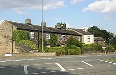
Houses along Halifax Road, Clifton - geograph.org.uk - 216493.jpg 640 × 415; 82 KB
-
M62 Eastbound - geograph.org.uk - 1324253.jpg 640 × 480; 40 KB
-
Manor Street - Scholes Lane - geograph.org.uk - 1311845.jpg 640 × 480; 248 KB
-
Scholes Lane - Halifax Road - geograph.org.uk - 1311851.jpg 640 × 480; 244 KB
-
Stafford Arms - Scholes Lane - geograph.org.uk - 1311848.jpg 640 × 439; 179 KB
-
Stafford Arms, Hartshead Moor Top (13435544463).jpg 3,079 × 2,332; 4.77 MB
-
View towards Hartshead Moor Top from Pits Lane - geograph.org.uk - 6434716.jpg 2,000 × 788; 1.69 MB
-
Walton Lane - Halifax Road - geograph.org.uk - 1311855.jpg 640 × 480; 219 KB


