Category:Harby, Nottinghamshire
Jump to navigation
Jump to search
English: Harby is a village in the English county of Nottinghamshire. The nearest large town is Lincoln over the border in Lincolnshire. According to the 2001 census it had a population of 289 . The parish church of All Saints was built in 1875-76 in Early English style. In the east wall of the tower is a statue to Eleanor of Castile who died in 1290 at the nearby house of Richard de Weston. The moated site of Weston's house is to the east of the church. The capless stump of a five-storey tower windmill, built c. 1877, stands at the end of Mill Field Close . A post windmill is also recorded for Harby.
village and civil parish in Nottinghamshire, UK  | |||||
| Upload media | |||||
| Instance of | |||||
|---|---|---|---|---|---|
| Location |
| ||||
| Population |
| ||||
| Said to be the same as | Harby (Wikimedia duplicated page, civil parish) | ||||
 | |||||
Subcategories
This category has the following 13 subcategories, out of 13 total.
A
B
E
H
- Hedges in Harby, Nottinghamshire (17 F)
J
- Jowett's Wood (12 F)
S
- Snow in Harby, Nottinghamshire (43 F)
T
- Trees in Harby, Nottinghamshire (12 F)
Media in category "Harby, Nottinghamshire"
The following 200 files are in this category, out of 499 total.
(previous page) (next page)-
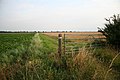
 7 miles left on Cycle Route 64 to Lincoln - geograph.org.uk - 2392036.jpg 4,000 × 3,000; 2.94 MB
-
 A pheasant in the snow - geograph.org.uk - 1653402.jpg 640 × 426; 97 KB
-
 A session in the local - geograph.org.uk - 2504407.jpg 640 × 427; 92 KB
-
 A view of Carr Farm - geograph.org.uk - 6060660.jpg 3,729 × 5,029; 5.92 MB
-
 Across the border - geograph.org.uk - 1091008.jpg 640 × 427; 82 KB
-
 AEC Regal Bus - geograph.org.uk - 3528142.jpg 640 × 427; 92 KB
-
 After the harvest - geograph.org.uk - 567549.jpg 640 × 427; 87 KB
-
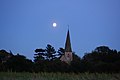
 All Saints' church - geograph.org.uk - 5591991.jpg 1,024 × 683; 98 KB
-
 All Saints' church - geograph.org.uk - 6709541.jpg 1,024 × 683; 197 KB
-
 Allotment Field - geograph.org.uk - 2932276.jpg 640 × 427; 157 KB
-
 Allotment Field - geograph.org.uk - 3279296.jpg 640 × 427; 113 KB
-
 Allotment inferno - geograph.org.uk - 711223.jpg 640 × 427; 68 KB
-
 Allotment shed - geograph.org.uk - 3543440.jpg 640 × 427; 132 KB
-
 Angel - geograph.org.uk - 298372.jpg 640 × 427; 75 KB
-
 Arachnid nursery - geograph.org.uk - 1860614.jpg 640 × 427; 168 KB
-
 Autumn on route 647 - geograph.org.uk - 4728490.jpg 1,024 × 768; 307 KB
-
 Barley field - geograph.org.uk - 4525467.jpg 1,024 × 683; 283 KB
-
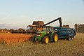
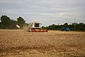
 Barley harvest - geograph.org.uk - 4600472.jpg 1,024 × 683; 206 KB
-
 Barley harvest - geograph.org.uk - 4600477.jpg 1,024 × 683; 287 KB
-
 Barley harvest - geograph.org.uk - 4600486.jpg 1,024 × 683; 187 KB
-
 Barley harvest - geograph.org.uk - 4600494.jpg 1,024 × 683; 177 KB
-
 Barley harvest - geograph.org.uk - 4600500.jpg 1,024 × 683; 244 KB
-
 Barley harvest - geograph.org.uk - 6721681.jpg 1,024 × 683; 208 KB
-
 Barley harvest - geograph.org.uk - 6721683.jpg 1,024 × 683; 211 KB
-
 Barley harvest - geograph.org.uk - 6721801.jpg 1,024 × 683; 239 KB
-
 Barley harvest - geograph.org.uk - 6721808.jpg 1,024 × 683; 227 KB
-
 Behind the camera - geograph.org.uk - 4165531.jpg 683 × 1,024; 160 KB
-
 Bench mark on Harby Station bridge - geograph.org.uk - 3073244.jpg 1,280 × 960; 371 KB
-
 Best in Show - geograph.org.uk - 4165572.jpg 1,024 × 683; 188 KB
-
 Black clouds over Harby - geograph.org.uk - 3996033.jpg 1,024 × 768; 234 KB
-
 Black House Field - geograph.org.uk - 4773526.jpg 1,024 × 683; 265 KB
-
 Black House Field - geograph.org.uk - 4879931.jpg 1,024 × 683; 186 KB
-
 Black House Field - geograph.org.uk - 5234239.jpg 1,024 × 676; 373 KB
-
 Black o'er Jack's house - geograph.org.uk - 3044375.jpg 640 × 427; 109 KB
-
 Black o'er Jack's house - geograph.org.uk - 788129.jpg 640 × 427; 40 KB
-
 Black o'er Trev's Farm - geograph.org.uk - 4079710.jpg 1,024 × 683; 79 KB
-
 Blacksmith Cottage, Harby - geograph.org.uk - 6060651.jpg 4,978 × 3,646; 3.84 MB
-
 Blacksmith's Cottage - geograph.org.uk - 3073254.jpg 1,280 × 960; 191 KB
-
 Blacksmith's Cottage - geograph.org.uk - 3311628.jpg 640 × 427; 92 KB
-
 Bonfire night - geograph.org.uk - 5591624.jpg 1,024 × 677; 156 KB
-
 Bonfire night - geograph.org.uk - 5591994.jpg 1,024 × 676; 211 KB
-
 Bonfire night - geograph.org.uk - 5591996.jpg 1,024 × 683; 299 KB
-
 Bottle and Glass pub, Harby - geograph.org.uk - 3653462.jpg 640 × 480; 50 KB
-
 Boxing Day walk - geograph.org.uk - 2211705.jpg 640 × 427; 79 KB
-
 Bracket fungus - geograph.org.uk - 4778967.jpg 1,024 × 683; 241 KB
-
 Bullrushes - geograph.org.uk - 896887.jpg 640 × 427; 91 KB
-
 Camper van - geograph.org.uk - 2539324.jpg 640 × 426; 75 KB
-
 Carr Lane (B1190) - geograph.org.uk - 3653478.jpg 640 × 480; 78 KB
-
 Charity allotments - geograph.org.uk - 3270804.jpg 640 × 427; 116 KB
-
 Charity Allotments - geograph.org.uk - 4290419.jpg 1,024 × 683; 230 KB
-
 Charity allotments - geograph.org.uk - 630025.jpg 640 × 427; 89 KB
-
 Charity Allotments - geograph.org.uk - 94712.jpg 640 × 480; 115 KB
-
 Charity Allotments and Jowett's Wood - geograph.org.uk - 94714.jpg 640 × 480; 167 KB
-
 Cheeky squirrel - geograph.org.uk - 5181186.jpg 1,024 × 683; 234 KB
-
 Chestnut House - geograph.org.uk - 4347246.jpg 1,024 × 683; 188 KB
-
 Children's Play Area - geograph.org.uk - 108173.jpg 640 × 480; 135 KB
-
 Chinook and sunset sky - geograph.org.uk - 4213877.jpg 1,024 × 683; 149 KB
-
 Church Field - geograph.org.uk - 3311624.jpg 427 × 640; 72 KB
-
 Church Road - geograph.org.uk - 1659610.jpg 640 × 426; 88 KB
-
 Church Road - geograph.org.uk - 1732994.jpg 426 × 640; 91 KB
-
 Church Road - geograph.org.uk - 2185309.jpg 640 × 427; 66 KB
-
 Church Road - geograph.org.uk - 3310615.jpg 640 × 427; 90 KB
-
 Church Road - geograph.org.uk - 3310619.jpg 640 × 427; 77 KB
-
 Church Road - geograph.org.uk - 3310622.jpg 640 × 427; 93 KB
-
 Church Road - geograph.org.uk - 3311631.jpg 640 × 427; 70 KB
-
 Church Road at Harby - geograph.org.uk - 3307806.jpg 3,648 × 2,736; 2.23 MB
-
 Church Road flooded - geograph.org.uk - 3239868.jpg 480 × 640; 96 KB
-
 Church Road flooded - geograph.org.uk - 3239885.jpg 640 × 480; 140 KB
-
 Church Road, Harby - geograph.org.uk - 3653471.jpg 640 × 480; 98 KB
-
 Clay Lane - geograph.org.uk - 2188719.jpg 640 × 427; 50 KB
-
 Clay Lane - geograph.org.uk - 2794160.jpg 640 × 427; 58 KB
-
 Clay Lane - geograph.org.uk - 3073246.jpg 1,280 × 960; 246 KB
-
 Clay Lane - geograph.org.uk - 3310816.jpg 640 × 427; 62 KB
-
 Clay Lane - geograph.org.uk - 799940.jpg 640 × 427; 68 KB
-
 Clay Lane - geograph.org.uk - 802986.jpg 640 × 427; 94 KB
-
 Clay Lane - geograph.org.uk - 802995.jpg 640 × 427; 97 KB
-
 Clay Lane Harby - geograph.org.uk - 4728775.jpg 1,024 × 768; 205 KB
-
 Clay Lane, Harby - geograph.org.uk - 2612430.jpg 768 × 1,024; 320 KB
-
 Close Encounters - geograph.org.uk - 3019340.jpg 640 × 427; 24 KB
-
 Colourful stall at Harby Show - geograph.org.uk - 4648975.jpg 3,864 × 3,152; 5.86 MB
-
 Cottage Field - geograph.org.uk - 4591692.jpg 1,024 × 683; 297 KB
-
 Cottam smokestack - geograph.org.uk - 3424606.jpg 640 × 427; 25 KB
-
 Council houses on Station Road - geograph.org.uk - 3073234.jpg 1,280 × 960; 189 KB
-
 County Boundary - geograph.org.uk - 191420.jpg 427 × 640; 112 KB
-
 County Boundary - geograph.org.uk - 359466.jpg 640 × 427; 91 KB
-
 County Boundary - geograph.org.uk - 952866.jpg 640 × 427; 84 KB
-
 County Boundary waymark - geograph.org.uk - 387031.jpg 640 × 427; 90 KB
-
 Cumulonimbus - geograph.org.uk - 1970440.jpg 640 × 426; 29 KB
-
 Cycle path on disused railway - geograph.org.uk - 3653446.jpg 640 × 480; 106 KB
-

-
 Cycle route and old engine shed near Harby - geograph.org.uk - 2730816.jpg 1,280 × 960; 400 KB
-
 Daisy at the Lodge - geograph.org.uk - 508798.jpg 640 × 427; 97 KB
-
 Derelict farm buildings - geograph.org.uk - 3073223.jpg 1,280 × 960; 273 KB
-
 Disc harrowing - geograph.org.uk - 4879941.jpg 1,024 × 683; 191 KB
-
 Disc harrowing - geograph.org.uk - 4879944.jpg 1,024 × 683; 227 KB
-
 Disc harrowing - geograph.org.uk - 4879948.jpg 1,024 × 683; 184 KB
-
 Disc harrowing - geograph.org.uk - 4880124.jpg 1,024 × 683; 249 KB
-
 Disc harrowing - geograph.org.uk - 4880146.jpg 1,024 × 683; 266 KB
-
 Discing at dusk - geograph.org.uk - 3407435.jpg 640 × 427; 52 KB
-
 Disused railway track, Harby, Notts. - geograph.org.uk - 42554.jpg 481 × 640; 100 KB
-
 Doddington Hall, aerial 2013 - geograph.org.uk - 3597895.jpg 640 × 427; 68 KB
-
 Dog agility at Harby Show - geograph.org.uk - 4648980.jpg 4,050 × 2,835; 4.52 MB
-
 Dog Rose - geograph.org.uk - 191416.jpg 427 × 640; 94 KB
-
 Dressed for the occasion - geograph.org.uk - 2979265.jpg 640 × 427; 108 KB
-
 Dusk at Harby - geograph.org.uk - 146727.jpg 640 × 427; 78 KB
-
 Dusk in Harby - geograph.org.uk - 6007432.jpg 1,024 × 683; 181 KB
-
 Dusk on Wigsley Road - geograph.org.uk - 2197482.jpg 640 × 480; 74 KB
-

-
 Eggs ^ larvae - geograph.org.uk - 4405045.jpg 1,024 × 683; 188 KB
-
 Electricity Board helicopter - geograph.org.uk - 3019379.jpg 640 × 427; 26 KB
-
 Electricity Pylons near North Harby - geograph.org.uk - 2612426.jpg 640 × 480; 69 KB
-
 Enfield House Farm - geograph.org.uk - 3073227.jpg 1,280 × 960; 209 KB
-
 Fallen Oak - geograph.org.uk - 952859.jpg 640 × 427; 80 KB
-
 Farm buildings at Harby - geograph.org.uk - 3179182.jpg 1,024 × 768; 185 KB
-
 Farm track - geograph.org.uk - 905456.jpg 640 × 427; 78 KB
-
 Farm track - geograph.org.uk - 905468.jpg 640 × 427; 51 KB
-
 Farm track crossing - geograph.org.uk - 3073241.jpg 1,280 × 960; 220 KB
-
 Farmland and power lines - geograph.org.uk - 3653443.jpg 480 × 640; 72 KB
-
 Farmland east of Harby - geograph.org.uk - 6060648.jpg 5,184 × 3,888; 5.47 MB
-
 Farmland off Wigsley Road - geograph.org.uk - 2197388.jpg 640 × 480; 39 KB
-
 Farmland south of Harby - geograph.org.uk - 3307823.jpg 3,648 × 2,736; 3.32 MB
-
 Farmland, Manterfield Farm - geograph.org.uk - 3653457.jpg 640 × 480; 84 KB
-
 Farmland, North Harby - geograph.org.uk - 3653474.jpg 640 × 480; 77 KB
-
 Fell pony - geograph.org.uk - 3311621.jpg 640 × 427; 70 KB
-
 Festive Lights - geograph.org.uk - 6719659.jpg 1,024 × 679; 227 KB
-
 Field gate - geograph.org.uk - 905463.jpg 640 × 427; 68 KB
-
 Field Pond - geograph.org.uk - 801911.jpg 640 × 427; 73 KB
-
 Field pond - geograph.org.uk - 896859.jpg 640 × 427; 72 KB
-
 Field pond - geograph.org.uk - 896861.jpg 640 × 427; 69 KB
-
 Fir Tree Farm - geograph.org.uk - 1611998.jpg 640 × 426; 59 KB
-
 Flood in Harby - geograph.org.uk - 482317.jpg 640 × 427; 59 KB
-
 Foggy and freezing - geograph.org.uk - 1099690.jpg 640 × 427; 43 KB
-
 Footbridge and irrigation pump - geograph.org.uk - 2564157.jpg 1,024 × 768; 240 KB
-
 Footpath from Clay Lane - geograph.org.uk - 800035.jpg 640 × 427; 76 KB
-
 Footpath through the wheat - geograph.org.uk - 1005251.jpg 640 × 427; 87 KB
-
 Footpath to Harby - geograph.org.uk - 2561044.jpg 1,024 × 768; 211 KB
-
 Footpath to Harby - geograph.org.uk - 278562.jpg 640 × 427; 58 KB
-
 Footpath to Little Sale - geograph.org.uk - 2194200.jpg 640 × 427; 32 KB
-
 Former Railway bridge at Harby - geograph.org.uk - 1337221.jpg 640 × 480; 41 KB
-
 Former railway building on NCN647 near Harby - geograph.org.uk - 4728492.jpg 1,024 × 768; 225 KB
-
 Former windmill at Harby - geograph.org.uk - 3179190.jpg 1,024 × 768; 158 KB
-
 Freezing fog - geograph.org.uk - 2794163.jpg 640 × 427; 39 KB
-
 Frozen farmland - geograph.org.uk - 1634446.jpg 640 × 426; 105 KB
-
 Full dyke - geograph.org.uk - 1599651.jpg 480 × 640; 100 KB
-
 Full moon - geograph.org.uk - 2979260.jpg 640 × 427; 25 KB
-
 Full moon - geograph.org.uk - 567556.jpg 640 × 427; 27 KB
-
 Funeral bier - geograph.org.uk - 4422642.jpg 1,024 × 683; 249 KB
-
 Fungi in the grass - geograph.org.uk - 2076389.jpg 640 × 427; 86 KB
-
 Glebe Field - geograph.org.uk - 637462.jpg 640 × 427; 78 KB
-
 Glebe House - geograph.org.uk - 3471733.jpg 640 × 427; 138 KB
-
 Golden Age TV - geograph.org.uk - 4165514.jpg 1,024 × 683; 241 KB
-
 Golden barley - geograph.org.uk - 894381.jpg 640 × 427; 102 KB
-
 Golden Girl - geograph.org.uk - 5139549.jpg 1,024 × 683; 183 KB
-
 Grange Farm - geograph.org.uk - 1377769.jpg 640 × 426; 113 KB
-
 Grange Farm - geograph.org.uk - 2188191.jpg 640 × 427; 57 KB
-
 Grange Farm - geograph.org.uk - 2188195.jpg 640 × 427; 57 KB
-
 Gymnastics display - geograph.org.uk - 4165453.jpg 1,024 × 683; 278 KB
-
 Half a harvest - geograph.org.uk - 952863.jpg 640 × 427; 74 KB
-
 Halloween - geograph.org.uk - 2671887.jpg 640 × 628; 54 KB
-
 Harby - geograph.org.uk - 1634448.jpg 640 × 426; 88 KB
-
 Harby - geograph.org.uk - 180764.jpg 640 × 427; 55 KB
-
 Harby and Queen Eleanor information board - geograph.org.uk - 4728770.jpg 1,024 × 768; 192 KB
-
 Harby Bowls Club - geograph.org.uk - 995147.jpg 640 × 427; 55 KB
-
 Harby bullrushes - geograph.org.uk - 952856.jpg 640 × 427; 95 KB
-
 Harby Car Boot Sale - geograph.org.uk - 3471738.jpg 640 × 427; 98 KB
-
 Harby Ent - geograph.org.uk - 1809751.jpg 480 × 640; 128 KB
-
 Harby farmland - geograph.org.uk - 3279299.jpg 640 × 427; 106 KB
-
 Harby farmland - geograph.org.uk - 3382692.jpg 640 × 427; 77 KB
-
 Harby fireworks - geograph.org.uk - 1569839.jpg 426 × 640; 39 KB
-
 Harby fireworks - geograph.org.uk - 1569841.jpg 640 × 426; 26 KB
-
 Harby fireworks - geograph.org.uk - 1569843.jpg 426 × 640; 34 KB
-
 Harby Goods shed - geograph.org.uk - 3073238.jpg 1,280 × 960; 216 KB
-
 Harby harvest - geograph.org.uk - 2557010.jpg 640 × 480; 90 KB
-
 Harby harvest - geograph.org.uk - 4100159.jpg 1,024 × 683; 155 KB
-
 Harby harvest - geograph.org.uk - 4100161.jpg 1,024 × 683; 170 KB
-
 Harby Harvest - geograph.org.uk - 4100163.jpg 1,024 × 683; 175 KB
-
 Harby Harvest - geograph.org.uk - 4100171.jpg 1,024 × 683; 145 KB
-
 Harby harvest - geograph.org.uk - 514810.jpg 640 × 427; 69 KB
-
 Harby Mill - geograph.org.uk - 1755089.jpg 640 × 426; 148 KB
-
 Harby Mill - geograph.org.uk - 3543438.jpg 640 × 427; 71 KB
-
 Harby Mill - geograph.org.uk - 4290413.jpg 1,024 × 683; 225 KB
-
 Harby Mill - geograph.org.uk - 4525459.jpg 1,024 × 683; 192 KB
-
 Harby Mill - geograph.org.uk - 6722760.jpg 1,024 × 659; 120 KB
-
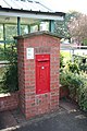
 Harby Post Office postbox (ref. NG23 169) - geograph.org.uk - 3073253.jpg 960 × 1,280; 221 KB
-
 Harby postbox - geograph.org.uk - 1005137.jpg 427 × 640; 84 KB
-
 Harby Road - geograph.org.uk - 2185370.jpg 640 × 427; 40 KB
-
 Harby Rocket - geograph.org.uk - 180769.jpg 640 × 427; 64 KB
-
 Harby Station bridge - geograph.org.uk - 3073245.jpg 1,280 × 960; 158 KB
-
 Harby sunrise - geograph.org.uk - 4831682.jpg 1,024 × 683; 112 KB
-
 Harby sunrise - geograph.org.uk - 5274642.jpg 1,024 × 683; 127 KB
-
 Harby sunrise - geograph.org.uk - 6707908.jpg 1,024 × 683; 160 KB
-
 Harby sunset - geograph.org.uk - 4213724.jpg 1,024 × 683; 50 KB
-
 Harby sunset - geograph.org.uk - 4213863.jpg 1,024 × 683; 151 KB
-
 Harby Sunset - geograph.org.uk - 5479000.jpg 1,024 × 683; 89 KB
-
 Harby sunset - geograph.org.uk - 6669450.jpg 1,024 × 683; 99 KB
-
 Harby sunset - geograph.org.uk - 6728733.jpg 1,024 × 683; 124 KB
-
 Harby view - geograph.org.uk - 1732961.jpg 640 × 426; 82 KB
-
 Harby view - geograph.org.uk - 1732969.jpg 640 × 426; 101 KB
-
 Harby view - geograph.org.uk - 1732986.jpg 640 × 426; 105 KB
-
 Harby view - geograph.org.uk - 1733126.jpg 640 × 426; 75 KB


_-_geograph.org.uk_-_3653478.jpg)


_-_geograph.org.uk_-_3073253.jpg)


