Category:Hampton Hill
Jump to navigation
Jump to search
English: Hampton Hill is a village in Middlesex that has now become part of the London Borough of Richmond upon Thames.
town in the London Borough of Richmond upon Thames  | |||||
| Upload media | |||||
| Instance of | |||||
|---|---|---|---|---|---|
| Location | London Borough of Richmond upon Thames, Greater London, London, England | ||||
 | |||||
Subcategories
This category has the following 4 subcategories, out of 4 total.
B
- Bushy Park Water Gardens (30 F)
H
- Hampton Hill Cricket Club (2 F)
Media in category "Hampton Hill"
The following 64 files are in this category, out of 64 total.
-
 Arundel Close - geograph.org.uk - 6710354.jpg 1,024 × 684; 295 KB
-
-
 Burtons Road, Hampton Hill - geograph.org.uk - 5879175.jpg 1,958 × 1,232; 2.1 MB
-
 Burtons Road, Hampton Hill - geograph.org.uk - 5879180.jpg 2,020 × 1,334; 1.92 MB
-
 Bus over Longford.JPG 3,648 × 2,736; 2.33 MB
-

-
 Canadian War grave, Hampton Hill.JPG 2,736 × 3,648; 3.54 MB
-
 Canadian War Graves, Hampton Hill.JPG 3,648 × 2,736; 3.19 MB
-
 Costa and Hampton Hill Library, High Street Hampton Hill - geograph.org.uk - 4048665.jpg 2,304 × 1,728; 853 KB
-
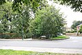
 Cranmer Road - geograph.org.uk - 2503634.jpg 1,000 × 631; 143 KB
-
 Cross Street, Hampton Hill - geograph.org.uk - 4048386.jpg 2,304 × 1,728; 818 KB
-
 Eastbank Road, Hampton Hill - geograph.org.uk - 1500279.jpg 640 × 480; 102 KB
-
 Eastbank Road, Hampton Hill - geograph.org.uk - 4048391.jpg 2,304 × 1,728; 797 KB
-
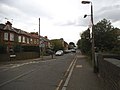
 Edward Rd - geograph.org.uk - 6710251.jpg 1,024 × 684; 211 KB
-
 Flowers on Burtons Road, Hampton Hill - geograph.org.uk - 5879176.jpg 2,034 × 1,356; 2.5 MB
-
 Ghost sign on High Street, Hampton Hill - geograph.org.uk - 4048831.jpg 1,728 × 2,304; 810 KB
-
 Hampton Hill - Cross Road - geograph.org.uk - 5092274.jpg 4,608 × 3,456; 6.7 MB
-
 Hampton Hill cemetery.JPG 3,648 × 2,736; 3.65 MB
-
 Hampton Road at the junction of High Street - geograph.org.uk - 4048379.jpg 2,304 × 1,728; 845 KB
-
 Hanworth Road at the junction of Uxbridge Road - geograph.org.uk - 3411821.jpg 2,048 × 1,536; 1.38 MB
-
 Hanworth Road bus stop, on Uxbridge Road - geograph.org.uk - 4124331.jpg 640 × 480; 147 KB
-
 Holly rd rec.jpg 3,648 × 1,971; 1.03 MB
-
 Houses on Seymour Road, Hampton Hill - geograph.org.uk - 4123852.jpg 640 × 480; 104 KB
-
 Laurel rd entrance to Bushy Park.JPG 2,736 × 3,648; 2.98 MB
-
 Links View Road, Hampton Hill - geograph.org.uk - 5879179.jpg 2,034 × 1,329; 2.05 MB
-
 Local bus to Richmond - geograph.org.uk - 4920336.jpg 2,425 × 1,756; 2.39 MB
-
 London Buses route 671 Hampton Hill.jpg 1,600 × 1,200; 650 KB
-
 Longford River - geograph.org.uk - 1613458.jpg 640 × 480; 121 KB
-
 Longford River - geograph.org.uk - 26236.jpg 640 × 480; 113 KB
-
 Longford River aqueduct - geograph.org.uk - 373812.jpg 640 × 466; 119 KB
-
 Longford River in Bushy Park - geograph.org.uk - 373825.jpg 640 × 451; 118 KB
-
 Longford Water Gardens outlet.JPG 3,648 × 2,736; 4.28 MB
-
 Oxford Cottage, Uxbridge Road - geograph.org.uk - 2263356.jpg 3,624 × 2,460; 795 KB
-
 Pantile Bridge Hampton Hill.JPG 2,736 × 3,648; 3.06 MB
-
 Park Rd - geograph.org.uk - 6710255.jpg 1,024 × 684; 299 KB
-
 Park Rd - geograph.org.uk - 6710283.jpg 1,024 × 684; 298 KB
-
 Park Road at the junction of Uxbridge Road - geograph.org.uk - 3411294.jpg 2,048 × 1,536; 1.4 MB
-
 Park Road, Hampton Hill - geograph.org.uk - 3411469.jpg 2,048 × 1,536; 1.46 MB
-
 Playground, Holly rd rec.jpg 3,437 × 1,397; 497 KB
-
 Railway south of Burton's Road - geograph.org.uk - 3134924.jpg 640 × 480; 165 KB
-
 Red Deer in Longford River.jpeg 3,648 × 2,736; 2.47 MB
-
 Sanders Close, Hampton Hill - geograph.org.uk - 4048736.jpg 2,304 × 1,728; 896 KB
-
 Seymour Rd - geograph.org.uk - 6710279.jpg 1,024 × 684; 223 KB
-
 St James's Rd - geograph.org.uk - 6710335.jpg 1,024 × 684; 310 KB
-
 St James's Rd - geograph.org.uk - 6710337.jpg 1,024 × 684; 247 KB
-
 St James's Rd - geograph.org.uk - 6710338.jpg 1,024 × 684; 284 KB
-
 St James's Rd, Windmill Rd junction - geograph.org.uk - 6710340.jpg 1,024 × 684; 240 KB
-
 Swan in Longford.JPG 3,648 × 2,736; 3.9 MB
-
 The Mews - geograph.org.uk - 4044877.jpg 640 × 427; 88 KB
-
 The Pantile Bridge, Hampton Hill - geograph.org.uk - 362702.jpg 640 × 616; 117 KB
-
 The railway line by Eastbank Road, Hampton Hill - geograph.org.uk - 4048396.jpg 2,304 × 1,728; 843 KB
-
 Uxbridge Rd - geograph.org.uk - 6710351.jpg 1,024 × 684; 226 KB
-
 Uxbridge Rd - geograph.org.uk - 6710358.jpg 1,024 × 684; 220 KB
-
 Uxbridge Road at the junction of Park Road - geograph.org.uk - 3411372.jpg 2,048 × 1,536; 1.5 MB
-
 Uxbridge Road at the junction of Windmill Road - geograph.org.uk - 4048421.jpg 2,304 × 1,728; 832 KB
-
 Uxbridge Road at the junction of Windmill Road - geograph.org.uk - 4048426.jpg 2,304 × 1,728; 804 KB
-
 Uxbridge Road, Hampton - geograph.org.uk - 4048728.jpg 2,304 × 1,728; 830 KB
-
 Wellington Rd - geograph.org.uk - 6710246.jpg 1,024 × 684; 193 KB
-
 Wide verge, Uxbridge Road - geograph.org.uk - 4124312.jpg 640 × 480; 140 KB
-
 Width restriction on Windmill Road - geograph.org.uk - 4048414.jpg 2,304 × 1,728; 850 KB
-
 Windmill Road - geograph.org.uk - 2503636.jpg 1,000 × 667; 241 KB
-
 Windmill Road crossing the railway - geograph.org.uk - 4048403.jpg 2,304 × 1,728; 819 KB
-
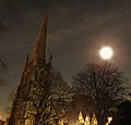 Wolf Moon 2020 above St James Church, Hampton Hill, UK (49366434642).jpg 2,904 × 2,773; 1.62 MB
-
 Wolsey Road, Hampton Hill - geograph.org.uk - 2272203.jpg 3,512 × 2,548; 874 KB


.jpg)
