Category:Hamilton, South Lanarkshire (civil parish)
Jump to navigation
Jump to search
Scottish parish | |||||
| Upload media | |||||
| Instance of | |||||
|---|---|---|---|---|---|
| Part of |
| ||||
| Named after | |||||
| Location |
| ||||
| Population |
| ||||
| Area |
| ||||
 | |||||
Subcategories
This category has the following 2 subcategories, out of 2 total.
B
H
Media in category "Hamilton, South Lanarkshire (civil parish)"
The following 200 files are in this category, out of 446 total.
(previous page) (next page)-
 A futile plea - geograph.org.uk - 2668620.jpg 640 × 414; 257 KB
-
 A72 towards Hamilton - geograph.org.uk - 6967444.jpg 800 × 600; 114 KB
-
 Aitkin Road - geograph.org.uk - 2469537.jpg 640 × 480; 340 KB
-
 Angus Avenue, Hamilton - geograph.org.uk - 6967402.jpg 800 × 600; 110 KB
-
 Animal Rescue and Re-homing Centre, Hamilton - geograph.org.uk - 6658092.jpg 1,024 × 768; 262 KB
-
 Annsfield Road, Hamilton - geograph.org.uk - 3874018.jpg 640 × 480; 48 KB
-

-
 Approaching North Quarter farm - geograph.org.uk - 1722721.jpg 640 × 480; 69 KB
-

-

-

-
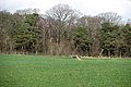
 Autumnal trees in the woodland - geograph.org.uk - 5202597.jpg 640 × 427; 341 KB
-
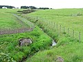
 Avon Water - geograph.org.uk - 2994823.jpg 640 × 360; 289 KB
-
 Avon Water - geograph.org.uk - 2998936.jpg 640 × 426; 290 KB
-
 Baling silage - geograph.org.uk - 2469604.jpg 640 × 480; 309 KB
-
 Belvidere Plantation - geograph.org.uk - 2837615.jpg 640 × 426; 281 KB
-
 Belvidere Plantation - geograph.org.uk - 6967442.jpg 800 × 596; 188 KB
-
 Bench by the Avon Walkway - geograph.org.uk - 6397598.jpg 5,035 × 3,848; 7.13 MB
-
 Bench by the Avon Water, South Haugh - geograph.org.uk - 5695494.jpg 4,608 × 3,456; 4.83 MB
-
 Bing near Thinacre - geograph.org.uk - 4705751.jpg 1,024 × 683; 146 KB
-
 Bing, Boghead - geograph.org.uk - 5358132.jpg 1,024 × 683; 371 KB
-
 Biofuel, Limekilnburn Road - geograph.org.uk - 2668604.jpg 640 × 480; 318 KB
-
 Blackbog Glen - geograph.org.uk - 2469565.jpg 640 × 480; 249 KB
-
 Blocked path - geograph.org.uk - 1722911.jpg 640 × 480; 124 KB
-
 Bog by Boghead - geograph.org.uk - 5356627.jpg 1,024 × 683; 369 KB
-
 Boghead - geograph.org.uk - 5358107.jpg 1,024 × 683; 292 KB
-

-
 Boundary fence of Carscallan Quarry, Quarter - geograph.org.uk - 6755060.jpg 1,024 × 768; 438 KB
-
 Bowling Club Gate - geograph.org.uk - 6992356.jpg 3,120 × 3,003; 2.52 MB
-
 Brackenhill Farm - geograph.org.uk - 1719912.jpg 640 × 480; 69 KB
-
 Brackenhill Farm, South Lanarkshire - geograph.org.uk - 3874027.jpg 640 × 480; 54 KB
-

-
 Bridge over burn near Crookedstone - geograph.org.uk - 6979638.jpg 5,184 × 3,888; 7.64 MB
-
 Bridge over M74 motorway - geograph.org.uk - 6984752.jpg 1,024 × 576; 78 KB
-
 Bridge Over the M74 - geograph.org.uk - 2934010.jpg 640 × 480; 464 KB
-
 Bridge over the Powforth Burn - geograph.org.uk - 4705578.jpg 1,024 × 683; 197 KB
-
 Bridges at Browntod Farm - geograph.org.uk - 3821785.jpg 640 × 480; 103 KB
-

-
 Broomelton farm - geograph.org.uk - 1700336.jpg 640 × 480; 55 KB
-
 Broomelton Farm - geograph.org.uk - 1741787.jpg 640 × 480; 61 KB
-
 Broomelton Farm - geograph.org.uk - 4705827.jpg 1,024 × 683; 114 KB
-
 Broomelton Near Larkhall - geograph.org.uk - 2297933.jpg 640 × 481; 58 KB
-
 Broomleton - geograph.org.uk - 2668031.jpg 640 × 480; 295 KB
-
 Brownfield site near the railway and A72 - geograph.org.uk - 2045448.jpg 800 × 531; 152 KB
-
 Browntod Farm from Limekilnburn Road - geograph.org.uk - 3874046.jpg 640 × 480; 63 KB
-
 Bull and heifer, Thinacres - geograph.org.uk - 2668050.jpg 640 × 480; 332 KB
-
 Bungalow on Carlisle Road, Hamilton - geograph.org.uk - 6967399.jpg 800 × 600; 152 KB
-
 Bunker on Hamilton Golf Course - geograph.org.uk - 6739723.jpg 4,608 × 3,456; 5.63 MB
-
 Burn by Crookedstone - geograph.org.uk - 5356615.jpg 1,024 × 683; 326 KB
-
 Burn near Crookedstone Farm - geograph.org.uk - 3821744.jpg 640 × 480; 100 KB
-
 Burn running to the Blackbog Glen - geograph.org.uk - 2469570.jpg 640 × 480; 304 KB
-
 Burn running to the Blackbog Glen - geograph.org.uk - 2469581.jpg 640 × 480; 225 KB
-
 Burnbrae farm wind turbine - geograph.org.uk - 6464193.jpg 576 × 1,024; 127 KB
-
 Calm waters - geograph.org.uk - 6951053.jpg 3,120 × 3,208; 1.1 MB
-
 Cameron II - geograph.org.uk - 6967379.jpg 1,024 × 768; 307 KB
-
 Car park, Hamilton Park - geograph.org.uk - 2669593.jpg 640 × 480; 355 KB
-
 Carscallan - geograph.org.uk - 1744866.jpg 640 × 480; 78 KB
-
 Carscallan - geograph.org.uk - 3874057.jpg 640 × 480; 87 KB
-
 Carscallan farm track - geograph.org.uk - 2060276.jpg 1,024 × 768; 211 KB
-
 Carscallan Road at Carscallan - geograph.org.uk - 4705491.jpg 1,024 × 683; 146 KB
-
 Carscallan Wall - geograph.org.uk - 2060136.jpg 1,460 × 1,095; 290 KB
-
 Carscallan Wall - geograph.org.uk - 945091.jpg 640 × 480; 81 KB
-
 Carsecallan Road - geograph.org.uk - 5356601.jpg 1,024 × 683; 350 KB
-
 Cattle on the south bank - geograph.org.uk - 6951061.jpg 2,085 × 2,094; 334 KB
-
 Cattle, Broomleton - geograph.org.uk - 2668030.jpg 640 × 480; 256 KB
-
 Cattle, Thinacres - geograph.org.uk - 2668053.jpg 640 × 480; 274 KB
-
 Chewing the cud, North Crookedstone - geograph.org.uk - 6979650.jpg 5,049 × 3,786; 5.07 MB
-
 Clyde valley, seen from the M74 in traffic - geograph.org.uk - 3839343.jpg 2,592 × 1,936; 1.79 MB
-
 Clydesdale Avenue - geograph.org.uk - 2668627.jpg 640 × 480; 230 KB
-
 Coming together again - geograph.org.uk - 6951099.jpg 2,435 × 2,482; 1.54 MB
-
 Community Woodland near Plotcock Bridge - geograph.org.uk - 3353181.jpg 1,600 × 1,066; 1.38 MB
-
 Community Woodland off Plotcock Road - geograph.org.uk - 2668047.jpg 640 × 480; 352 KB
-
 Confluence of the Clyde and the Avon - geograph.org.uk - 5658129.jpg 4,608 × 3,456; 5.65 MB
-
 Copse of trees at Boghead Farm - geograph.org.uk - 3821711.jpg 640 × 480; 48 KB
-
 Cottage at Knowetop - geograph.org.uk - 4705548.jpg 1,024 × 683; 129 KB
-

-

-
 Covered reservoir near Viewfield - geograph.org.uk - 6464750.jpg 1,024 × 576; 132 KB
-
 Cows and calves by Brackenhill - geograph.org.uk - 2469991.jpg 640 × 480; 346 KB
-
 Craigendhill Farm - geograph.org.uk - 3821700.jpg 640 × 480; 56 KB
-
 Craigthornhill Road - geograph.org.uk - 2350533.jpg 640 × 480; 103 KB
-
 Craigthornhill Road - geograph.org.uk - 3652102.jpg 640 × 481; 91 KB
-
 Craigthornhill Road - geograph.org.uk - 4039917.jpg 640 × 480; 341 KB
-

-
 Crossroads near Hamilton - geograph.org.uk - 2045720.jpg 800 × 531; 144 KB
-

-
 Cycle-walk path through Meikle Earnock, Hamilton - geograph.org.uk - 6762890.jpg 1,024 × 768; 438 KB
-
 Darngaber Burn near Browntod Farm - geograph.org.uk - 6572578.jpg 1,024 × 768; 332 KB
-
 Darngaber Road, Quarter - geograph.org.uk - 6762897.jpg 1,024 × 768; 266 KB
-
 Date on building, Low Waters Road - geograph.org.uk - 2469539.jpg 640 × 480; 291 KB
-
 Davington Drive, Hamilton - geograph.org.uk - 2166699.jpg 640 × 481; 68 KB
-
 Deposits on the River Clyde - geograph.org.uk - 3515081.jpg 640 × 480; 87 KB
-
 Developments at Sunnyside - geograph.org.uk - 1722503.jpg 640 × 480; 56 KB
-
 Dismantled railway in Earnock, Hamilton - geograph.org.uk - 4212767.jpg 640 × 480; 125 KB
-
 Driving range at Hamilton Park - geograph.org.uk - 3020561.jpg 640 × 480; 81 KB
-
 Dykehead Wood - geograph.org.uk - 2511433.jpg 640 × 480; 134 KB
-
 Earnockmuir Farm - geograph.org.uk - 3353222.jpg 5,184 × 3,456; 6.01 MB
-
 East Thinacremuir - geograph.org.uk - 6579382.jpg 1,024 × 768; 257 KB
-
 Eddlewood Burn - geograph.org.uk - 2469548.jpg 640 × 480; 388 KB
-
 Eddlewood Glen - geograph.org.uk - 1752322.jpg 3,000 × 4,000; 6.11 MB
-
 Edge of plantation near Allanton - geograph.org.uk - 6438350.jpg 5,148 × 3,677; 4.96 MB
-
 Electricity Pylons near Hamilton - geograph.org.uk - 1719790.jpg 4,000 × 3,000; 2.82 MB
-

-
 Electricity substation near Hamilton - geograph.org.uk - 2166697.jpg 640 × 481; 71 KB
-
 End of the Track - geograph.org.uk - 3821680.jpg 640 × 480; 89 KB
-
 Entering Hamilton from the South - geograph.org.uk - 1743806.jpg 4,000 × 3,000; 3.58 MB
-

-
 Fading light, Hamilton High Parks - geograph.org.uk - 6716241.jpg 5,149 × 3,677; 2.94 MB
-
 Farm access bridge over the M74 - geograph.org.uk - 4652609.jpg 4,237 × 2,613; 2.33 MB
-
 Farm road to Crookedstonemuir - geograph.org.uk - 6572577.jpg 1,024 × 768; 213 KB
-
 Farm road to Mafflat - geograph.org.uk - 2045661.jpg 800 × 531; 168 KB
-
 Farm road, Crookedstone - geograph.org.uk - 5356617.jpg 1,024 × 683; 318 KB
-
 Farm Track near East Thinacremuir - geograph.org.uk - 6579381.jpg 1,024 × 768; 350 KB
-
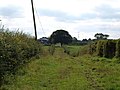
 Farm track to Shotlinn - geograph.org.uk - 3124292.jpg 640 × 481; 76 KB
-
 Farm track to Thinacre Muir - geograph.org.uk - 2368753.jpg 640 × 480; 88 KB
-
 Farmland from M74 southbound - geograph.org.uk - 2420389.jpg 640 × 480; 69 KB
-
 Farmland off Limekilnburn Road - geograph.org.uk - 2668612.jpg 640 × 480; 266 KB
-
 Fast food outlets, Hamilton Retail Park - geograph.org.uk - 6992353.jpg 2,536 × 2,254; 1.48 MB
-
 Fergus Gardens, Hamilton - geograph.org.uk - 6967398.jpg 800 × 592; 206 KB
-
 Field Boundary - geograph.org.uk - 4705502.jpg 1,024 × 683; 128 KB
-
 Field Gate and Track of Old Mineral Railway - geograph.org.uk - 6579377.jpg 1,024 × 768; 327 KB
-
 Field near Simpsonland - geograph.org.uk - 4705465.jpg 1,024 × 683; 137 KB
-
 Field off Plotcock Road - geograph.org.uk - 2668034.jpg 640 × 480; 269 KB
-
 Field, Boghead - geograph.org.uk - 5356629.jpg 1,024 × 683; 318 KB
-
 Field, Crookedstane - geograph.org.uk - 5356613.jpg 1,024 × 683; 233 KB
-
 Fields at Brackenhill Farm - geograph.org.uk - 2166693.jpg 640 × 481; 69 KB
-
 Footbridge, M74 - geograph.org.uk - 2777363.jpg 640 × 430; 48 KB
-
 Footbridge, M74 near Merryton - geograph.org.uk - 2774029.jpg 640 × 430; 48 KB
-
 Footpath at South Haugh - geograph.org.uk - 6698855.jpg 5,148 × 3,678; 5.59 MB
-
 Former Lodge House - geograph.org.uk - 4617962.jpg 1,024 × 576; 207 KB
-

-
 Friesian dairy herd near Allanton - geograph.org.uk - 6438358.jpg 5,152 × 3,864; 6.24 MB
-
 Frost in the shade - geograph.org.uk - 6992287.jpg 3,120 × 3,200; 3.04 MB
-

-
 Gate and stile, Boghead - geograph.org.uk - 5358117.jpg 1,024 × 683; 425 KB
-

-
 Gates at the entrance to Fairholm - geograph.org.uk - 6808940.jpg 1,024 × 577; 207 KB
-
 Georgian border, Chatelherault - geograph.org.uk - 6992233.jpg 3,120 × 4,160; 2.31 MB
-
 Gnarled tree, Hamilton High Parks - geograph.org.uk - 5999583.jpg 3,456 × 4,608; 4.57 MB
-
 Grass field, Merryton - geograph.org.uk - 2832366.jpg 640 × 426; 225 KB
-
 Grass, Crookedstone - geograph.org.uk - 5356619.jpg 1,024 × 683; 355 KB
-
 Grassed over road, Boghead - geograph.org.uk - 5358122.jpg 1,024 × 683; 476 KB
-
 Grassland off Muttonhole Lane - geograph.org.uk - 2470234.jpg 640 × 480; 259 KB
-
 Grassland to bog - geograph.org.uk - 5358143.jpg 1,024 × 683; 351 KB
-
 Grassland, Earnockmuir - geograph.org.uk - 2472206.jpg 640 × 480; 260 KB
-
 Grassland, Quarter - geograph.org.uk - 2668331.jpg 640 × 480; 231 KB
-
 Grazing cattle - geograph.org.uk - 4705718.jpg 1,024 × 683; 177 KB
-
 Grazing north of Lanark Road, Merryton - geograph.org.uk - 6967457.jpg 1,024 × 768; 210 KB
-
 Green space, Fleming Way - geograph.org.uk - 2472235.jpg 640 × 480; 297 KB
-
 Grid line over the Clyde near Adder's Gill Wood - geograph.org.uk - 6371544.jpg 814 × 1,024; 187 KB
-
 Hamilton and Strathaven Railway - geograph.org.uk - 2668336.jpg 640 × 480; 275 KB
-
 Hamilton Bus Station – 1978 - geograph.org.uk - 7053050.jpg 1,280 × 849; 267 KB
-

-
 Hamilton Golf Club - Clubhouse - geograph.org.uk - 1605795.jpg 640 × 480; 59 KB
-
 Hamilton High Parks - geograph.org.uk - 2060194.jpg 2,936 × 2,103; 1.21 MB
-
 Hamilton High Parks - geograph.org.uk - 2994808.jpg 640 × 360; 240 KB
-
 Hamilton High Parks - geograph.org.uk - 2994819.jpg 640 × 360; 260 KB
-
 Hamilton High Parks - geograph.org.uk - 945049.jpg 640 × 480; 121 KB
-
 Hamilton Low Park (3) - geograph.org.uk - 4700187.jpg 1,024 × 683; 201 KB
-
 Hamilton Mausoleum 1996 - geograph.org.uk - 6990551.jpg 1,799 × 2,736; 245 KB
-
 Hamilton Services, M74 - geograph.org.uk - 6951111.jpg 1,024 × 684; 123 KB
-
 Hamilton Services, Northbound M74 - geograph.org.uk - 4700001.jpg 1,024 × 683; 130 KB
-
 Hamilton, Bothwell Road - geograph.org.uk - 4700235.jpg 1,024 × 683; 129 KB
-
 Hamilton, Eddlewood - geograph.org.uk - 4704363.jpg 1,024 × 683; 142 KB
-
 Hamilton, Low Waters - geograph.org.uk - 4704358.jpg 1,024 × 683; 119 KB
-
 Hamilton, military memorial - geograph.org.uk - 4700216.jpg 1,024 × 683; 292 KB
-
 Hamilton, Orchard Brae - geograph.org.uk - 4700222.jpg 1,024 × 683; 179 KB
-
 Hamilton, Silvertonhill Avenue - geograph.org.uk - 4704353.jpg 1,024 × 683; 133 KB
-
 Haspielaw - geograph.org.uk - 3874034.jpg 640 × 480; 57 KB
-
 Hedgerow-lined road above Barncluith - geograph.org.uk - 6722981.jpg 4,608 × 3,456; 2.64 MB
-
 High Parks Gospel Hall - geograph.org.uk - 2247483.jpg 640 × 481; 75 KB
-
 Highstonehall Road - geograph.org.uk - 2470210.jpg 640 × 480; 358 KB
-
 Hill - geograph.org.uk - 3353267.jpg 1,600 × 1,066; 1,016 KB
-

-
 Horse on the horizon - geograph.org.uk - 6727154.jpg 4,608 × 3,456; 5.45 MB
-
 Hot Food Takeaway - geograph.org.uk - 3427189.jpg 640 × 480; 102 KB
-
 House on Broomelton Rd - geograph.org.uk - 844726.jpg 640 × 480; 109 KB
-
 Houses at Limekilnburn - geograph.org.uk - 6464747.jpg 1,024 × 564; 148 KB
-
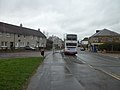
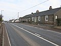
 Houses on Burnbank Road (A724) - geograph.org.uk - 6967354.jpg 1,024 × 654; 129 KB
-
 Huntsman's Ride, Chatelherault - geograph.org.uk - 6992241.jpg 3,120 × 3,200; 3.02 MB
-
 I Love Glasgow - geograph.org.uk - 3427107.jpg 446 × 640; 93 KB
-
 Ice rink car park - geograph.org.uk - 3822612.jpg 2,592 × 1,936; 1.44 MB
-
 Important sign^ - geograph.org.uk - 6508727.jpg 1,024 × 576; 148 KB
-
 Industrial site near Burnhead - geograph.org.uk - 5358150.jpg 1,024 × 683; 283 KB
-
 Joining the M74 from Hamilton Services - geograph.org.uk - 6951115.jpg 1,024 × 684; 90 KB
-
 Junction 6, M74 - geograph.org.uk - 2777365.jpg 640 × 430; 42 KB
-
 Junction 6, M74 northbound - geograph.org.uk - 2647130.jpg 800 × 570; 52 KB
-
 Junction of farm roads between Darngaber and Knowetop - geograph.org.uk - 6743498.jpg 5,152 × 3,864; 6.56 MB
-
 Knowetop Glen - geograph.org.uk - 5356596.jpg 1,024 × 683; 298 KB
-
 Lanark Road (A72), Merryton - geograph.org.uk - 6967458.jpg 800 × 600; 133 KB
-
 Lanark Road End - geograph.org.uk - 6806923.jpg 1,024 × 601; 196 KB
-
 Landscaped area at Hamilton Services - geograph.org.uk - 4434081.jpg 1,500 × 1,338; 2.09 MB
-
 Larkhall to Hamilton Railway - geograph.org.uk - 3169797.jpg 640 × 481; 83 KB
-

-
 Leaving Hamilton Services - geograph.org.uk - 6951114.jpg 1,024 × 509; 79 KB
-
 Leyland Avenue - geograph.org.uk - 2472213.jpg 640 × 480; 305 KB
-
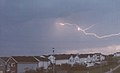 Lightning over High Earnock - geograph.org.uk - 2194497.jpg 640 × 392; 32 KB
-
 Limekilnburn - geograph.org.uk - 1743780.jpg 640 × 480; 62 KB
-
 Limekilnburn Road - geograph.org.uk - 1743693.jpg 640 × 480; 73 KB
-
 Limekilnburn Road - geograph.org.uk - 2668324.jpg 640 × 480; 264 KB


_-_geograph.org.uk_-_6133583.jpg)


_-_geograph.org.uk_-_4700187.jpg)


_-_geograph.org.uk_-_6967354.jpg)


,_Merryton_-_geograph.org.uk_-_6967458.jpg)


&filefrom=Limekilnburn+Road%2C+Quarter+-+geograph.org.uk+-+6464184.jpg#mw-category-media)