Category:Hameldon Hill
Jump to navigation
Jump to search
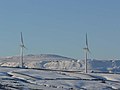
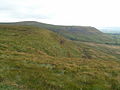
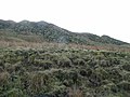
English: Hameldon Hill is located in the east of Lancashire, England, between the towns of Burnley and Accrington.
hill in Lancashire, England, UK | |||||
| Upload media | |||||
| Instance of | |||||
|---|---|---|---|---|---|
| Location |
| ||||
 | |||||
Media in category "Hameldon Hill"
The following 41 files are in this category, out of 41 total.
-
 A clough above Huncoat - geograph.org.uk - 1654055.jpg 640 × 428; 87 KB
-
 Bank Hall Park - geograph.org.uk - 1114550.jpg 640 × 427; 88 KB
-
 Beyond the future - geograph.org.uk - 616415.jpg 640 × 425; 49 KB
-
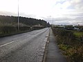 Burnley Road, Hapton - geograph.org.uk - 1606223.jpg 640 × 480; 64 KB
-
 Burnley Way (geograph 2996963).jpg 4,320 × 3,240; 4.85 MB
-
 Burnley Way near Green Side Farm, Hapton.jpg 3,005 × 4,007; 4.96 MB
-
 Bypass A56 - geograph.org.uk - 1199020.jpg 640 × 423; 77 KB
-
 Bypass Cutting - geograph.org.uk - 1199490.jpg 640 × 430; 87 KB
-
 Cronker Plantation - geograph.org.uk - 1654068.jpg 640 × 428; 89 KB
-
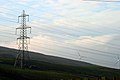 Electricity - geograph.org.uk - 616411.jpg 640 × 425; 56 KB
-
 Farmhouse at New Laithe - geograph.org.uk - 124214.jpg 640 × 480; 104 KB
-
 Great Hameldon Trig 409m - geograph.org.uk - 222635.jpg 640 × 480; 106 KB
-
 Hameldon from Read.jpg 2,171 × 1,628; 937 KB
-
 Hameldon Hill (geograph 3732100).jpg 3,648 × 2,736; 4.01 MB
-
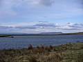
 Hameldon Reservoir - geograph.org.uk - 1654015.jpg 640 × 428; 45 KB
-
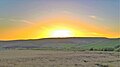 Hameldon sunset from Gambleside.jpg 3,200 × 1,800; 1.11 MB
-
 Hapton Tower excavation 2.jpg 4,008 × 3,005; 4.55 MB
-
 Hapton Tower excavation.jpg 4,008 × 3,006; 4.13 MB
-
 In need of a coat of whitewash - geograph.org.uk - 1078707.jpg 480 × 640; 59 KB
-
 King's Highway - geograph.org.uk - 2059051.jpg 480 × 640; 87 KB
-
 Lower Clough Bank, Altham 1.jpg 4,010 × 3,007; 3.73 MB
-
 May Road Well - geograph.org.uk - 767569.jpg 640 × 480; 137 KB
-
 Old quarry workings, Hameldon Scouts - geograph.org.uk - 1654042.jpg 640 × 428; 106 KB
-
 Reservoir of the Oak Print Works - geograph.org.uk - 767585.jpg 640 × 480; 55 KB
-
 Road to Further Barn Farm - geograph.org.uk - 1611586.jpg 640 × 465; 58 KB
-
 The top of Great Hameldon - geograph.org.uk - 1654025.jpg 640 × 428; 82 KB
-

-
 Thursden Valley picnic area - geograph.org.uk - 675111.jpg 640 × 427; 58 KB
-

-
 Wind power Hameldon Hill - geograph.org.uk - 444217.jpg 640 × 480; 70 KB
-
 Windfarm below Hameldon Hill - geograph.org.uk - 1126222.jpg 640 × 480; 58 KB
-
 A56 Accington Easterly By-pass - geograph.org.uk - 117197.jpg 640 × 426; 127 KB
-
 Heys Farm - geograph.org.uk - 158538.jpg 640 × 480; 103 KB
-
 Looking down on Burnley - geograph.org.uk - 222650.jpg 640 × 480; 133 KB
-
 Looking towards Great Hameldon - geograph.org.uk - 222646.jpg 640 × 480; 127 KB
-
 Old quarry works - geograph.org.uk - 124225.jpg 640 × 480; 79 KB
-
 On Great Hemeldon - geograph.org.uk - 222641.jpg 640 × 480; 118 KB
-
 Radio mast on Hameldon Hill - geograph.org.uk - 124215.jpg 476 × 637; 66 KB
-
 Rishton golf course - geograph.org.uk - 39356.jpg 640 × 427; 97 KB
-
 This way lies Accrington - geograph.org.uk - 425149.jpg 640 × 304; 238 KB
-
 View from Shawcliff Lane - geograph.org.uk - 46284.jpg 640 × 427; 125 KB


.jpg)


.jpg)


