Category:Halton, Cheshire
Jump to navigation
Jump to search
village in Cheshire, UK; part of the town of Runcorn  Ruines del castell de Halton. | |||||
| Upload media | |||||
| Instance of | |||||
|---|---|---|---|---|---|
| Location | Halton, Cheshire, North West England, England | ||||
| Different from | |||||
 | |||||
English: Halton, formerly a separate village, is now part of the town of Runcorn, Cheshire, England. The name Halton has been assumed by the borough of Halton, which includes Runcorn, Widnes and some outlying parishes.
Subcategories
This category has the following 10 subcategories, out of 10 total.
Media in category "Halton, Cheshire"
The following 69 files are in this category, out of 69 total.
-
 125 and 127 Main St.jpg 2,592 × 1,944; 884 KB
-
 31 Main Street.jpg 2,592 × 1,944; 1.15 MB
-
 6, 8 and 10 Castle Rd.jpg 2,592 × 1,944; 1.16 MB
-
 Access Road, Halton Lea - geograph.org.uk - 747623.jpg 640 × 480; 66 KB
-
 12, 14 and 16 Castle Rd.jpg 1,928 × 1,944; 924 KB
-

-
 Central Expressway - geograph.org.uk - 2459180.jpg 640 × 481; 45 KB
-
 Chemical Works Weston Point.jpg 640 × 480; 74 KB
-
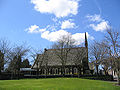
 Church of St Mary, Halton - geograph.org.uk - 2215210.jpg 4,000 × 3,000; 1.58 MB
-
 Fields in Town Park - geograph.org.uk - 3746848.jpg 3,264 × 2,448; 4.68 MB
-
 Fireworks at the opening of the Mersey Gateway Bridge.jpg 4,032 × 3,024; 3.14 MB
-
 Halton Brook Avenue, Runcorn - geograph.org.uk - 3504490.jpg 1,800 × 1,350; 812 KB
-
 Halton Brow, Runcorn.JPG 4,608 × 3,456; 3.36 MB
-
 Halton Castle - geograph.org.uk - 2215217.jpg 4,000 × 3,000; 1.97 MB
-
 Halton Castle - geograph.org.uk - 2215221.jpg 4,000 × 3,000; 2.02 MB
-
 Halton Castle - geograph.org.uk - 2215226.jpg 4,000 × 3,000; 1.92 MB
-
 Halton Castle - geograph.org.uk - 3350584.jpg 1,594 × 1,194; 488 KB
-
 Halton Castle seen, far above, from Main St, Halton - geograph.org.uk - 2215235.jpg 4,000 × 3,000; 3.05 MB
-
 Halton House.jpg 2,524 × 1,879; 930 KB
-
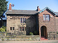
 Halton Royal British Legion.JPG 4,608 × 3,456; 3.55 MB
-
 Halton Trinity Methodist Church - geograph.org.uk - 1200498.jpg 640 × 480; 97 KB
-
 Halton UK ward map 2021.svg 767 × 531; 176 KB
-
 Halton UK ward map 2022.svg 767 × 531; 174 KB
-
 Halton Village Hall.JPG 4,608 × 3,456; 3.55 MB
-
 Halton Village, Cheshire (1).JPG 4,608 × 3,456; 3.38 MB
-
 Halton Village, Cheshire (2).JPG 4,608 × 3,456; 3.42 MB
-
 Halton Village, Cheshire (3).JPG 4,608 × 3,456; 3.46 MB
-
 Halton Village, Cheshire (4).JPG 4,608 × 3,456; 3.37 MB
-
 Halton Village, Cheshire (5).JPG 4,608 × 3,456; 3.31 MB
-
 Halton Village, Cheshire (6).JPG 4,608 × 3,456; 3.33 MB
-
 Halton Village, Cheshire (7).JPG 4,608 × 3,456; 3.41 MB
-
 Hollybank House.jpg 2,592 × 1,944; 906 KB
-
 Inglenook Cottage, Halton.JPG 4,608 × 3,456; 3.44 MB
-
 Junction of Summer Lane and Main Street, Halton.JPG 4,608 × 3,456; 3.58 MB
-
 Main St, Halton - geograph.org.uk - 2215231.jpg 4,000 × 3,000; 1.41 MB
-
 Main St, Halton, looking SE towards Trinity Methodist Church - geograph.org.uk - 2215228.jpg 4,000 × 3,000; 1.39 MB
-
 59-63 Main Street.jpg 2,503 × 1,769; 1.01 MB
-
 90 and 92 Main St.jpg 2,508 × 1,667; 868 KB
-
 Main Street, Halton - geograph.org.uk - 4412516.jpg 800 × 533; 408 KB
-
 Main Street, Halton Village - geograph.org.uk - 3746921.jpg 2,934 × 2,201; 864 KB
-
 Norton Arms.jpg 2,592 × 1,944; 1.07 MB
-

-
 Norton Priory Lodge.jpg 2,592 × 1,944; 1.05 MB
-
 Palace Fields Community Centre - geograph.org.uk - 3746903.jpg 640 × 480; 61 KB
-
 Public footpath in Town Park - geograph.org.uk - 3746838.jpg 3,264 × 2,448; 5.61 MB
-

-
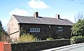
 Rock Farm House 2.jpg 2,592 × 1,944; 988 KB
-
 Rock Farm House.jpg 2,592 × 1,944; 1,020 KB
-
 Runcorn Central Expressway - geograph.org.uk - 3219278.jpg 4,592 × 3,056; 5.75 MB
-
 Runcorn Central Expressway - geograph.org.uk - 3520238.jpg 1,800 × 1,350; 499 KB
-
 Seneschal's House, Halton (1).JPG 4,608 × 3,456; 3.51 MB
-
 Swing Bridge - geograph.org.uk - 43351.jpg 640 × 480; 120 KB
-
 The Norton Arms, Halton - geograph.org.uk - 2215201.jpg 4,000 × 3,000; 1.66 MB
-
 The Norton Arms, Halton - geograph.org.uk - 747601.jpg 640 × 480; 70 KB
-
 The Norton Arms, Halton.JPG 4,608 × 3,456; 3.5 MB
-
 The Seneschal's House, Halton - geograph.org.uk - 2215206.jpg 4,000 × 3,000; 1.64 MB
-
 The Village Farmhouse, Halton - geograph.org.uk - 747582.jpg 640 × 480; 92 KB
-
 Trinity Methodist Chapel, Halton.jpg 2,592 × 1,944; 947 KB
-
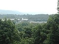
 View to Mersey Gateway Bridge from Halton Castle - geograph.org.uk - 5626441.jpg 5,184 × 2,920; 4.54 MB
-
 Village Farm House.jpg 2,168 × 1,320; 849 KB
-
 Country in the town - geograph.org.uk - 140859.jpg 640 × 426; 122 KB
-
 Family outing - geograph.org.uk - 15061.jpg 640 × 551; 118 KB
-
 Halton Lea - Asda - Trident Park - geograph.org.uk - 31388.jpg 640 × 480; 76 KB
-

-
 Round Runcorn's roads - geograph.org.uk - 89311.jpg 640 × 426; 92 KB
-
 The rumbling lorries ran - geograph.org.uk - 89316.jpg 640 × 426; 96 KB
-
 Underneath the arches - geograph.org.uk - 89306.jpg 640 × 402; 104 KB
-
 View from Castle - River Mersey - geograph.org.uk - 31387.jpg 640 × 480; 76 KB
-
 Weaver bridges - geograph.org.uk - 207480.jpg 640 × 557; 122 KB


.JPG)
.JPG)
.JPG)
.JPG)
.JPG)
.JPG)
.JPG)


.JPG)


