Category:Haisla
Jump to navigation
Jump to search
indigenous people of the Pacific Northwest Coast | |||||
| Upload media | |||||
| Instance of | |||||
|---|---|---|---|---|---|
| Subclass of | |||||
| Part of | |||||
| |||||
Subcategories
This category has the following 3 subcategories, out of 3 total.
Media in category "Haisla"
The following 27 files are in this category, out of 27 total.
-
"man peeing" waterfall - panoramio.jpg 2,144 × 1,424; 848 KB
-
1850 Kitlope shaman's tool.jpg 3,805 × 2,537; 6.69 MB
-
1875 bent-corner box 01.jpg 2,848 × 4,288; 5.59 MB
-
1875 bent-corner box 02.jpg 2,848 × 4,288; 5.59 MB
-
1875 bent-corner box 03.jpg 2,848 × 4,288; 5.67 MB
-
Big slide along Kitlope Lake - panoramio.jpg 2,144 × 1,424; 1.14 MB
-
CAN BC Haisla Nation locator.svg 1,944 × 1,737; 1.41 MB
-
Gardner Canal - panoramio.jpg 2,144 × 1,424; 916 KB
-
Haisla baton (UBC-2010a).jpg 3,184 × 912; 358 KB
-
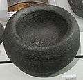
Haisla bowl (UBC-2010).jpg 2,496 × 2,400; 664 KB
-
Haisla canoe (UBC-2009).jpg 3,264 × 2,448; 956 KB
-
Haisla Community School - panoramio.jpg 2,144 × 1,424; 1.24 MB
-
Haisla ladles (UBC-2010).jpg 3,264 × 2,448; 1.88 MB
-
Haisla paddles (UBC-2010a).jpg 2,448 × 3,264; 1.98 MB
-
Haisla seat (UBC-2010a).jpg 3,264 × 2,448; 2.06 MB
-
Haisla whistle (UBC-2010).jpg 3,256 × 1,664; 666 KB
-
Indigenous - Ken Hall and Sami.jpg 1,180 × 885; 458 KB
-
Kawesas Lodge - panoramio.jpg 2,144 × 1,424; 1.33 MB
-
Kawesas River estuary at evening high tide - panoramio.jpg 2,144 × 1,424; 632 KB
-
Kitamaat Village Council building - panoramio.jpg 2,018 × 1,342; 1.02 MB
-
Kitlope Lake - panoramio (1).jpg 2,144 × 1,424; 865 KB
-
Kitlope Lake - panoramio.jpg 2,144 × 1,424; 1.69 MB
-
Kitlope Lake mouth panorama - panoramio.jpg 4,001 × 903; 1.44 MB
-
Looking down Kawesas River - panoramio.jpg 2,144 × 1,424; 1.32 MB
-
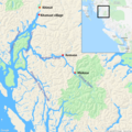
Map, Haisla, Kitimat, Kitamaat village.png 1,000 × 1,000; 856 KB
-
Mouth of Kitlope Lake.jpg 2,552 × 1,912; 2.06 MB
-
Watchmen's Cabin - panoramio.jpg 2,144 × 1,424; 1.88 MB


