Category:Hainford
Jump to navigation
Jump to search
English: Hainford (originally Haynford) is a village and civil parish in the English county of Norfolk.
village in the United Kingdom   | |||||
| Upload media | |||||
| Instance of | |||||
|---|---|---|---|---|---|
| Location | Broadland, Norfolk, East of England, England | ||||
| Population |
| ||||
| Area |
| ||||
| Said to be the same as | Hainford (Wikimedia duplicated page, civil parish) | ||||
 | |||||
Subcategories
This category has the following 4 subcategories, out of 4 total.
Media in category "Hainford"
The following 152 files are in this category, out of 152 total.
-
 5 miles to Norwich - geograph.org.uk - 757301.jpg 480 × 640; 173 KB
-
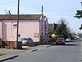 A Pink Post Office - geograph.org.uk - 388997.jpg 640 × 480; 79 KB
-
 A140 Cromer Road, Hainford ^ Cromer Road Postbox - geograph.org.uk - 3474860.jpg 3,072 × 2,304; 1.54 MB
-

-
 B1354 approaching the A140 Cromer Road - geograph.org.uk - 2743564.jpg 3,072 × 2,304; 1.46 MB
-
 B1354 Waterloo Road - geograph.org.uk - 2743559.jpg 3,072 × 2,304; 1.36 MB
-
 B1354 Waterloo Road - geograph.org.uk - 2743568.jpg 3,072 × 2,304; 1.36 MB
-
 B1354 Waterloo Road ^ Old Church Road, Hainford - geograph.org.uk - 2743019.jpg 3,072 × 2,304; 1.31 MB
-
 B1354 Waterloo Road, Hainford - geograph.org.uk - 2742765.jpg 3,072 × 2,304; 1.56 MB
-
 B1354 Waterloo Road, Hainford - geograph.org.uk - 2742769.jpg 3,072 × 2,304; 1.37 MB
-
 B1354 Waterloo Road, Hainford - geograph.org.uk - 2743533.jpg 3,072 × 2,304; 1.23 MB
-
 Bus shelter - geograph.org.uk - 679332.jpg 640 × 480; 156 KB
-
 Chapel Road sign - geograph.org.uk - 2742846.jpg 3,072 × 2,304; 1.52 MB
-
 Chapel Road Telephone Box - geograph.org.uk - 2742880.jpg 2,304 × 3,072; 1.47 MB
-
 Chapel Road ^ Hainford Post Office Postbox - geograph.org.uk - 2742872.jpg 3,072 × 2,304; 1.51 MB
-
 Chapel Road, Hainford - geograph.org.uk - 2742844.jpg 3,072 × 2,304; 1.31 MB
-
 Chapel Road, Hainford - geograph.org.uk - 2742884.jpg 3,072 × 2,304; 1.42 MB
-
 Church Road past Church Farm - geograph.org.uk - 757405.jpg 640 × 480; 164 KB
-
 Cromer Road New Hainford Postbox - geograph.org.uk - 2743572.jpg 3,072 × 2,304; 1.44 MB
-
 Cromer Road Postbox - geograph.org.uk - 3474863.jpg 2,304 × 3,072; 1.63 MB
-
 Cromer Road Postbox - geograph.org.uk - 3474864.jpg 2,304 × 3,072; 1.67 MB
-
 Cromer Road Postbox - geograph.org.uk - 3474865.jpg 2,304 × 3,072; 1.63 MB
-
 Daffodils at All Saints' church - geograph.org.uk - 5321886.jpg 640 × 601; 593 KB
-

-
 Driveway to Park Farm - geograph.org.uk - 557499.jpg 640 × 480; 81 KB
-
 Dumbs Lane sign - geograph.org.uk - 2742782.jpg 3,072 × 2,304; 1.68 MB
-
 Dumbs Lane, Hainford - geograph.org.uk - 2742780.jpg 3,072 × 2,304; 1.49 MB
-
 Dumbs Lane, Hainford - geograph.org.uk - 2742982.jpg 2,304 × 3,072; 1.41 MB
-
 Dumbs Lane, Hainford - geograph.org.uk - 2743001.jpg 3,072 × 2,304; 1.46 MB
-
 Entering Hainford on the A140 Cromer Road - geograph.org.uk - 2687553.jpg 3,072 × 2,304; 1.54 MB
-
 Entrance into All Saints' churchyard - geograph.org.uk - 5321879.jpg 640 × 606; 583 KB
-

-
 Entrance to Grove Farm, Hainford - geograph.org.uk - 3134360.jpg 640 × 489; 120 KB
-
 Entrance to the Langmere Lakes - geograph.org.uk - 556132.jpg 640 × 480; 49 KB
-
 Gated farm track off Old Church Road - geograph.org.uk - 5321878.jpg 640 × 480; 402 KB
-
 Grange Road sign - geograph.org.uk - 2742992.jpg 3,072 × 2,304; 1.69 MB
-
 Grange Road, Hainford - geograph.org.uk - 2742968.jpg 3,072 × 2,304; 1.51 MB
-
 Grange Road, Hainford - geograph.org.uk - 2742989.jpg 2,304 × 3,072; 1.54 MB
-
 Gravestones in All Saints' churchyard - geograph.org.uk - 5321881.jpg 640 × 571; 550 KB
-
 Hainford Post Office Postbox - geograph.org.uk - 2742877.jpg 2,304 × 3,072; 1.64 MB
-
 Hainford Post Office Postbox - geograph.org.uk - 2742878.jpg 2,304 × 3,072; 1.5 MB
-
 Hainford Primary Partnership School - geograph.org.uk - 2742797.jpg 3,072 × 2,304; 1.43 MB
-
 Hainford Primary Partnership School - geograph.org.uk - 2742798.jpg 3,072 × 2,304; 1.39 MB
-
 Hainford Primary Partnership School sign - geograph.org.uk - 2742801.jpg 3,072 × 2,304; 1.37 MB
-
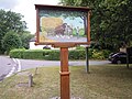
 Hainford Village Sign - geograph.org.uk - 2742972.jpg 2,304 × 3,072; 1.63 MB
-
 Hainford Village Sign - geograph.org.uk - 2742990.jpg 3,072 × 2,304; 1.37 MB
-
 Hainford village sign - geograph.org.uk - 6705287.jpg 2,044 × 2,044; 1.42 MB
-
 Hainford village sign - geograph.org.uk - 6705295.jpg 4,608 × 3,072; 5.67 MB
-
 Hainford village sign, 01 08 2010.JPG 4,000 × 3,000; 2.32 MB
-
 Hainford, Chequers Inn beer garden - geograph.org.uk - 2188852.jpg 480 × 640; 68 KB
-
 Hainford, the Chequers Inn - geograph.org.uk - 2188850.jpg 640 × 480; 93 KB
-
 Hall Road, Hainford - geograph.org.uk - 2742958.jpg 3,072 × 2,304; 1.53 MB
-
 Hall Road, Hainford - geograph.org.uk - 2742964.jpg 3,072 × 2,304; 1.46 MB
-
 Hall Road, Hainford - geograph.org.uk - 2742997.jpg 2,304 × 3,072; 1.33 MB
-
 Harvested field at Grove Farm - geograph.org.uk - 3134367.jpg 640 × 480; 71 KB
-
 Heading north on Old Cromer Road - geograph.org.uk - 556129.jpg 480 × 640; 101 KB
-
 Houses on Cromer Road, New Hainford - geograph.org.uk - 5415014.jpg 2,014 × 1,490; 910 KB
-
 Lady Lane sign - geograph.org.uk - 2742830.jpg 3,072 × 2,304; 1.46 MB
-
 Lady Lane, Hainford - geograph.org.uk - 2742826.jpg 3,072 × 2,304; 1.4 MB
-
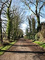
 Long Plantation - geograph.org.uk - 728142.jpg 480 × 640; 183 KB
-
 Map of Hainford - geograph.org.uk - 2743008.jpg 2,304 × 3,072; 1.52 MB
-
 Map of Hainford - geograph.org.uk - 2743010.jpg 3,072 × 2,304; 1.42 MB
-
 Newton Road sign - geograph.org.uk - 2742774.jpg 3,072 × 2,304; 1.53 MB
-
 Newton Road, Hainford - geograph.org.uk - 2742773.jpg 3,072 × 2,304; 1.47 MB
-
 Newton Road, Hainford - geograph.org.uk - 2742778.jpg 3,072 × 2,304; 1.4 MB
-
 Newton Road, Hainford - geograph.org.uk - 2742809.jpg 3,072 × 2,304; 1.55 MB
-
 Newton Road, Hainford - geograph.org.uk - 2742820.jpg 3,072 × 2,304; 1.5 MB
-
 Newton Road, Hainford - geograph.org.uk - 2742838.jpg 3,072 × 2,304; 1.36 MB
-
 Notice Board of All Saints Church, Haynford - geograph.org.uk - 2742793.jpg 2,304 × 3,072; 1.5 MB
-
 Old Church Road sign - geograph.org.uk - 2743026.jpg 3,072 × 2,304; 1.66 MB
-
 Pollard Road sign - geograph.org.uk - 2743550.jpg 3,072 × 2,304; 1.64 MB
-
 Pollard Road, Waterloo - geograph.org.uk - 2743549.jpg 3,072 × 2,304; 1.27 MB
-
 Private Woodland - geograph.org.uk - 728152.jpg 640 × 480; 183 KB
-
 Private Woods - geograph.org.uk - 728146.jpg 480 × 640; 168 KB
-
 Roadsign on Hall Road - geograph.org.uk - 2742891.jpg 2,304 × 3,072; 1.53 MB
-
 Roadsign on Newton Road - geograph.org.uk - 2742805.jpg 2,304 × 3,072; 1.49 MB
-
 Roadsign on the B1354 Waterloo-Old Church Roads - geograph.org.uk - 2743556.jpg 2,304 × 3,072; 1.16 MB
-
 Roadsigns on the A140 Cromer Road - geograph.org.uk - 2743567.jpg 2,304 × 3,072; 1.44 MB
-
 Roadsigns on the B1354 Waterloo Road - geograph.org.uk - 2743562.jpg 2,304 × 3,072; 1.52 MB
-
 Spixworth Bridge on Spixworth Road - geograph.org.uk - 5862767.jpg 3,456 × 2,592; 3.95 MB
-
 Stratton Road sign - geograph.org.uk - 2743030.jpg 3,072 × 2,304; 1.65 MB
-
 Stratton Road ^ Stratton-Waterloo Road Postbox - geograph.org.uk - 2743555.jpg 3,072 × 2,304; 1.28 MB
-
 Stratton Road ^ The Chequers Public House sign - geograph.org.uk - 2743551.jpg 2,304 × 3,072; 1.34 MB
-
 Stratton Road, Waterloo - geograph.org.uk - 2743548.jpg 3,072 × 2,304; 1.47 MB
-
 Stratton Road, Waterloo ^ Stratton-Waterloo Road Postbox - geograph.org.uk - 2743544.jpg 3,072 × 2,304; 1.3 MB
-
 Stratton-Waterloo Road Postbox - geograph.org.uk - 2743039.jpg 3,072 × 2,304; 1.44 MB
-
 Stratton-Waterloo Road Postbox - geograph.org.uk - 2743045.jpg 3,072 × 2,304; 1.3 MB
-
 Stratton-Waterloo Road Postbox - geograph.org.uk - 2743048.jpg 2,304 × 3,072; 1.46 MB
-
 Stratton-Waterloo Road Postbox - geograph.org.uk - 2743054.jpg 2,304 × 3,072; 1.52 MB
-
 The 'Chequers' public house at Hainford - geograph.org.uk - 5321631.jpg 3,456 × 2,592; 2.73 MB
-
 The Bluebell Wood burial park - geograph.org.uk - 5321875.jpg 640 × 419; 289 KB
-
 The Chequers Public House - geograph.org.uk - 2743538.jpg 3,072 × 2,304; 1.3 MB
-
 The Chequers Public House - geograph.org.uk - 2743539.jpg 3,072 × 2,304; 1.3 MB
-
 The Chequers Public House sign - geograph.org.uk - 2743535.jpg 2,304 × 3,072; 1.29 MB
-
 The Chequers Public House sign - geograph.org.uk - 2743536.jpg 2,304 × 3,072; 1.15 MB
-
 The Chequers Public House sign - geograph.org.uk - 2743552.jpg 2,304 × 3,072; 1.43 MB
-
 The Chequers.JPG 2,304 × 1,728; 1.68 MB
-
 The church of All Saints in Hainford - geograph.org.uk - 5321885.jpg 640 × 622; 529 KB
-
 The churchyard of All Saints in Hainford - geograph.org.uk - 5321884.jpg 640 × 622; 487 KB
-
 The Hainford Chequers - geograph.org.uk - 3793029.jpg 640 × 428; 102 KB
-
 The hanging sign of the 'Chequers' public house - geograph.org.uk - 5321633.jpg 2,592 × 3,456; 3.08 MB
-
-
 To Cromer 16 - geograph.org.uk - 1637879.jpg 640 × 480; 138 KB
-

-
 View east across field - geograph.org.uk - 679306.jpg 640 × 480; 110 KB
-
 View from Grange Road - geograph.org.uk - 556111.jpg 640 × 480; 57 KB
-

-
 View north along Newton Road - geograph.org.uk - 679319.jpg 480 × 640; 119 KB
-
 View west across the A140 (Cromer Road) - geograph.org.uk - 728120.jpg 480 × 640; 124 KB
-
 Wartime Liberator crash memorial - geograph.org.uk - 5862756.jpg 3,456 × 2,592; 3.95 MB
-
 Waterloo Plantation - geograph.org.uk - 728135.jpg 480 × 640; 190 KB
-

-
 Waterloo Road sign - geograph.org.uk - 2743020.jpg 3,072 × 2,304; 1.65 MB
-
 Woodland by Cromer Road, New Hainford - geograph.org.uk - 5415015.jpg 1,942 × 1,382; 749 KB
-
 A very short section of pavement - geograph.org.uk - 757372.jpg 480 × 640; 150 KB
-
 Attractive house - geograph.org.uk - 679365.jpg 640 × 480; 137 KB
-
 Autumn is in the air - geograph.org.uk - 557430.jpg 480 × 640; 124 KB
-
 Barn Plantation - geograph.org.uk - 557305.jpg 480 × 640; 104 KB
-
 Bendy road - geograph.org.uk - 679355.jpg 640 × 480; 147 KB
-
 Conifer trunks - geograph.org.uk - 757418.jpg 480 × 640; 185 KB
-
 Entrance to Lodge Farm - geograph.org.uk - 557286.jpg 480 × 640; 127 KB
-
 Fairholme Road - geograph.org.uk - 679333.jpg 480 × 640; 158 KB
-

-
 Field beside Buxton Road - geograph.org.uk - 757288.jpg 640 × 467; 105 KB
-
 Fields across the road - geograph.org.uk - 679348.jpg 640 × 480; 165 KB
-
 Forestry road to Barn Plantation - geograph.org.uk - 557293.jpg 480 × 640; 130 KB
-
 Grange Road meets Buxton Road - geograph.org.uk - 556114.jpg 480 × 640; 92 KB
-
 Heading east - geograph.org.uk - 679339.jpg 640 × 480; 206 KB
-
 Heaps of muck - geograph.org.uk - 757432.jpg 640 × 480; 115 KB
-
 House on Parish Road - geograph.org.uk - 556369.jpg 640 × 480; 84 KB
-
 Houses in Chapel Road - geograph.org.uk - 679303.jpg 640 × 480; 132 KB
-
 Houses on Court Hill - geograph.org.uk - 757276.jpg 640 × 459; 107 KB
-
 Looking east along Lady Lane - geograph.org.uk - 679314.jpg 480 × 640; 167 KB
-
 Middle Farm - geograph.org.uk - 557617.jpg 640 × 480; 76 KB
-
 North Farm - geograph.org.uk - 679341.jpg 640 × 480; 148 KB
-
 Off the track in Horsford Woods - geograph.org.uk - 557424.jpg 480 × 640; 115 KB
-
 One bend too many - geograph.org.uk - 679361.jpg 640 × 480; 162 KB
-
 Parish Road Bridge - geograph.org.uk - 518121.jpg 640 × 480; 84 KB
-

-
 Plantations line the B1354 - geograph.org.uk - 389004.jpg 640 × 480; 135 KB
-

-
 Private driveway to Wood Farm - geograph.org.uk - 679301.jpg 480 × 640; 189 KB
-
 Public Footpath past Manor Cottage - geograph.org.uk - 518127.jpg 640 × 480; 76 KB
-

-
 Running parallel - geograph.org.uk - 679350.jpg 480 × 640; 178 KB
-
 Sheds belonging to Wood Farm - geograph.org.uk - 679311.jpg 640 × 480; 137 KB
-
 Small Pond beside Green Lane - geograph.org.uk - 389020.jpg 640 × 480; 140 KB
-
 Stinkhorn (Phallus impudicus) - geograph.org.uk - 557438.jpg 480 × 640; 73 KB
-
 The A140 through New Hainford - geograph.org.uk - 557279.jpg 640 × 480; 85 KB
-
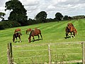
 The Brookfield Stud - geograph.org.uk - 556089.jpg 640 × 480; 96 KB
-

-
 Track to East Farm - geograph.org.uk - 557608.jpg 640 × 480; 75 KB


_-_geograph.org.uk_-_728120.jpg)


_-_geograph.org.uk_-_557438.jpg)


