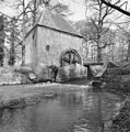
Category:Hackfort watermill
Jump to navigation
Jump to search
| Object location | | View all coordinates using: OpenStreetMap |
|---|
| Upload media | |||||
| Instance of | |||||
|---|---|---|---|---|---|
| Part of | |||||
| Location | Vorden, Gelderland, Netherlands | ||||
| Located in or next to body of water | |||||
| Street address |
| ||||
| Located on street |
| ||||
| Has use | |||||
| Heritage designation |
| ||||
| Source of energy | |||||
 | |||||
|
This is a category about rijksmonument number 527368
|
| Address |
|
Media in category "Hackfort watermill"
The following 33 files are in this category, out of 33 total.
-
7251 Vorden, Netherlands - panoramio (45).jpg 2,048 × 1,148; 794 KB
-
Hackfort generator.jpg 3,264 × 2,448; 1.86 MB
-
Hackfort interieur.jpg 3,264 × 2,448; 1.68 MB
-
Hackfort molen.jpg 2,141 × 1,475; 979 KB
-
Hackfort vistrap.jpg 3,264 × 2,448; 3.29 MB
-
Hackfort watermill 01.JPG 4,320 × 3,240; 4.37 MB
-
Hackfort watermill 02.JPG 4,320 × 3,240; 3.55 MB
-
Hackfort watermill 03.JPG 3,240 × 4,320; 3.24 MB
-
Hackfort watermill 04.JPG 3,240 × 4,320; 2.38 MB
-
Hackfort watermill 05.JPG 4,320 × 3,240; 4.41 MB
-
Hackfort watermill 06.JPG 4,320 × 3,240; 4.8 MB
-
Molen Hackfort, exterieur - Vorden - 20247086 - RCE.jpg 1,200 × 1,195; 396 KB
-
Molen Hackfort, waterrad - Vorden - 20247087 - RCE.jpg 1,200 × 1,193; 367 KB
-
Molensteen.JPG 4,912 × 3,264; 8.26 MB
-
Oostgevel met geblokte bakstenen omlijsting van de ingang - Vorden - 20247085 - RCE.jpg 2,429 × 3,307; 1.51 MB
-
Overzicht scheprand van de watermolen - Vorden - 20528186 - RCE.jpg 4,368 × 2,912; 1.75 MB
-
Overzicht watermolen met scheprad - Vorden - 20528187 - RCE.jpg 4,368 × 2,912; 3.71 MB
-
The mill - panoramio.jpg 4,928 × 3,264; 15.32 MB
-
The mill closer - panoramio.jpg 4,928 × 3,264; 14.74 MB
-
Vispassage Kasteel Hackfort.jpg 4,000 × 3,000; 4.05 MB
-
Vorden - watermolen Hackfort foto 1.jpg 1,000 × 1,500; 1.35 MB
-
Vorden - watermolen Hackfort foto 2.jpg 1,000 × 1,500; 1.51 MB
-
Vorden - watermolen Hackfort foto 3.jpg 1,500 × 1,000; 1.5 MB
-
Vorden, Hackfort RM527365.jpg 2,736 × 3,648; 9.41 MB
-
Watermolen - Vorden - 20246838 - RCE.jpg 3,048 × 3,072; 2.71 MB
-
Watermolen01.jpg 500 × 375; 65 KB
-
Waterrad van de watermolen - Vorden - 20246839 - RCE.jpg 3,066 × 3,078; 2.38 MB
-
Waterrad van de watermolen - Vorden - 20246840 - RCE.jpg 3,066 × 3,054; 2.51 MB
-
Waterrad02.jpg 800 × 600; 279 KB
-
Waterraddetail03.jpg 800 × 600; 236 KB


