Category:HVDC maps
Jump to navigation
Jump to search
Media in category "HVDC maps"
The following 34 files are in this category, out of 34 total.
-
2012 11 17 V4 Original.JPG 2,980 × 2,488; 403 KB
-
Blank map europe Nordned cable.svg 100 × 120; 524 KB
-
Britned map.svg 571 × 342; 147 KB
-
BritNed.svg 571 × 342; 68 KB
-
CobraCable map.svg 988 × 1,159; 602 KB
-
Elettrodotto Italia-Grecia.jpg 1,666 × 1,249; 369 KB
-
Estlink map.png 1,202 × 683; 149 KB
-
Fullconnection.jpg 800 × 648; 135 KB
-
HDVC Inga-Shaba.png 330 × 355; 39 KB
-
HGÜ Cahora Bassa.svg 320 × 350; 69 KB
-
Hokkaido-Honshu HVDC Link 01.svg 643 × 415; 130 KB
-
HVDC basslink map.svg 1,361 × 1,231; 139 KB
-
HVDC Europe annotated 2012.svg 560 × 690; 698 KB
-
HVDC Europe.svg 1,755 × 1,523; 416 KB
-
HVDC Italy–Greece.jpg 750 × 537; 78 KB
-
HVDC Map Nelson River Bipol I II.svg 1,512 × 1,864; 756 KB
-
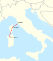
HVDC Map SACOI.svg 958 × 1,095; 783 KB
-
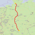
Hvdc südlink 140120.png 751 × 755; 544 KB
-
HVDC Volgograd Donbass Eastern Part.png 4,932 × 2,120; 3.15 MB
-
HVDC Volgograd Donbass Western Part.png 15,312 × 2,144; 5.16 MB
-
HVDC Volgograd Donbass1.gif 1,648 × 432; 62 KB
-
HVDC Volgograd Donbass2.gif 913 × 431; 35 KB
-
HVDC Volgograd Donbass3.gif 865 × 507; 54 KB
-
HVDC Yunnan-Guangdong.PNG 460 × 250; 42 KB
-
Karte Offshore-Windkraftanlagen in der Deutschen Bucht.png 4,342 × 3,483; 2.61 MB
-
Karte Offshore-Windparks in der Deutschen Bucht.svg 4,181 × 2,987; 1.84 MB
-
Kii Channel HVDC Link 01.svg 600 × 400; 110 KB
-
Map europe NORD.LINK and NorGer cable.svg 100 × 120; 98 KB
-
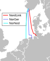
Map europe NORD.LINK NorGer NorNedr cable.svg 100 × 120; 101 KB
-
Map europe NorNed and NorGer cable.svg 100 × 120; 353 KB
-
Map of the offshore wind power farms in the German Bight.png 4,342 × 3,483; 2.6 MB
-
Map Offshore Windfarms in the German Bight.svg 4,181 × 2,987; 1.84 MB
-
Pacific intertie geographic map.png 854 × 1,655; 154 KB
-
SwePol w Polsce.png 1,085 × 1,085; 277 KB


