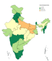
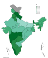
Category:HDI maps of India
Jump to navigation
Jump to search
Media in category "HDI maps of India"
The following 25 files are in this category, out of 25 total.
-
1981nian Yindu Renlei Fazhan Zhishu.png 624 × 704; 59 KB
-
1991nian Yindu Renlei Fazhan Zhishu.png 624 × 704; 59 KB
-
2001nian Yindu Renlei Fazhan Zhishu.png 624 × 704; 60 KB
-
2005nian Yindu Renlei Fazhan Zhishu.png 624 × 704; 111 KB
-
2006 Human Development Index for India map by states, HDI data by GoI and UNDP India.svg 1,578 × 1,738; 862 KB
-
2006 India HDI-ar.png 2,669 × 3,005; 1.41 MB
-
2006 India HDI-ar.svg 1,578 × 1,738; 890 KB
-
2011nian Yindu Renlei Fazhan Zhishu.png 624 × 704; 109 KB
-
Indian States & Union Territories by HDI (2018) .png 3,818 × 4,600; 997 KB
-
Human Development Index of Indian states and union territories 2018.png 3,816 × 4,512; 782 KB
-
HDI NSC method 2017 18.png 3,818 × 4,600; 947 KB
-
Human Development Index 01.png 3,731 × 4,387; 1.16 MB
-
Human Development Index for Indian states in 2001.png 624 × 704; 123 KB
-
India HDI 2015.png 10,000 × 11,382; 1.96 MB
-
India States and Union Territories by Human Development Index (2019).png 3,000 × 3,677; 943 KB
-
Indian States & Union Territories by HDI (2018).png 3,818 × 4,600; 731 KB
-
Indian states and territories by HDI (2017).svg 512 × 612; 203 KB
-
Indian states and Union territories by HDI (2015).png 3,818 × 4,600; 677 KB
-
Indian States and Union Territories by HDI (2018) (3).png 3,818 × 4,600; 835 KB
-
Indian States and Union Territories by HDI (2018) (5).png 3,818 × 4,600; 829 KB
-
Indian States and Union Territories by HDI (2018) (6).png 3,818 × 4,600; 1.05 MB
-
Indian states and union territories HDI (2022).png 3,818 × 4,600; 1,024 KB
-
IndianHDIstates.png 791 × 900; 125 KB
-
Per Capita Income of India 2017.png 1,908 × 2,264; 427 KB
-
Tamil Nadu HDI map (2017).png 1,592 × 1,976; 343 KB


