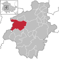
Category:Hörsel (municipality)
Jump to navigation
Jump to search
municipality in the district of Gotha, in Thuringia, Germany | |||||
| Upload media | |||||
| Instance of |
| ||||
|---|---|---|---|---|---|
| Location | Gotha, Thuringia, Germany | ||||
| Inception |
| ||||
| Population |
| ||||
| Area |
| ||||
| Elevation above sea level |
| ||||
| Different from | |||||
| official website | |||||
 | |||||
Landkreis Gotha  Bad Tabarz · Bienstädt · Dachwig · Döllstädt · Drei Gleichen · Emleben · Eschenbergen · Friedrichroda · Friemar · Georgenthal · Gierstädt · Gotha · Großfahner · Hörsel · Luisenthal · Molschleben · Nesse-Apfelstädt · Nessetal · Nottleben · Ohrdruf · Pferdingsleben · Schwabhausen · Sonneborn · Tambach-Dietharz · Tonna · Tröchtelborn · Tüttleben · Waltershausen · Zimmernsupra ·
Subcategories
This category has the following 15 subcategories, out of 15 total.
*
A
E
F
H
L
M
N
W
Media in category "Hörsel (municipality)"
The following 2 files are in this category, out of 2 total.
-
Hörsel in GTH.svg 1,116 × 1,116; 135 KB
-
Karte Hörsel Ortsteile.png 955 × 700; 314 KB


