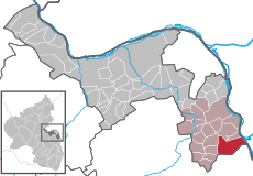
Category:Guntersblum
Jump to navigation
Jump to search
municipality of Germany | |||||
| Upload media | |||||
| Instance of |
| ||||
|---|---|---|---|---|---|
| Location | Rhein-Selz, Mainz-Bingen district, Rhineland-Palatinate, Germany | ||||
| Population |
| ||||
| Area |
| ||||
| Elevation above sea level |
| ||||
| official website | |||||
 | |||||
Subcategories
This category has the following 9 subcategories, out of 9 total.
!
B
- Bahnhof Guntersblum (37 F)
G
- Guntersblumer Kellerweg (22 F)
K
N
P
- Postcards of Guntersblum (2 F)
R
- Römerturm (Guntersblum) (4 F)
S
- St. Viktor (Guntersblum) (29 F)
V
Media in category "Guntersblum"
The following 66 files are in this category, out of 66 total.
-
2008-04-25 (15) Water, Wasser guntersblum.JPG 3,008 × 2,000; 3.27 MB
-
Alte und neue Ziegel Dach Guntersblum 2011.JPG 2,736 × 3,648; 2.05 MB
-
Augustus Büchel aus Guntersblum.jpg 230 × 300; 98 KB
-
B 9 nach Oppenheim- bei Guntersblum- Richtung Oppenheim 16.12.2007.jpg 3,648 × 2,736; 1.28 MB
-
B 9- bei Guntersblum- Richtung Mainz 17.12.2010.jpg 4,000 × 3,000; 2.85 MB
-
Bahnstrecke Mainz–Ludwigshafen- bei Guntersblum- Richtung Mainz (RB 928 314) 29.7.2009.jpg 4,224 × 3,095; 6.36 MB
-
Bepflanzte Kelter Guntersblum 2011.JPG 2,736 × 3,648; 4.38 MB
-
Blick auf Guntersblum von den Weinbergen- Ev. Kirche und Rathaus 23.12.2007.jpg 3,648 × 2,736; 2.59 MB
-
Boule-Bahn Guntersblum.jpg 3,072 × 2,304; 3.33 MB
-
Boule-Bahn-Guntersblum - panoramio.jpg 2,198 × 2,304; 919 KB
-
Carl Kuestner.jpg 378 × 560; 86 KB
-
Deutsches Rotes Kreuz Guntersblum 2011.JPG 3,648 × 2,736; 3.86 MB
-
Figur Schlafwandler Guntersblum 2011.JPG 2,736 × 3,648; 1.24 MB
-
Figuren und Pflanzen auf Fenstersims Guntersblum 2011.JPG 2,736 × 3,648; 4.02 MB
-
Garagentor Bremer Stadtmusikanten Guntersblum 2011.JPG 2,736 × 3,304; 1.85 MB
-
Grüne Fensterläden Wohnhaus Guntersblum 2011.JPG 2,726 × 3,145; 1.64 MB
-
DEU Guntersblum Banner.svg 200 × 500; 95 KB
-
DEU Guntersblum COA.svg 496 × 600; 93 KB
-
DEU Guntersblum Flag.svg 900 × 600; 94 KB
-
DEU Guntersblum VG Banner.svg 200 × 500; 94 KB
-
Guntersblum am Rheindamm- Ortseinfahrt von Guntersblum (K 43) kommend 17.5.2009.jpg 4,224 × 3,168; 2.2 MB
-
Guntersblum Eiche mit Sitzbänken 2011.JPG 2,736 × 3,648; 2.34 MB
-
Guntersblum Im Rathaus findet man 2011.JPG 2,736 × 3,160; 1.6 MB
-
Guntersblum in MZ.svg 349 × 241; 224 KB
-
Guntersblum Lebensmittelgeschäft Friedrich Orlemann 2011.JPG 3,623 × 2,330; 1.29 MB
-
Guntersblum Partnergmeindehinweis Muldenstein 2011.JPG 2,736 × 3,648; 2.66 MB
-
Guntersblum Wohnhaus mit bemaltem Garagentor 2011.JPG 3,619 × 2,337; 1.38 MB
-
Guntersblum- Alsheimer Straße- bei Einmündung der Neustraße- Fastnachtsumzug 3.2.2008.jpg 3,648 × 2,736; 3.69 MB
-
Guntersblum- am Rheindamm- Rhein- Fähre König Gunther- Richtung Hessen 26.5.2011.JPG 4,000 × 3,000; 2.87 MB
-
Guntersblum- Carl-Küstner-Grundschule- von Schulhof aus 26.1.2009.JPG 4,224 × 3,168; 1.7 MB
-
Guntersblum- Dr.-H.F.-Paulizky-Straße- Straßenschild 12.9.2009.JPG 4,224 × 3,168; 1.34 MB
-
Guntersblum- Georg-K.-Glaser-Straße- Straßenschild 12.9.2009.JPG 4,224 × 3,168; 1.34 MB
-
Guntersblum- Hauptstraße- Einmündung der Eimsheimer Straße 7.5.2011.JPG 4,000 × 3,000; 2.83 MB
-
Guntersblum- Joh.-Ph.-Kreißler-Straße- Straßenschild 12.9.2009.jpg 4,224 × 3,168; 1.44 MB
-
Guntersblum- Ortseinfahrt von Ludwigshöhe (L 439) kommend (bei Kellerwegfest) 18.8.2012.JPG 4,912 × 3,264; 4.78 MB
-
Guntersblum- Prof.-F.A.-Kehrer-Straße- Straßenschild 12.9.2009.JPG 4,224 × 3,168; 1.45 MB
-
Guntersblum- Promenade (bei Grabenstraße) 2.10.2008.jpg 3,648 × 2,736; 2.5 MB
-
DEU Guntersblum VG COA.svg 544 × 659; 92 KB
-
Holzbank vor Steinmauer mit Rosen 2011.JPG 3,648 × 2,736; 4.1 MB
-
Julianenbrunnen Guntersblum.jpg 5,152 × 3,864; 8.74 MB
-
Kellerweg01.jpg 681 × 1,024; 741 KB
-
Kellerwegfest.jpg 2,048 × 1,536; 723 KB
-
Kleine Neustraße Guntersblum 2011.JPG 3,648 × 2,736; 4.26 MB
-
Niedrige Holztür Guntersblum 2011.JPG 2,736 × 3,648; 4.24 MB
-
Promenade Guntersblum 2011.JPG 2,736 × 3,648; 2.23 MB
-
Relief und Mosaik Guntersblum 2011.JPG 2,736 × 3,648; 4.28 MB
-
Renovierungsbedürftige Fassade Gebäude Guntersblum 2011.JPG 2,736 × 3,648; 1.45 MB
-
Rot-gelbe Prärie-Kokardenblume mit 2 Insekten 2011.JPG 3,648 × 2,736; 3.67 MB
-
Schaukel Spielplatz Guntersblum 2011.JPG 2,736 × 3,648; 2.47 MB
-
Schussaparat zur Vogelabwehr.jpg 1,385 × 2,060; 748 KB
-
Steinmauer mit Holztür 2011 Guntersblum.JPG 3,648 × 2,736; 2.37 MB
-
SWR1 Gemeine Guntersblum 2011.JPG 2,563 × 3,583; 1.24 MB
-
Wappen am Rathaus in Guntersblum 2011.JPG 2,736 × 3,648; 4.28 MB
-
Wappen der Verbandsgemeinde Guntersblum 2011.JPG 2,736 × 3,648; 4.05 MB
-
Wappen von Guntersblum.png 285 × 340; 91 KB
-
Wappenscheibe Graf Leiningen.jpg 2,090 × 2,320; 1.77 MB
-
Weingut Burghof Oswald-Guntersblum-Innenhof.jpg 2,811 × 2,351; 2.36 MB


